Updating search results...

Search Resources

1073 Results

View
Selected filters:
  • Reading
Unit 2: How seismic waves travel through the ground
Conditional Remix & Share Permitted
CC BY-NC-SA
Rating
0.0 stars

This unit presents core underlying principles needed to understand refraction seismology concepts including refraction of rays, types of seismic waves, interpreting information about subsurface materials from seismic properties and developing conceptual models of the subsurface environment.

(Note: this resource was added to OER Commons as part of a batch upload of over 2,200 records. If you notice an issue with the quality of the metadata, please let us know by using the 'report' button and we will flag it for consideration.)

Subject:
Agriculture and Natural Resources
Biology
Environmental Studies
Life Science
Mathematics
Measurement and Data
Statistics and Probability
Material Type:
Activity/Lab
Data Set
Lesson Plan
Reading
Provider:
Science Education Resource Center (SERC) at Carleton College
Provider Set:
Teach the Earth
Date Added:
09/03/2022
Unit 3: Codorus Creek case study: Measuring and interpreting seismic refraction data
Conditional Remix & Share Permitted
CC BY-NC-SA
Rating
0.0 stars

This unit presents an applied Case Study example and the associated concepts related to designing a seismic survey and analyzing the data. Parts of the instrument are discussed and practical experience simulating travel time arrivals on a travel time-offset plot are presented. A real dataset from the Case Study site at Codorus Creek, York, PA is presented and analysis strategies are discussed.

(Note: this resource was added to OER Commons as part of a batch upload of over 2,200 records. If you notice an issue with the quality of the metadata, please let us know by using the 'report' button and we will flag it for consideration.)

Subject:
Agriculture and Natural Resources
Biology
Environmental Studies
Life Science
Mathematics
Measurement and Data
Statistics and Probability
Material Type:
Activity/Lab
Case Study
Data Set
Lesson Plan
Reading
Provider:
Science Education Resource Center (SERC) at Carleton College
Provider Set:
Teach the Earth
Date Added:
09/03/2022
Unit 3: Field Geophysical Measurements
Conditional Remix & Share Permitted
CC BY-NC-SA
Rating
0.0 stars

Near surface geophysical measurements are performed by moving sensors across the Earth's surface. Active geophysical sensors transmit a signal into the Earth and record a returned signal that contains information on the physical and chemical properties of the Earth (see Unit 2). This unit introduces the student to the basics of geophysical data acquisition using two techniques that record variations in the electrical conductivity (see Unit 2) of the Earth: [1] electrical imaging (EI), and [2] electromagnetic (EM) conductivity mapping.


Basic concept of electrical imaging measurements

Provenance: Lee Slater, Rutgers University-Newark
Reuse: This item is in the public domain and maybe reused freely without restriction.
Electrical imaging is a galvanic geophysical approach whereby electrical contact with the Earth is made directly via electrodes (typically metal stakes) that are inserted into the ground. Electromagnetic conductivity mapping is a non-contact approach whereby the physics of EM induction is used to sense changes in electrical conductivity. The advantages and disadvantages of using galvanic (EI) and non-contact (EM) techniques for measuring electrical conductivity are described. Ohm's Law is introduced and students investigate how electrical resistance measurements are related to the electrical conductivity of soils. Field implementation of both EI and EM techniques is demonstrated using surveys performed in Harrier Meadow as an example. Students investigate how variations in survey configuration parameters (e.g. electrode configuration and electrode spacing in EI, frequency and coil spacing in EM) control investigation depth (how far into the ground the signals sense) and spatial resolution (what size objects can be detected). The concept of pre-modeling a geophysical survey (i.e. running some simulations of likely effectiveness of the methods before going to the field) to evaluate expected investigation depth and sensitivity is introduced. The Excel-based Scenario Evaluator for Electrical Resistivity (SEER) tool provided by the United States Geological Survey (USGS) is used to demonstrate some key concepts.

(Note: this resource was added to OER Commons as part of a batch upload of over 2,200 records. If you notice an issue with the quality of the metadata, please let us know by using the 'report' button and we will flag it for consideration.)

Subject:
Agriculture and Natural Resources
Chemistry
Earth and Space Science
Environmental Studies
Hydrology
Mathematics
Measurement and Data
Physical Science
Statistics and Probability
Material Type:
Activity/Lab
Data Set
Interactive
Reading
Provider:
Science Education Resource Center (SERC) at Carleton College
Provider Set:
Teach the Earth
Date Added:
09/03/2022
Unit 4: The Magic of Geophysical Inversion
Conditional Remix & Share Permitted
CC BY-NC-SA
Rating
0.0 stars

The concepts of forward modeling and inverse modeling

Provenance: Lee Slater, Rutgers University-Newark
Reuse: If you wish to use this item outside this site in ways that exceed fair use (see http://fairuse.stanford.edu/) you must seek permission from its creator.
This unit introduces the student to the concept of geophysical inversion, which is the process of estimating the geophysical properties of the subsurface from the geophysical observations. The basic mechanics of the inversion process used to estimate spatial variations in electrical conductivity from electrical imaging (EI) datasets are introduced in a way that avoids the heavy mathematics. The challenges of inverting two dimensional geophysical datasets and the strategies for limiting the inversion to geologically reasonable solutions are described. The unfortunate characteristics of geophysical images (blurriness, imaging artifacts) are explained to highlight the limitations of inversion and to emphasize that the inverted images never match with geological reality. Students use the Excel-based Scenario Evaluator for Electrical Resistivity (SEER) tool introduced in Unit 3, Field Geophysical Measurements, to investigate key inversion concepts associated with measurement errors and the benefits of adding boreholes to surface data using synthetic datasets. Students are then led through an inversion of the two-dimensional EI dataset acquired in Harrier Meadow using ResIPy, a Python-based graphical user interface developed for instructional use. Following the instructional video, students then perform the inversion in ResIPy themselves and explore how variations in inversion settings related to the errors in the measurements result in distinctly different images.

(Note: this resource was added to OER Commons as part of a batch upload of over 2,200 records. If you notice an issue with the quality of the metadata, please let us know by using the 'report' button and we will flag it for consideration.)

Subject:
Agriculture and Natural Resources
Chemistry
Earth and Space Science
Environmental Studies
Hydrology
Mathematics
Measurement and Data
Physical Science
Statistics and Probability
Material Type:
Activity/Lab
Data Set
Interactive
Reading
Provider:
Science Education Resource Center (SERC) at Carleton College
Provider Set:
Teach the Earth
Date Added:
09/03/2022
Unit 5: Integrated Geophysical Interpretation and Comparison with Ground Truthing
Conditional Remix & Share Permitted
CC BY-NC-SA
Rating
0.0 stars

Screenshot of the slider tool used to relate geophysical images to vegetation pattern

Provenance: Lee Slater, Rutgers University-Newark
Reuse: This item is in the public domain and maybe reused freely without restriction.
In this unit, students explore spatial associations between the three-dimensional electromagnetic (EM) conductivity inversions and the visible patterns of Salicornia (Pickleweed) introduced in Unit 1, Exploring Harrier Meadow. The Arcview Storymap started in Unit 1 allows students to overlay inverted electrical conductivity patterns for different depths on aerial photographs of Harrier Meadow that highlight the patches of Pickleweed. Students analyze how conductivity patterns vary with depth and explore for evidence for a relationship between electrical conductivity and Pickleweed patches based on the hypothesis introduced in Unit 1. Students then perform an integrated interpretation of both the EM and electrical imaging inversions along with the results of direct sampling (coring, pore water sampling, soil characterization) conducted at locations selected using the electrical conductivity patterns observed in the EM dataset. Students perform basic qualitative assessments of the correlation between physical and chemical properties of the sampled soils and soil electrical conductivity from the EM inversions. Students finish the module by evaluating the extent to which the geophysical dataset and supporting direct measurements support the hypothesis pertaining to the cause of the Salicornia clusters introduced in Unit 1.

(Note: this resource was added to OER Commons as part of a batch upload of over 2,200 records. If you notice an issue with the quality of the metadata, please let us know by using the 'report' button and we will flag it for consideration.)

Subject:
Agriculture and Natural Resources
Chemistry
Earth and Space Science
Environmental Studies
Hydrology
Mathematics
Measurement and Data
Physical Science
Statistics and Probability
Material Type:
Activity/Lab
Data Set
Lesson Plan
Reading
Provider:
Science Education Resource Center (SERC) at Carleton College
Provider Set:
Teach the Earth
Date Added:
09/03/2022
Unit Design: Tribes, Exploration, and Expansion
Unrestricted Use
CC BY
Rating
0.0 stars

The unit has two parts. In each, students dive into inquiry to answer the compelling questions:

1. Who are some of our closest tribal neighbors, and what have they been their lifeways since time immemorial?
2. Why do people explore, and how does this lead to expansion?

Part 1 is focused on the examination of the northwest and some of the original inhabitants. Through these questions students will learn about the culture of some of their closest tribal neighbors, the Spokane Indians. The final project for Part 1 is a cultural investigation display, in which students will show what they know about the culture of the Spokane Tribe.

In Part 2, Students will also learn about forces that brought change to the northwest: fur trade era and exploration. Students will ultimately learn about the Corps of Discovery and the Oregon Trail and know the impact each had on the west. Students will finish Part 2 with a timeline activity that will reflect choice and build upon student strengths according to their skill set.

Finally, a lesson on a Tribe of the Columbia Plateau is offered as an extension, but it is strongly recommended that students get to experience this lesson.

Note that the emphasis here is on the Spokane Tribe as one of our closest tribal neighbors. In no way is this an exhaustive study nor should the tribal cultures be generalized to other tribes of the region. We understand that each tribe in our region and North America was and continues to be unique in its culture, practices, lifeways, and traditions.

Subject:
Cultural Geography
Economics
Education
Elementary Education
English Language Arts
History
Reading Informational Text
Social Science
U.S. History
Material Type:
Activity/Lab
Assessment
Case Study
Diagram/Illustration
Interactive
Lesson
Lesson Plan
Module
Primary Source
Reading
Simulation
Student Guide
Teaching/Learning Strategy
Unit of Study
Date Added:
04/05/2023
Urban planning: Ecofying Cities
Only Sharing Permitted
CC BY-NC-ND
Rating
0.0 stars

TED Studies, created in collaboration with Wiley, are curated video collections — supplemented by rich educational materials — for students, educators and self-guided learners. In Ecofying Cities, speakers reveal ideas about sustainable development (and redevelopment) that aren't all about setting limits, going without or preparing for the worst. Rather, they find solutions in resourceful, hopeful, beautiful communities.

Subject:
Applied Science
Architecture and Design
Material Type:
Lecture
Reading
Teaching/Learning Strategy
Provider:
TED
Provider Set:
TED Studies
Author:
Andy van den Dobbelsteen
Pierre Filion
Terri Peters
Date Added:
05/11/2023
Use of Underground Space
Conditional Remix & Share Permitted
CC BY-NC-SA
Rating
0.0 stars

Students obtain basic knowledge of the multidisciplinary aspects of the use of undergrounds space. Based on knowledge about the characteristics of several construction technologies they are able to asses their applicability in different situations. This may be different geological or physical conditions. They are able to analyze and structure the complex decision making process that is related to the use of underground space and define an integral approach

Subject:
Applied Science
Architecture and Design
Material Type:
Full Course
Lecture
Lecture Notes
Reading
Textbook
Provider:
Delft University of Technology
Provider Set:
Delft University OpenCourseWare
Author:
J.W. Bosch
Date Added:
02/05/2016
Using Brain-Computer Interface to improve learning skills for students with disabilities: a rapid review
Conditional Remix & Share Permitted
CC BY-NC
Rating
0.0 stars

Brain-Computer Interface (BCI) enables direct communication between the brain and an external device. BCI systems have become a popular area of study in recent years. These technologies can be utilized in various ways to assist people with disabilities and healthy individuals. Regarding substantial BCI advancements, we can say that these systems are on the verge of commercialization. This review has considered current trends in BCI research on inclusive education to assist students with disabilities in achieving improved learning outcomes for all students in an inclusive environment.

Subject:
Applied Science
Career and Technical Education
Computer Science
Computer, Networking and Telecommunications Systems
Electronic Technology
Engineering
Information Science
Material Type:
Reading
Date Added:
04/11/2023
Using Cooperative Learning to Teach Mineralogy (and Other Courses Too!)
Conditional Remix & Share Permitted
CC BY-NC-SA
Rating
0.0 stars

This chapter is concerned primarily with how the content of a mineralogy course can be organized so that the students are more active and conscientious learners. This chapter is divided into three sections: Section I briefly describes the fundamentals of cooperative learning: why it's important and what is essential. Section II describes a variety of cooperative learning structures and their uses. Section III provides more detailed descriptions of cooperative learning activities specifically for a mineralogy class.

(Note: this resource was added to OER Commons as part of a batch upload of over 2,200 records. If you notice an issue with the quality of the metadata, please let us know by using the 'report' button and we will flag it for consideration.)

Subject:
Biology
Life Science
Material Type:
Activity/Lab
Reading
Provider:
Science Education Resource Center (SERC) at Carleton College
Provider Set:
Teach the Earth
Date Added:
09/09/2020
Vanishing Island: Sea Level Rise
Read the Fine Print
Some Rights Reserved
Rating
0.0 stars

This video features interviews with native people living on atoll islands in Micronesia, so viewers are able to understand the real, current threats that these people are facing due to climate change.

Subject:
Physical Science
Material Type:
Reading
Provider:
CLEAN: Climate Literacy and Energy Awareness Network
Provider Set:
CLEAN: Climate Literacy and Energy Awareness Network
Date Added:
03/09/2023
Victor, CO Mining Town
Read the Fine Print
Educational Use
Rating
0.0 stars

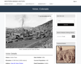
Victor, CO Mining Town. Western Mining History presents a brief summary of Colorado's Historical Mining Towns with links to additional Colorado resources for a mining town database and mines by county. Western Mining History is an historical site that provides information on mining, mining towns, the gold and silver rush, and Photos and maps of the western United States. This is a strong primary source resource that can be used for a variety of class research projects. Consider becoming a member or making a donation to help further the work of the site.

Subject:
Anthropology
Applied Science
Chemistry
Cultural Geography
Earth and Space Science
Economics
English Language Arts
Environmental Science
Geology
Geoscience
History
Physical Geography
Physical Science
Reading Informational Text
Social Science
Sociology
U.S. History
Material Type:
Data Set
Primary Source
Reading
Provider:
Western Mining History
Provider Set:
Colorado Mining Towns
Date Added:
02/06/2023
Virginia Cooperative Extension Gardener Handbook
Conditional Remix & Share Permitted
CC BY-NC-SA
Rating
0.0 stars

Virginia Cooperative Extension Gardener Handbook is a guide for all gardeners in Virginia. It covers a variety of topics important for beginning and experienced gardeners, including soil health, native plants, and integrated pest management. This manual provides an understanding of the basics of gardening in Virginia and helps to build a strong foundation of gardening knowledge. Resources for additional reading can be found at the end of each chapter. We encourage readers to take a deeper dive into the topics that interest them and continue their learning journey.

How to Access the Book
This text is available in multiple formats including PDF, a low-resolution PDF which is faster to download, and ePub. These are linked on the left side of your screen. The book is also available in HTML/Pressbooks at https://pressbooks.lib.vt.edu/emgtraining. Softcover print versions with color interior will be available for purchase in Spring/Summer 2023. The main landing page for this book is https://doi.org/10.21061/vcegardener

HTML/Pressbooks: ISBN 978-1-957213-47-7 https://pressbooks.lib.vt.edu/emgtraining
PDF: ISBN 978-1-957213-48-4
Print (paperback): ISBN 978-1-957213-42-2 [Forthcoming]
ePub: ISBN 978-1-957213-49-1

Table of Contents
1. Botany
2. Soils and Nutrient Management
3. Entomology
4. Plant Pathology
5. Abiotic Stress Effects on Plant Growth and Development
6. Diagnosing Plant Damage
7. Integrated Pest Management and Pesticide Safety
8. Plant Propagation
9. The Vegetable Garden
10. Fruits in the Home Garden
11. Lawns
12. Indoor Plants
13. Woody Landscape Plants
14. Pruning
15. Herbaceous Landscape Plants
16. Landscape Design
17. Water Quality and Conservation
18. Habitat Gardening for Wildlife
19. Virginia Native Plants

About Virginia Cooperative Extension
Virginia Cooperative Extension (VCE) is the outreach and engagement branch of Virginia Tech and Virginia State University, Virginia’s land-grant universities. Through VCE, Extension agents, specialists, and volunteers work to share knowledge and advance the wellbeing of all Virginians. This handbook serves as the main training text for new Extension Master Gardener volunteers.

If you are passionate about horticulture, environmental conservation, or gardening education, we invite you to join us by becoming an Extension Master Gardener at https://ext.vt.edu/lawn-garden/master-gardener/Become-a-Master-Gardener.html.

Are you a professor reviewing or adopting this book for a course?
https://bit.ly/interest-vcegardener Instructors adopting or reviewing this text are encouraged to record their use on this form. This helps the book's sponsors to understand this open textbook's impact.

Suggested Citation
Virginia Cooperative Extension (2023). Virginia Cooperative Extension Gardener Handbook. Blacksburg: Virginia Cooperative Extension. https://doi.org/10.21061/vcegardener. Licensed with CC BY-NC-SA 4.0.

Accessibility Statement
Virginia Tech Publishing is committed to making its publications accessible in accordance with the Americans with Disabilities Act of 1990. The Pressbooks (HTML) and ePub versions of this text are tagged structurally and include alternative text, which allows for machine readability.

Report an Error: https://bit.ly/report-error-vcegardener
View Errata: https://bit.ly/errata-vcegardener
Tell us how you found the book: https://bit.ly/interest-vcegardener

Acknowledgments
This version of the Virginia Extension Gardener Handbook was made possible in part by financial and technical support from the Open Education Initiative at the University Libraries. Additional financial support was provided by the Virginia Tech School of Plant and Environmental Sciences.

Thank you to contributors and editors of this handbook:
• Kathleen Reed (2022 project advisor, editor, and contributor)
• Devon Johnson (2022 project manager and image author)
• Kindred Grey (2022 image author and Pressbooks formatting)
• Stacey Morgan Smith (2022 handbook editor)
• Emma Freeborn (2022 alt text and editorial assistance)
• Anita Walz and the Virginia Tech Publishing team (2022)
• The 2021/22 Handbook Review Team: Barb Wilson, Beth Kirby, Carol King, Courtney Soria, Doug Levin, Elaine Mills, Elizabeth Brown, Fern Campbell, JC Gardner , Jim Revell, Khosro Aminpour, Maraea Harris, Margaret Brown, Meagan Shelley, Melanie Thompson, Michael Cole, Mimi Rosenthal, Nancy Brooks, Nancy Butler, Patricia Lust, Ralph Morini, Sabrina Morelli, Shawn Jadrnicek, Sherry Kern, Stacey Morgan Smith, Susan Dudley, Susan Perry, Wendy Silverman and all other volunteers who contributed.

Previous versions:
• Dave Close, State Coordinator, VCE Master Gardener Program & Consumer Horticulture Specialist (2015 project advisor)
• John Freeborn, Assistant State Coordinator, VCE-MG Program (2015 editor)
• Sue Edwards (2015 editorial assistant)
• Diane Relf, Retired Extension Specialist, Environmental Horticulture (original compilation, revision, and editing)
• Judith Schwab (original compilation, revision, and editing)
• Elissa Steeves (original compilation, revision, and editing)
• R. Peter Madsen (original compilation, revision, and editing)
• Virginia Nathan (original compilation, revision, and editing)
Thank you to the many Extension Master Gardener volunteers and agents who have contributed feedback or made suggestions for this handbook over the years. Thanks also to the original contributors, including the Northern Virginia Master Gardeners, the Utah Cooperative Extension Service, and the Georgia Cooperative Service for use of their handbook material and the Texas Agricultural Extension Service and N.C. State for the use of their revised and expanded versions of this handbook (circa 2009). According to the 2009 version of this handbook, “material was taken from many Extension publications written in Virginia and other states.” We have worked to identify, rewrite, and attribute this content.

The original edition of the Virginia Master Gardener Handbook was printed January 1985. The handbook was revised January 1986, January 1987, July 1990, November 1994, December 1999, July 2009, and December 2015.

Disclaimer: This work may contain components (e.g., illustrations or quotations) not covered by the license. Every effort has been made to clearly identify these components but ultimately it is your responsibility to independently evaluate the copyright status of any work or component part of a work you use, in light of your intended use. Please check the references at the end of each chapter before redistributing.

Subject:
Botany
Life Science
Material Type:
Reading
Student Guide
Textbook
Provider:
Virginia Tech
Provider Set:
VTech Works
Author:
Virginia Cooperative Extension
Date Added:
05/11/2023
Visualizing the Quantities of Climate Change
Read the Fine Print
Educational Use
Rating
0.0 stars

This visualization is a series of three short animations/videos that illustrate how the changing ice sheets result in sea level rise. It uses satellite data to show how Greenland and Antarctica are losing mass at a rate of 283 gigatons per year and 145 gigatons per year, respectively. Simulation shows visualization of one gigaton and how much this translates to sea level rise.

Subject:
Agriculture and Natural Resources
Applied Science
Earth and Space Science
Environmental Science
Environmental Studies
Oceanography
Physical Science
Material Type:
Diagram/Illustration
Reading
Provider:
CLEAN: Climate Literacy and Energy Awareness Network
Provider Set:
CLEAN: Climate Literacy and Energy Awareness Network
Author:
Matt Conlen
National Aeronautics and Space Administration, Global Climate Change Website
Date Added:
12/01/2020
Vital Ice STEM Kit
Conditional Remix & Share Permitted
CC BY-NC-SA
Rating
0.0 stars

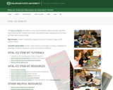
Vital Ice STEM Kit. The Natural Sciences Education & Outreach Center collaborates with CSU faculty, National Parks and citizen science programs to translate their current scientific research into unique STEM experiences for students in the form of Educational Kits that can be checked out. Each kit contains just about all of the materials needed (minus common things like water and paper towels) to explore some really interesting scientific research topics.The kits are available for teachers and informal educators in Colorado to check out for a duration of a week by submitting either a local pickup form or a delivery form available at the linked website. This kit is provided free for educational use. This Kit is available in Spanish. Global Surface Temperatures: https://scratch.mit.edu/projects/283054052/

Subject:
Agriculture and Natural Resources
Ancient History
Anthropology
Applied Science
Archaeology
Arts and Humanities
Atmospheric Science
Chemistry
Cultural Geography
Earth and Space Science
Ecology
Environmental Science
Environmental Studies
Ethnic Studies
Geology
Geoscience
History
Hydrology
Life Science
Oceanography
Paleontology
Physical Geography
Physical Science
Physics
Social Science
U.S. History
World Cultures
Material Type:
Activity/Lab
Case Study
Diagram/Illustration
Interactive
Lesson
Lesson Plan
Primary Source
Reading
Simulation
Student Guide
Unit of Study
Provider:
Colorado State University
Provider Set:
CSU Natural Sciences Education & Outreach Center
Date Added:
02/06/2023
Vocabulary List: Emotions and Personality Traits
Read the Fine Print
Educational Use
Rating
0.0 stars

This list presents a basic set of vocabulary words that deal with categories of emotions and personality traits, including verbs and nouns that deal with anger, sadness, happiness, and other descriptions of human emotion and behavior. The majority of words contained within the website are nouns, and some verbs are interspersed. The words and verbs are presented in both modern standard and colloquial Egypt, and feature Arabic text and transliteration.

Subject:
Arts and Humanities
Languages
World Languages
Material Type:
Reading
Provider:
Arabic Desert Sky
Date Added:
03/29/2023
Vocabulary Words: Professions and Careers
Read the Fine Print
Educational Use
Rating
0.0 stars

This brief list provides seven contemporary professions and careers in Arabic and translated English. The words are also accompanied by transliteration, and are written in masculine and feminine form.

Subject:
Arts and Humanities
Languages
World Languages
Material Type:
Reading
Provider:
Wikibooks
Date Added:
03/29/2023
Vuelve Viral Equipo STEM
Conditional Remix & Share Permitted
CC BY-NC-SA
Rating
0.0 stars

Vuelve Viral Equipo STEM. El Centro de Extensión y Educación en Ciencias Naturales colabora con la facultad de CSU, los Parques Nacionales y los programas de ciencia ciudadana para traducir su investigación científica actual en experiencias STEM únicas para los estudiantes en forma de kits educativos que se pueden prestar. Cada kit contiene casi todos los materiales necesarios (menos cosas comunes como agua y toallas de papel) para explorar algunos temas de investigación científica realmente interesantes. enviando un formulario de recogida local o un formulario de entrega disponible en el sitio web vinculado. Utilice la información de contacto en la página de descripción general del kit STEM para obtener más información. https://www.cns-eoc.colostate.edu/stem-kits/ Este kit se proporciona de forma gratuita para uso educativo.

Subject:
Allied Health
Applied Science
Biology
Career and Technical Education
Chemistry
Ecology
Environmental Science
Genetics
Health Sciences, Criminal Justice and Public Safety
Health, Medicine and Nursing
Hospitality, Tourism and Social Service Careers
Life Science
Mathematics
Measurement and Data
Numbers and Operations
Physical Science
Ratios and Proportions
Statistics and Probability
Zoology
Material Type:
Activity/Lab
Case Study
Diagram/Illustration
Educational Kit
Interactive
Lesson
Lesson Plan
Primary Source
Reading
Simulation
Student Guide
Unit of Study
Provider:
Colorado State University
Provider Set:
Natural Sciences Education & Outreach Center
Date Added:
02/24/2023
Vulcan, CO Mining Town
Read the Fine Print
Educational Use
Rating
0.0 stars

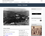
Vulcan, CO Mining Town. Western Mining History presents a brief summary of Colorado's Historical Mining Towns with links to additional Colorado resources for a mining town database and mines by county. Western Mining History is an historical site that provides information on mining, mining towns, the gold and silver rush, and Photos and maps of the western United States. This is a strong primary source resource that can be used for a variety of class research projects. Consider becoming a member or making a donation to help further the work of the site.

Subject:
Anthropology
Applied Science
Chemistry
Cultural Geography
Earth and Space Science
Economics
English Language Arts
Environmental Science
Geology
Geoscience
History
Physical Geography
Physical Science
Reading Informational Text
Social Science
Sociology
U.S. History
Material Type:
Data Set
Primary Source
Reading
Provider:
Western Mining History
Provider Set:
Colorado Mining Towns
Date Added:
02/06/2023
Vyavahāracintāmaṇi
Unrestricted Use
CC BY
Rating
0.0 stars

Vyavahāracintāmaṇi by Vācaspati Miśra. A Digest on Hindu Legal Procedure. crit. ed. and trans. Ludo Rocher. Gentse Orientalistiche Bijdragen 1. Gent, 1956.

Subject:
Arts and Humanities
Languages
World Languages
Material Type:
Reading
Provider:
University of Texas at Austin
Provider Set:
COERLL
Author:
Ludo Rocher
Date Added:
06/13/2023