Dissolved ions are present in all freshwater systems, but humans can change …
Dissolved ions are present in all freshwater systems, but humans can change the chemical composition of freshwater in several ways. In this activity, students will examine the concentration of major ions in freshwater systems over time and reason about potential drivers of these changes.
(Note: this resource was added to OER Commons as part of a batch upload of over 2,200 records. If you notice an issue with the quality of the metadata, please let us know by using the 'report' button and we will flag it for consideration.)
Make your own compass. Activity from Weekly STEM in a Bag. Colorado …
Make your own compass. Activity from Weekly STEM in a Bag. Colorado Americorp agents in Araphahoe, Denver, Garfield, Larimer, and Weld Counties. Work supported by the Corporation for National and Community Service under Americorps grant number 18AFHCO0010008. Opinions or points of view expressed in this lesson are those of the authors and do not necessarily represent the official position of or a position that is endorsed by the Corporation or the Americorps program. This resource is also available in Spanish in the linked file.
This activity is a combination outdoor/indoor lab where students will collect natural …
This activity is a combination outdoor/indoor lab where students will collect natural materials from the environment and use them to create both a mold and cast model of a fossil. Students will learn how a fossil is formed and why scientists use models to help them understand how things work and develop.
Create a river. Learn how water flows. Activity from Weekly STEM in …
Create a river. Learn how water flows. Activity from Weekly STEM in a Bag. Colorado Americorp agents in Araphahoe, Denver, Garfield, Larimer, and Weld Counties. Work supported by the Corporation for National and Community Service under Americorps grant number 18AFHCO0010008. Opinions or points of view expressed in this lesson are those of the authors and do not necessarily represent the official position of or a position that is endorsed by the Corporation or the Americorps program. This resource is also available in Spanish in the linked file.
Join Curator of Paleontology, Dr. Julia McHugh, as she teaches you how …
Join Curator of Paleontology, Dr. Julia McHugh, as she teaches you how to make her famous frosted sugar cookies and throws in some neat dinosaur facts! Dinosaur Cut-Out Sugar Cookies:
1 cup of sugar ¼ cup of softened butter ½ tsp. of vanilla extract 2 large eggs 1 tsp. of salt 1 tsp. of baking soda 2 ½ cups of flour In a separate bowl, sift flour, baking soda, and salt together and set aside. Cream together butter and sugar until fluffy, and sugar completely dissolves. Add eggs and vanilla to butter/sugar mixture and beat with mixer until well-blended (about 2-4 minutes). Gradually add the flour mixture, stirring well. Once entire mixture is well creamed together, divide into 2-4 “loafs” and wrap in waxed paper. Chill dough for 2-4 hours. Rolling out cookies: Cover surface with a light dusting of flour to prevent dough from sticking. Rub flour onto rolling pin and cookie cutters. Remove dough and roll “loafs” into a flat layer about ¼ inch thick (thinner for crispy cookies, thicker for doughy cookies). Use cookie cutters to cut dinosaur shapes. Peel away dough from in between shapes and add this remnant dough to the next loaf. Place cookies on non-stick or greased cookie sheet and bake at 400 degrees for 6-8 minutes, or until edges turn golden brown. Let cookies completely cool on wire rack or on parchment paper before decorating. Vanilla Butter Cream Frosting ½ cup of softened butter (not melted) 1 ½ tsp. of vanilla extract 5-6 Tbsp. of milk 4 ½ cups confectionary (powdered) sugar Cream butter using spoon or spatula until light and fluffy. Gradually add in the rest of the ingredients, beating the mixture as you add them. If too runny, add small amounts of additional sugar, or if too stiff add additional milk. Beat frosting until desired consistency. Divide into bowls and add food coloring.
Students learn the components of the rock cycle and how rocks can …
Students learn the components of the rock cycle and how rocks can change over time under the influence of weathering, erosion, pressure and heat. They learn about geotechnical engineering and the role these engineers play in the development of an area of land, the design and placement of new structures, and detection of natural disasters.
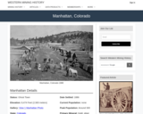
Manhattan, CO Mining Town. Western Mining History presents a brief summary of …
Manhattan, CO Mining Town. Western Mining History presents a brief summary of Colorado's Historical Mining Towns with links to additional Colorado resources for a mining town database and mines by county. Western Mining History is an historical site that provides information on mining, mining towns, the gold and silver rush, and Photos and maps of the western United States. This is a strong primary source resource that can be used for a variety of class research projects. Consider becoming a member or making a donation to help further the work of the site.
Spreadsheets Across the Curriculum Module. Students build spreadsheets to estimate discharge for …
Spreadsheets Across the Curriculum Module. Students build spreadsheets to estimate discharge for a culvert using the Manning equation, and to estimate culvert size, given a specified discharge.
In this classroom activity, students will work in groups to observe how …
In this classroom activity, students will work in groups to observe how patterns of topography, bathymetry, earthquake locations and depths, and the location of volcanoes vary across regions of the Earth. They will then use this data to predict and map the locations and types of major plate tectonic boundaries. Finally, they should begin to form an intuition about the 3D nature of these plate tectonic boundaries by sketching a cross sectional concept diagram through a convergent boundary, plotting surface topography, earthquakes' locations below the surface, the position of volcanoes at the surface, and inferring the location of the plate tectonic boundary at depth.
The Silurian coastal Maine magmatic province is characterized by commingled gabbroic and …
The Silurian coastal Maine magmatic province is characterized by commingled gabbroic and granitic magmas that have resulted in magmatic structures such as pillows and pipes that can be used to determine the kinematics of the magma chamber. On the Eastern Head of Isle Au Haut, students map and collect structural data on the contacts between commingled gabbroic and granitic/dioritic sheets and the pipes and pillows that form along the base of these. A bedrock geologic map and cross section are then made in ArcGIS showing the geometry of the magmatic sheets. We kayak out to the island to map it, but there is also a ferry there. Eastern Head is situated within Acadia National Park and, as a result, no hammers can be used.
(Note: this resource was added to OER Commons as part of a batch upload of over 2,200 records. If you notice an issue with the quality of the metadata, please let us know by using the 'report' button and we will flag it for consideration.)
This earth systems field lab begins with an in-class guided inquiry experience …
This earth systems field lab begins with an in-class guided inquiry experience which uses Minnesota Geological Survey 3-D maps of the upper Midwest to determine where they believe glaciers may have had an influence. They will determine this by looking at landscapes and compiling their own evidence from the maps. They will also offer evidence for a hypothesis they generate which involves the direction that the glacier was traveling.
This lesson is designed to reinforce the basic skill sets and concepts …
This lesson is designed to reinforce the basic skill sets and concepts introduced in Lessons 1���3 of this module. Students will use the steps of the Geographic Approach to explore data sets and images in a scientific manner.
(Note: this resource was added to OER Commons as part of a batch upload of over 2,200 records. If you notice an issue with the quality of the metadata, please let us know by using the 'report' button and we will flag it for consideration.)
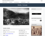
Marble, CO Mining Town. Western Mining History presents a brief summary of …
Marble, CO Mining Town. Western Mining History presents a brief summary of Colorado's Historical Mining Towns with links to additional Colorado resources for a mining town database and mines by county. Western Mining History is an historical site that provides information on mining, mining towns, the gold and silver rush, and Photos and maps of the western United States. This is a strong primary source resource that can be used for a variety of class research projects. Consider becoming a member or making a donation to help further the work of the site.
This lesson is a classroom activity where students learn about paleontologist Mary …
This lesson is a classroom activity where students learn about paleontologist Mary Anning, briefly learn about sedimentary rock, and complete observation drawings of Platteville Limestone fossils.
Middle School Paleontology Kit Module from Museums of the West in Grand …
Middle School Paleontology Kit Module from Museums of the West in Grand Junction, CO. Lesson 5 on Mass Extinction. Students will learn about the causes of the "Big 5" mass extinctions in Earth's history and the effects of biodiversity over time. Lessons 1, 2, 3 and 5 can be completed without access to the Fossil Kit from Museums of Western Colorado. Lesson 4 uses fossile from the kit. District 51 personnel can request a kit to complete Lesson 4. See this URL for an overview of the module and a link to the Teacher's guide to Paleontology: https://www.museumofwesternco.com/classroom-resources/stem-lessons/
A spectacular gravel quarry near Rotterdam Junction, New York along the north …
A spectacular gravel quarry near Rotterdam Junction, New York along the north shore of the Mohawk River is an ideal place to discuss deglaciation history and the development of the ancestral Mohawk Delta building into former Lake Albany. The sedimentary petrology, sedimentary structures, and cementation history of the outwash gravel deposits can be discussed in detail at the outcrop. The 3-D exposures of partially cemented, cross-bedded gravels are representative of the surficial unconfined aquifer system which provides groundwater to many communities in the Schenectady area. The locality is easily accessible via Route 5 westbound, and is an excellent site for sample collection. I use specimens from this quarry as teaching tools in many of my geology classes.
(Note: this resource was added to OER Commons as part of a batch upload of over 2,200 records. If you notice an issue with the quality of the metadata, please let us know by using the 'report' button and we will flag it for consideration.)
Explore how melting of ice cubes floating in water is influenced by …
Explore how melting of ice cubes floating in water is influenced by the salinity of the water. Important oceanographic concepts like density and density driven currents are visualized and can be discussed on the basis of this experiment.
(Note: this resource was added to OER Commons as part of a batch upload of over 2,200 records. If you notice an issue with the quality of the metadata, please let us know by using the 'report' button and we will flag it for consideration.)
In this activity, students will learn about the Mercalli Scale for rating …
In this activity, students will learn about the Mercalli Scale for rating earthquakes. Also, students will make a booklet with drawings that represent each rating of the scale.
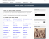
This Western Mining History database uses Mineral Resources Data System to list …
This Western Mining History database uses Mineral Resources Data System to list known Colorado historical mines by county. Each county site has links to the known mines within its borders. Some are known and named, others are unnamed. Mines should be assumed to be on private property unless other research is conducted. Data provided for each mine site include: Name, State, County, Elevation, Primary Mineral Mined, Latitude and Longitude and a link to Google Maps. Photos are provided where available. Additional information for some Mines are satellite photos, and ownership, business and historical records. Mining History is an historical site that provides information on mining, mining towns, the gold and silver rush, and Photos and maps of the western United States. This is a great database for student historical research or data and statistics classes. Consider becoming a member or making a donation to help further the work of the site.
Average inquiry level: Structured In this lab, students will use observations to …
Average inquiry level: Structured In this lab, students will use observations to compare and contrast metamorphic processes and features to draw conclusions about the geologic history of metamorphic rocks. As optional final work, students further explore the use of metamorphic rocks and minerals in modern life and aspects related to human health. This lab is designed for face-to-face instruction. Key words:Metamorphism, metamorphic rocks, deformation, foliated, non foliated, plate boundaries, uses of metamorphic rocks
(Note: this resource was added to OER Commons as part of a batch upload of over 2,200 records. If you notice an issue with the quality of the metadata, please let us know by using the 'report' button and we will flag it for consideration.)
No restrictions on your remixing, redistributing, or making derivative works. Give credit to the author, as required.
Your remixing, redistributing, or making derivatives works comes with some restrictions, including how it is shared.
Your redistributing comes with some restrictions. Do not remix or make derivative works.
Most restrictive license type. Prohibits most uses, sharing, and any changes.
Copyrighted materials, available under Fair Use and the TEACH Act for US-based educators, or other custom arrangements. Go to the resource provider to see their individual restrictions.