In Part 2 of this unit, student groups will plan and execute …
In Part 2 of this unit, student groups will plan and execute the field collection of sensory data (scents and/or sounds) using previously developed data collection protocols. The advantage of using sensory data is that students are equipped with the analytical equipment (ears and nose) and are familiar with its use. Class time will be devoted to developing a field investigation plan. Students will create guiding questions and choose a study area, develop or obtain maps of the study area, assign field roles to group members, and develop a timeline for completion of fieldwork. The plan will need to ensure proper execution of data collection protocol, a clear record of the data collected, and a record of field conditions. Careful planning of fieldwork is important to ensure that the time in the field is utilized efficiently and effectively and that the data collected meets the intended requirements. Likewise, an environmental professional (such as a geoscientist) undertaking an environmental investigation would need to develop a field investigation plan to meet the needs of the investigation.
(Note: this resource was added to OER Commons as part of a batch upload of over 2,200 records. If you notice an issue with the quality of the metadata, please let us know by using the 'report' button and we will flag it for consideration.)
Perigo, CO Mining Town. Western Mining History presents a brief summary of …
Perigo, CO Mining Town. Western Mining History presents a brief summary of Colorado's Historical Mining Towns with links to additional Colorado resources for a mining town database and mines by county. Western Mining History is an historical site that provides information on mining, mining towns, the gold and silver rush, and Photos and maps of the western United States. This is a strong primary source resource that can be used for a variety of class research projects. Consider becoming a member or making a donation to help further the work of the site.
For this homework assignment, students have to draw two scaled timelines. The …
For this homework assignment, students have to draw two scaled timelines. The first is a personal timeline. They need to come up with the events themselves, an easy task that will build confidence for student who are intimidated by science and math. Following guidelines, they decide on a scale, and draw a linear timeline on which they plot their chosen events. Most students will primarily include recent events. They are asked to identify and explain any patterns in their timeline. Students should note the clustering at the present, and describe the emphasis on the present as resulting from memory, relevance to future hopes and worries, etc.
The second timeline is more traditional. The students are given 16 Earth history events with dates and asked to draw another timeline, using the procedure from the personal timeline, but the line is already drawn for them. They will probably recognize most of the events on the list, and will be keeping them in order and spacing them out on the timeline. They are once again asked to identify and explain patterns and should recognize the emphasis on the present. This time, availability of fossils/rocks and relevance to current conditions and problems are good answers.
(Note: this resource was added to OER Commons as part of a batch upload of over 2,200 records. If you notice an issue with the quality of the metadata, please let us know by using the 'report' button and we will flag it for consideration.)
Pre-lab material provides background on the Hawaiian hotspot and the current eruption …
Pre-lab material provides background on the Hawaiian hotspot and the current eruption utilizing maps, diagrams, information, photographs, and video footage of the Pu'u '��'�� eruption with written questions that test understanding of this material. Examination of hand samples (available on request) and photomicrographs of lavas from a distinct interval of the Pu'u '��'�� eruption with group partners in lab. Working within groups assigned to particular intervals of the eruption to make time-series analyses of lava geochemistry from the Pu'u '��'�� eruption to evaluate crustal processes of magmatic evolution. Interpretation and synthesis of background information, petrography, and geochemistry, and presentation of results and interpretation with group partners at the beginning of the next lab period.
(Note: this resource was added to OER Commons as part of a batch upload of over 2,200 records. If you notice an issue with the quality of the metadata, please let us know by using the 'report' button and we will flag it for consideration.)
This problem set challenges students to interpret a simplified temperature-composition phase diagram …
This problem set challenges students to interpret a simplified temperature-composition phase diagram for the system enstatite (Mg2Si2O6) - diopside (CaMgSi2O6), which are common constituents of peridotites, gabbros, and basalts. Students are provided with the phase diagram and asked to answer 13 questions about it.
(Note: this resource was added to OER Commons as part of a batch upload of over 2,200 records. If you notice an issue with the quality of the metadata, please let us know by using the 'report' button and we will flag it for consideration.)
An ability to read and use simple igneous phase diagrams is a …
An ability to read and use simple igneous phase diagrams is a major goal of most undergraduate courses in petrology. Many students have difficulty attaining this goal because phase diagrams are an unfamiliar kind of graph and they are described in most textbooks with an unfamiliar language
Students can review stratigraphic concepts such as original horizontality and superposition. The …
Students can review stratigraphic concepts such as original horizontality and superposition. The white layers are pure snow, the tan layers are a mixture of gravel, sand, salt, clay and snow. Dark layers are clay-sand-rich, wet with water from melting snow (salt has caused the snow to melt).
The Journal of Geoscience Education article Fourth Grade Students Investigate Stratigraphy through Experiments and Photographs of Snow Layers provides an example of how this was used in the classroom.
(Note: this resource was added to OER Commons as part of a batch upload of over 2,200 records. If you notice an issue with the quality of the metadata, please let us know by using the 'report' button and we will flag it for consideration.)
This optional field trip is designed to augment the in-class learning experience …
This optional field trip is designed to augment the in-class learning experience in introductory physical geology by providing students the opportunity to see firsthand local geological features and understand their context in the long-term tectonic evolution of the western United States. The university is conveniently located in a portion of the American west where a plethora of geological features are readily accessible over a total field trip duration of 6 hours. Over a total of 6 field stops, students are presented with an opportunity to observe features relevant to topics learned in class involving rock types, volcanic features (lava flows and ash fall deposits), faults and folds, mass wasting features, catastrophic flood deposits (Bonneville and Missoula floods), and loess deposits.
(Note: this resource was added to OER Commons as part of a batch upload of over 2,200 records. If you notice an issue with the quality of the metadata, please let us know by using the 'report' button and we will flag it for consideration.)
Teaching the students how to picture match fossils and to use the …
Teaching the students how to picture match fossils and to use the Treatise to find more information. Students are given a wide range of fossils to look at and appropriate material to match their fossil to an image which gives the genus and species name. With that information, the students turn to the Treatise of Invertebrate Paleontology to find upper level taxonomic names.
Piedras de Alta Tecnología. El Centro de Extensión y Educación en Ciencias …
Piedras de Alta Tecnología. El Centro de Extensión y Educación en Ciencias Naturales colabora con la facultad de CSU, los Parques Nacionales y los programas de ciencia ciudadana para traducir su investigación científica actual en experiencias STEM únicas para los estudiantes en forma de kits educativos que se pueden prestar. Cada kit contiene casi todos los materiales necesarios (menos cosas comunes como agua y toallas de papel) para explorar algunos temas de investigación científica realmente interesantes. enviando un formulario de recogida local o un formulario de entrega disponible en el sitio web vinculado. Utilice la información de contacto en la página de descripción general del kit STEM para obtener más información. https://www.cns-eoc.colostate.edu/stem-kits/ Este kit se proporciona de forma gratuita para uso educativo.
Piscinas Anquialinas Equipo STEM. Este equipo proporciona recursos para socios del Parque …
Piscinas Anquialinas Equipo STEM. Este equipo proporciona recursos para socios del Parque Histórico Nacional Kaloko-Honokōhau en Hawái. El equipo incluye referencias al idioma nativo hawaiano y la ecología con una entrevista con el tío Fred Cachola, un ambientalista local. El Centro de Extensión y Educación en Ciencias Naturales colabora con la facultad de CSU, los Parques Nacionales y los programas de ciencia ciudadana para traducir su investigación científica actual en experiencias STEM únicas para los estudiantes en forma de kits educativos que se pueden prestar. Cada kit contiene casi todos los materiales necesarios (menos cosas comunes como agua y toallas de papel) para explorar algunos temas de investigación científica realmente interesantes. enviando un formulario de recogida local o un formulario de entrega disponible en el sitio web vinculado. Utilice la información de contacto en la página de descripción general del kit STEM para obtener más información. https://www.cns-eoc.colostate.edu/stem-kits/ Este kit se proporciona de forma gratuita para uso educativo.
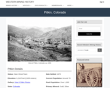
Pitkin, CO Mining Town. Western Mining History presents a brief summary of …
Pitkin, CO Mining Town. Western Mining History presents a brief summary of Colorado's Historical Mining Towns with links to additional Colorado resources for a mining town database and mines by county. Western Mining History is an historical site that provides information on mining, mining towns, the gold and silver rush, and Photos and maps of the western United States. This is a strong primary source resource that can be used for a variety of class research projects. Consider becoming a member or making a donation to help further the work of the site.
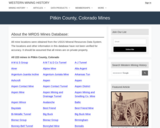
This Western Mining History database uses Mineral Resources Data System to list …
This Western Mining History database uses Mineral Resources Data System to list known Colorado historical mines by county. Each county site has links to the known mines within its borders. Some are known and named, others are unnamed. Mines should be assumed to be on private property unless other research is conducted. Data provided for each mine site include: Name, State, County, Elevation, Primary Mineral Mined, Latitude and Longitude and a link to Google Maps. Photos are provided where available. Additional information for some Mines are satellite photos, and ownership, business and historical records. Mining History is an historical site that provides information on mining, mining towns, the gold and silver rush, and Photos and maps of the western United States. This is a great database for student historical research or data and statistics classes. Consider becoming a member or making a donation to help further the work of the site.
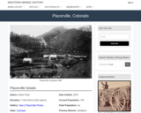
Placerville, CO Mining Town. Western Mining History presents a brief summary of …
Placerville, CO Mining Town. Western Mining History presents a brief summary of Colorado's Historical Mining Towns with links to additional Colorado resources for a mining town database and mines by county. Western Mining History is an historical site that provides information on mining, mining towns, the gold and silver rush, and Photos and maps of the western United States. This is a strong primary source resource that can be used for a variety of class research projects. Consider becoming a member or making a donation to help further the work of the site.
This is a short exercise aimed at evaluating whether students understand how …
This is a short exercise aimed at evaluating whether students understand how to interpret the Ab-An phase diagram. If students know what is going on, it takes about 10 minutes to complete. This active learning exercise makes a good break from lecture. It is best done as a group activity.
(Note: this resource was added to OER Commons as part of a batch upload of over 2,200 records. If you notice an issue with the quality of the metadata, please let us know by using the 'report' button and we will flag it for consideration.)
The scientific community must be effective in communicating the results of its …
The scientific community must be effective in communicating the results of its work to the public in a way that can be understood and used. The need for this is acute, for the complexity and difficulty of environmental and resource problems require full use of all the knowledge scientists can muster. The wisdom of the actions of both the government and private sectors depends in large part on their understanding of resource characteristics.
The U.S. Geological Survey is uniquely qualified to provide much of the required knowledge about natural resources through its many reports and maps and can be proud of the products of its work. Too often, however, reports are couched in words and phrases that are understandable only to other scientists, engineers, or technicians. But, who, really, are the ones to whom the Survey wishes to convey its findings? Other scientists and engineers, yes. But beyond them, by far a larger audience: teachers, students, businessmen, planners, and Federal, State, county, and municipal officials–in short, the public.
More than 50 years ago former Director George Otis Smith recognized the same problem. His plea for “Plain Geology” was a classic, just as applicable now as it was in 1921. It is herewith reprinted to make it generally available.
This is a lengthy PDF document (60 pages+) about plane groups and …
This is a lengthy PDF document (60 pages+) about plane groups and symmetry. It includes colorful images of each of the 17 plane groups, in several different forms. Additionally, there are some summarizing graphics that show unit cells, lattices, symmetry elements, etc. There is lots here to choose from -- I doubt that anyone will want to use all of the images.
Studying plane groups is a good way to introduce crystal systems, point groups, lattices, symmetry operators, etc. All is in 2-D, but it is easy to tell students that the principles are the same in 3-D.
For those who like to make changes, the PDF document was created from individual EPS files. This means that the files can be opened in Adobe Illustrator, Corel Draw, etc., and modified to fit your own needs.
(Note: this resource was added to OER Commons as part of a batch upload of over 2,200 records. If you notice an issue with the quality of the metadata, please let us know by using the 'report' button and we will flag it for consideration.)
How do scientists detect planets around distant stars? Use this model to …
How do scientists detect planets around distant stars? Use this model to explore how a star's movement and light intensity are affected by an orbiting planet. Explore the effects of changing the orbiting angle (tilt), type, and size of the planet on the star's velocity and light intensity. Use the habitability analyzer to determine whether the planet could harbor life.
This is one component of the Seismogenic zone Experiment Mini Lessons This …
This is one component of the Seismogenic zone Experiment Mini Lessons This mini lesson provides an example of how stratigraphy influences tectonics, and vice versa. The magnitude 9 Tohoku earthquake slipped a record 50m along a plate boundary fault comprised of extraordinarily weak smectite-rich pelagic clay [Chester et al., 2013; Ujiie et al., 2013, Fulton et al., 2013]. This clay may also have served as a slip surface for numerous large tsunami and tsunamigenic earthquakes along the subduction zone to the northeast, but it facilitated none along the Japan and Izu-Bonin Trenches to the south. During this lesson students will discover the probable reasons for this dichotomy. Students will be supplied with locations of the Tohoku earthquake ocean drilling site (C0019) and the reference Site (436) as they are back tracked through Pacific Plate motions to their locations of origin. Students will construct the vertical sedimentary sequence that would occur, using Walther's Law (Prothero and Schwab, 1996, p. 329-330).
The student-reconstructed vertical sequence of sedimentary deposits will be compared to that at IODP Site 436. Site 436 includes a conspicuous interval of pelagic clay and is the oceanic reference site for Site C0019 drilled during Exp. 343. Students will compare the vertical succession of sediment lithologies hypothetically accumulated in their backtracked site to those observed at Sites 436, C0019 and others on the oceanic plate incoming to the subduction zone. Students will learn that smooth seafloor correlates with continuity of the pelagic clay layer, whereas, areas of rough seafloor (containing seamounts capped with carbonate and siliceous pelagic sediments) correlate with discontinuity of the pelagic clay layer. They will also learn that large earthquakes and tsunamis occur only in areas of more continuous incoming pelagic clay. Students will be able to speculate on the role of seamounts in interruption of the propagation of seismic slip (e.g. Wang and Bilek, 2011, 2014).
While working in groups to facilitate peer tutoring, students manipulate a hands-on, …
While working in groups to facilitate peer tutoring, students manipulate a hands-on, physical model to better comprehend the dynamics of plate kinematics.
No restrictions on your remixing, redistributing, or making derivative works. Give credit to the author, as required.
Your remixing, redistributing, or making derivatives works comes with some restrictions, including how it is shared.
Your redistributing comes with some restrictions. Do not remix or make derivative works.
Most restrictive license type. Prohibits most uses, sharing, and any changes.
Copyrighted materials, available under Fair Use and the TEACH Act for US-based educators, or other custom arrangements. Go to the resource provider to see their individual restrictions.