Updating search results...

Search Resources

999 Results

View
Selected filters:
  • Geology
Grant Proposal Project
Conditional Remix & Share Permitted
CC BY-NC-SA
Rating
0.0 stars

To prepare for this project, students develop hands-on research skills throughout the course of the semester. A variety of class activities emphasize how to pose research questions, develop hypotheses, determine materials and methods, and understand how fossil data are used to answer a variety of research questions. Class discussions of primary literature emphasize how to track down, synthesize, and evaluate primary literature. Case studies presented in lecture illustrate how to tackle research questions in paleontology. For this project, students apply all of these skills to tackle a topic they find interesting in paleontology. Intermediate deadlines are established to help students develop a research question, write up a rough draft, and revise it in detail. Student progress is also tracked via updates to their peers in the classroom. The written grant proposals must range in length from between 10-12 pages (NOT including the references cited or figures and tables sections) and are double-spaced, 12 pt font, with 1" margins. The rough drafts of the proposals are worth 5% and the final versions are worth 15% of the students' total grade.

Subject:
Archaeology
Earth and Space Science
Geology
Social Science
Material Type:
Activity/Lab
Provider:
Science Education Resource Center (SERC) at Carleton College
Provider Set:
Teach the Earth
Date Added:
04/12/2023
Green Infrastructure/Green Roofs
Conditional Remix & Share Permitted
CC BY-NC-SA
Rating
0.0 stars

Runoff in urban areas is an increasingly important issue when it comes to water quality. It is a major hydrologic issue in New York City, as urban infrastructure creates excess runoff and impervious surfaces decrease the infiltration rate of land surfaces. This excess runoff, which often times carries with it pollutants and contaminants, has proven to create water quality issues. It has become ever more critical to try to mitigate the influx of runoff into our waterways. Urbanization increases runoff, and in NYC 64% of the area is impervious.
In this module students will explore green roofs as a potential solution to the environmental impacts of increased precipitation brought on by climate change. They will evaluate data collected from studies on 15 green roofs from different areas of the US and other countries, as well as historical precipitation data from Central Park in NY to illustrate how precipitation patterns are changing and if we need to use green infrastructure, such as green roofs, to combat the symptoms of climate change. Students will also use Model My Watershed , a watershed-modeling web app, to analyze real land use data, model storm-water runoff and water-quality impacts using professional-grade models, and compare how different conservation or development scenarios could modify runoff and water quality.

(Note: this resource was added to OER Commons as part of a batch upload of over 2,200 records. If you notice an issue with the quality of the metadata, please let us know by using the 'report' button and we will flag it for consideration.)

Subject:
Agriculture and Natural Resources
Biology
Earth and Space Science
Environmental Studies
Geology
Life Science
Mathematics
Measurement and Data
Statistics and Probability
Material Type:
Activity/Lab
Provider:
Science Education Resource Center (SERC) at Carleton College
Provider Set:
Teach the Earth
Date Added:
09/19/2022
Greenhouse Gases: A Closer Look
Read the Fine Print
Some Rights Reserved
Rating
0.0 stars

This lesson covers different aspects of the major greenhouse gases - water vapor, carbon dioxide, methane, nitrous oxides and CFCs - including some of the ways in which human activities are affecting the atmospheric concentrations of these key greenhouse gases. This is lesson six in a nine-lesson module about climate change.

Subject:
Agriculture and Natural Resources
Applied Science
Atmospheric Science
Biology
Chemistry
Earth and Space Science
Environmental Science
Environmental Studies
Geology
Life Science
Physical Science
Material Type:
Activity/Lab
Provider:
CLEAN: Climate Literacy and Energy Awareness Network
Provider Set:
CLEAN: Climate Literacy and Energy Awareness Network
Date Added:
03/09/2023
Ground Shaking and Damage at Your House
Conditional Remix & Share Permitted
CC BY-NC-SA
Rating
0.0 stars

In this activity, students use a seismic hazard map from the USGS to estimate the ground shaking hazard


Screenshot of seismic hazard map

Provenance: Carla Whittington, Highline Community College
Reuse: This item is offered under a Creative Commons Attribution-NonCommercial-ShareAlike license http://creativecommons.org/licenses/by-nc-sa/3.0/ You may reuse this item for non-commercial purposes as long as you provide attribution and offer any derivative works under a similar license.
in their community. The map shows a 10% probability of ground accelerations reaching or exceeding a certain % of gravity within the next 50 years. Students then adjust the acceleration value for the soil conditions/geologic materials that their home sits on. Once the acceleration hazard is determined, students equate that hazard to the Mercalli Intensity Scale and investigate the potential damage expected at their homes. Students also take into consideration housing types and the weaknesses inherent in different types/ages of structures.

(Note: this resource was added to OER Commons as part of a batch upload of over 2,200 records. If you notice an issue with the quality of the metadata, please let us know by using the 'report' button and we will flag it for consideration.)
Subject:
Agriculture and Natural Resources
Biology
Earth and Space Science
Environmental Studies
Geology
Life Science
Material Type:
Activity/Lab
Provider:
Science Education Resource Center (SERC) at Carleton College
Provider Set:
Teach the Earth
Date Added:
12/11/2021
Grow Your Own Crystal, Americorp STEM in a Bag
Read the Fine Print
Educational Use
Rating
0.0 stars

Grow your own crystal from household items. Activity from Weekly STEM in a Bag. Colorado Americorp agents in Araphahoe, Denver, Garfield, Larimer, and Weld Counties. Work supported by the Corporation for National and Community Service under Americorps grant number 18AFHCO0010008. Opinions or points of view expressed in this lesson are those of the authors and do not necessarily represent the official position of or a position that is endorsed by the Corporation or the Americorps program. This resource is also available in Spanish in the linked file.

Subject:
Applied Science
Chemistry
Earth and Space Science
Geology
Mineralogy
Physical Science
STEAM
Material Type:
Activity/Lab
Lesson Plan
Provider:
Americorps
Provider Set:
STEM in a bag weekly activity
Date Added:
02/24/2023
Growing Salt: An Independent Course Research Project Investigating Chemical Sediments
Conditional Remix & Share Permitted
CC BY-NC-SA
Rating
0.0 stars

To prepare for this project, students read a journal article about the processes and products of chemical sedimentation and early diagenesis in saline pan environments (Lowenstein and Hardie, 1985). In class, students are given some handouts that tabluate various evaporite minerals and how water chemistry affects their formation and dissolution. A short slide show and video illustrate some different types of saline environments. Photos and samples guide a lecture on the formation of different types of evaporite minerals and how they form. For example, chevron halite crystals are generally large (cm-scale) and grow upward from the floor of a shallow (less than ~0.5 m) surface water body; cumulate halite crystals are smaller (typically mm-scale) and grow on the water-air interface and settle to the bottom, regardless of water depth. Randomly-oriented halite crystals can grow displacively from groundwater in mud or sand. The students learn that the specific sedimentology of halite can be used to trace past surface water depth and groundwater salinity. I also give examples of how past quantitative climate data, past chemical data and even past microbiologial data can be interpreted from evaporites. I emphasize how, in order to understand evaporites, one must think critically about sedimentology and geochemistry.

The students are told, at the end of this lecture, that their next lab period will focus on designing and setting up a research project on growing salt. They are encouraged to start thinking about a research question they can pose about evaporite sedimentology. At this time, I also tell them what materials are available for their use (tap water, distilled water, seawater, various types of saline water I have collected during field trips, various types of store-bought table and road salt (including iodized, non-iodized, sea salt, etc.). A variety of table salts can be purchased cheaply (~$1 - $2/carton) at almost any grocery store. If you live in a cold climate, most grocery stores and hardware stores also sell several types of road salt (~$3-$4/bag). The table salts are mostly Na and Cl; some have lesser amopunts of Ca and SO4. Some road salts have Ca, Mg, Na, and Cl. In my experience, one carton and one bag of each type will provide more than enough salt for a class of 15 students.

When it is time for lab to begin, I gather my students in my research lab (but could also be done in a classroom), where I show them the materials I have available to them: various types of salt, various types of water, and plastic, glass, and metal containers of various shapes (baby food glass jars, plastic take-out food containers, etc). My lab also contains a variety of other miscellaneous materials, such as sand, gravel, clay, morter and pestle, wooden sticks, metal stirring rods, string, plastic tubing, beakers, food coloring (shows fluid inclusion bands well and everyone loves playing with food coloring), etc. I remind the students that they have a microwave oven, a freezer, a lab hood, a windowsill with plenty of sunlight, and a heating vent that can be used, as well. I make available a few thermometers, pH strips (or pH meter), and a hand-held refractometer for measuring salinity. These analytical field instruments are not neccessary for this assignment to work. However, as instructor, I would encourage you to use anything available to you.

I ask each student to tell me informally of their research question/hypothesis and then I try to help them find any materials they need for their experiments. Here are some examples of student research questions that have been tested with this assignment: (1) Does temperature of water affect rate of haite/gypsum growth?: (2) Will evaporite minerals grown from a complex saline fluid form a "bulls eye" pattern as their textbook claims?; (3) Will halite grow preferentially on glass substrates versus wooden and plastic substrates?; (4) Will evaporation of salt water make halite cement equally well in a gravel, a sand, a clay?; (5) What conditions best produce large halite crystals?; (6) Does pH of water influence halite and gypsum precipitation or dissolution?

Students spend most of a lab period (2-3 hours) setting up their experiment. As part of this initial experimental set-up, they start to learn basic research skills such as labelling samples well, documenting starting conditions, and taking detailed notes.

The students are allowed to leave their experiments on a windowsill in my lab or our classroom, on a radiator, in a lab fume hood, or in a lab refridgerator or freezer, depending upon the nature of the particular experiment. I encourage the students to check their samples on a daily basis and remind them to record their observations each time they check their experiment.

I give the students an assignment sheet that details the final lab report requirements. Most students will have results in 2-3 weeks, but some experiments may last up to 4-5 weeks. For this reason, I plan for this lab assignment to be started in the middle of the semester (which works well if your syllabus, like mine, calls for weathering, physical sedimentology, siliciclastics, and carbonates to be covered in the first 6-8 weeks of class; evaporites follow well after carbonates). The final lab report is not due until the end of the semester so that all students have time to bring their expermient to completion, make interpretations, and write their lab report.

At the end of the semester, depending on the number of students and time permitted, I ask the students to informally tell the class about their experiment and show the results. This has worked well for me. However, even in semesters in which we have not done this, the students still become familiar with each other's projects. On the initial experiment day, the students informally share their ideas. As students come to check on their own experiiments periodically, they usually look in on their classmates' experiments as well.

Students tell me that this is one of their favorite lab exercises. It encourages critical thinking and shows the importance of experimentation in science. In addition, I feel as if the students leave my course knowing more about evaporites than the average geologist.

(Note: this resource was added to OER Commons as part of a batch upload of over 2,200 records. If you notice an issue with the quality of the metadata, please let us know by using the 'report' button and we will flag it for consideration.)
Subject:
Biology
Earth and Space Science
Geology
Life Science
Material Type:
Activity/Lab
Homework/Assignment
Provider:
Science Education Resource Center (SERC) at Carleton College
Provider Set:
Teach the Earth
Date Added:
08/11/2019
Guffey, CO Mining Town
Read the Fine Print
Educational Use
Rating
0.0 stars

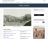
Guffey, CO Mining Town. Western Mining History presents a brief summary of Colorado's Historical Mining Towns with links to additional Colorado resources for a mining town database and mines by county. Western Mining History is an historical site that provides information on mining, mining towns, the gold and silver rush, and Photos and maps of the western United States. This is a strong primary source resource that can be used for a variety of class research projects. Consider becoming a member or making a donation to help further the work of the site.

Subject:
Anthropology
Applied Science
Chemistry
Cultural Geography
Earth and Space Science
Economics
English Language Arts
Environmental Science
Geology
Geoscience
History
Physical Geography
Physical Science
Reading Informational Text
Social Science
Sociology
U.S. History
Material Type:
Data Set
Primary Source
Reading
Provider:
Western Mining History
Provider Set:
Colorado Mining Towns
Date Added:
02/06/2023
Guided Discovery and Scoring Rubric for Petrographic Analysis of a Thin Section
Conditional Remix & Share Permitted
CC BY-NC-SA
Rating
0.0 stars

A series of spread sheets have been set up to provide a framework of observations and questions as a "guided discovery" exercise to clearly demonstrate the observations that a master petrographer would make. The observation of a thin section is broken down into a series of manageable tasks: reconnaissance overview of the thin section at low power; followed by creation of a systematic inventory of the rock-forming minerals (stable mineral paragenesis), alteration phases, and accessory minerals; and finally, analysis of the textures of igneous, sedimentary and metamorphic rocks.

Comprehensive lists of a) optical determinations, and b) textural features are provided as "cues" to the student to help focus attention on the full range of observations that could or should be made towards a comprehensive petrographic analysis of the thin section. These sheets are organized to include:

Consideration of the geologic context of the sample: What is the geologic setting where the rock was collected? What is the rock type (if known), or at least is it igneous, sedimentary or metamorphic? This type of contextual information will help guide you to interpret what minerals are likely to be present (or excluded) in the sample
Mineral Optics (identification of mineral phases in thin section.

Observations at low power in plane and cross polarized light.
Systematic characterization of the (stable) rock-forming minerals
Identification of a) secondary or replacement minerals, and b) important accessory minerals;

Description and Interpretation of Rock Textures

Igneous rocks
Clastic Sedimentary rocks
Non-clastic Sedimentary rocks (carbonates)
Metamorphic rocks

Applications; can these minerals/assemblages/textures be used to determine source area, physical conditions (thermobarometry), geo- or thermochronology, and other useful geologic information?

Initially, use of these spread sheets will appear to be prescriptive. However, given the complexity observed in Nature, no single set of questions can be universally applied to all types of samples. So, the steps and observations represented in these spread sheets provide a general framework--a place to start--and the lists of optical properties and textures are meant to be a reminder to students about the types of observations that should be made. Students can use these spread sheets as a guide to make decisions about what is important and useful for the overall interpretation.
Metacognitive components of the activity

Students derive an awareness of their own learning processes by considering "what" they are doing and "why" they are performing certain operations on the petrographic microscope.
Students monitor their own progress by considering a) what they expect to find based on geologic contexts, b) are their observations and interpretations consistent with what can (or cannot) occur in Nature, and
Adjust their learning strategies to accomodate new lines of evidence towards formulation of internally consistent (if not "correct") observations and interpretations of the thin section.

Metacognitive goals for this activity:
The first encounter with an unknown thin section can be both confusing and overwhelming: Where do I start? What should I look for? How should I proceed? How will I know if I'm doing the right thing, and making the right observations?....

The purpose of this exercise is to "unpack" the steps taken by a master petrographer, to describe "what" observations can be made, and explain "why" these steps should be taken, what the utility or significance of the observations is, and how these observations can be appropriately interpreted (often these observations are done instantaneously in the mind of the petrographer, but in this exercise we try to explicitly outline these steps). With practice and experience these steps will become second nature. The goal of this exercise is to help students master the art of petrography so that they can independently do petrographic analysis of any rock from any context.
Assessing students' metacognition
In the course of teaching petrography in my regular coursework, I find that I continually articulate to students (one at a time) what I am doing (and why), what I am seeing (and they may or may not be seeing the same thing), why certain relationships are to be expected or prohibited in Nature (by considering the larger geologic context). The development of these guided discovery activities is an attempt to clearly articulate to all students the steps that are routinely taken in the petrographic analysis of a thin section. The goal is to more efficiently and effectively get students past the "mechanical" stages of mineral identification and textural descriptions, and help them to begin to develop higher order thinking skills of application, analysis, synthesis, and evaluation.

(Note: this resource was added to OER Commons as part of a batch upload of over 2,200 records. If you notice an issue with the quality of the metadata, please let us know by using the 'report' button and we will flag it for consideration.)

Subject:
Biology
Earth and Space Science
Geology
Life Science
Physical Science
Physics
Material Type:
Activity/Lab
Provider:
Science Education Resource Center (SERC) at Carleton College
Provider Set:
Teach the Earth
Date Added:
08/23/2020
Gunnison County Mines
Read the Fine Print
Educational Use
Rating
0.0 stars

This Western Mining History database uses Mineral Resources Data System to list known Colorado historical mines by county. Each county site has links to the known mines within its borders. Some are known and named, others are unnamed. Mines should be assumed to be on private property unless other research is conducted. Data provided for each mine site include: Name, State, County, Elevation, Primary Mineral Mined, Latitude and Longitude and a link to Google Maps. Photos are provided where available. Additional information for some Mines are satellite photos, and ownership, business and historical records. Mining History is an historical site that provides information on mining, mining towns, the gold and silver rush, and Photos and maps of the western United States. This is a great database for student historical research or data and statistics classes. Consider becoming a member or making a donation to help further the work of the site.

Subject:
Anthropology
Applied Science
Chemistry
Cultural Geography
Earth and Space Science
Economics
English Language Arts
Environmental Science
Geology
Geoscience
History
Mathematics
Measurement and Data
Physical Geography
Physical Science
Reading Informational Text
Social Science
Sociology
U.S. History
Material Type:
Data Set
Primary Source
Reading
Provider:
Western Mining History
Provider Set:
Historical Colorado Mines
Date Added:
02/06/2023
Guston, CO Mining Town
Read the Fine Print
Educational Use
Rating
0.0 stars

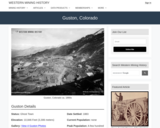
Guston, CO Mining Town. Western Mining History presents a brief summary of Colorado's Historical Mining Towns with links to additional Colorado resources for a mining town database and mines by county. Western Mining History is an historical site that provides information on mining, mining towns, the gold and silver rush, and Photos and maps of the western United States. This is a strong primary source resource that can be used for a variety of class research projects. Consider becoming a member or making a donation to help further the work of the site.

Subject:
Anthropology
Applied Science
Chemistry
Cultural Geography
Earth and Space Science
Economics
English Language Arts
Environmental Science
Geology
Geoscience
History
Physical Geography
Physical Science
Reading Informational Text
Social Science
Sociology
U.S. History
Material Type:
Data Set
Primary Source
Reading
Provider:
Western Mining History
Provider Set:
Colorado Mining Towns
Date Added:
02/06/2023
HMK 1_Plate Boundaries: Present, future, & past
Conditional Remix & Share Permitted
CC BY-NC-SA
Rating
0.0 stars

Prior to this homework assignment, students will have been exposed (for ~2-3 in class activities and lectures) to general concepts in plate tectonics, plate boundaries, hot spot volcanoes, use of earthquake/volcano trends at plate boundaries, as well as GPS as a modern use to document plate motion. Students receive this activity as a homework assignment to be completed outside of class. Their task is to use provided topographic/bathymetric data, earthquake and volcano distribution, GPS data, as well as ocean floor and hot spot age trends to characterize plate motion in modern, future, and ancient plate boundaries. This is a three-part exercise that involves a modern plate boundary study form the eastern margin of the Pacific plate, a potential future plate boundary in eastern Africa, and a identification of possible ancient plate boundaries in the Eurasian plate.

(Note: this resource was added to OER Commons as part of a batch upload of over 2,200 records. If you notice an issue with the quality of the metadata, please let us know by using the 'report' button and we will flag it for consideration.)
Subject:
Biology
Earth and Space Science
Geology
Life Science
Mathematics
Measurement and Data
Material Type:
Activity/Lab
Provider:
Science Education Resource Center (SERC) at Carleton College
Provider Set:
Teach the Earth
Date Added:
02/02/2022
Hacer que un Río Fluya, Americorp Bolsa de STEM
Read the Fine Print
Educational Use
Rating
0.0 stars

Crea un río. Aprende cómo fluye el agua.
Actividad de Bolsa de STEM Semanal. Agentes de Colorado Americorp en los condados de Araphahoe, Denver, Garfield, Larimer y Weld. Trabajo apoyado por la Corporación para el Servicio Nacional y Comunitario bajo el número de subvención 18AFHCO0010008 de Americorps. Las opiniones o puntos de vista expresados en esta lección pertenecen a los autores y no representan necesariamente la posición oficial o una posición respaldada por la Corporación o el programa Americorps.

Subject:
Applied Science
Atmospheric Science
Earth and Space Science
Geology
Geoscience
Hydrology
Maritime Science
Oceanography
Physical Geography
Physical Science
Physics
STEAM
Material Type:
Activity/Lab
Lesson Plan
Simulation
Provider:
Americorps
Provider Set:
STEM in a bag weekly activity
Date Added:
02/24/2023
Harvesting Oil from the Earth
Read the Fine Print
Educational Use
Rating
0.0 stars

In this lesson, students investigate sources of fossil fuels, particularly oil. Students will learn how engineers and scientists look for oil by taking core samples from a model of the Earth. Also, students will explore and analyze oil consumption and production in the United States and around the world.

Subject:
Applied Science
Earth and Space Science
Engineering
Geology
Material Type:
Activity/Lab
Lesson Plan
Provider:
TeachEngineering
Provider Set:
TeachEngineering
Date Added:
09/18/2014
Haz tu Propia Brújula, Americorp Bolsa de STEM
Read the Fine Print
Educational Use
Rating
0.0 stars

Haz tu propia brújula.
Actividad de Bolsa de STEM Semanal. Agentes de Colorado Americorp en los condados de Araphahoe, Denver, Garfield, Larimer y Weld. Trabajo apoyado por la Corporación para el Servicio Nacional y Comunitario bajo el número de subvención 18AFHCO0010008 de Americorps. Las opiniones o puntos de vista expresados en esta lección pertenecen a los autores y no representan necesariamente la posición oficial o una posición respaldada por la Corporación o el programa Americorps.

Subject:
Applied Science
Design
Do-It-Yourself
Earth and Space Science
Engineering
Family and Consumer Science
Geology
Geoscience
Manufacturing
Physical Science
Physics
STEAM
Skilled Trades and Services
Visual Arts and Design
Material Type:
Activity/Lab
Lesson Plan
Provider:
Americorps
Provider Set:
STEM in a bag weekly activity
Date Added:
02/24/2023
Help a geochronologist
Conditional Remix & Share Permitted
CC BY-NC-SA
Rating
0.0 stars

This activity allows students to better understand radiometric dating and absolute dating techniques by calculating radiometric ages of zircon crystals. Their calculated ages then serve as tools to practice creating graphs, interpret analytic data, and reconstruct geologic events.

(Note: this resource was added to OER Commons as part of a batch upload of over 2,200 records. If you notice an issue with the quality of the metadata, please let us know by using the 'report' button and we will flag it for consideration.)

Subject:
Biology
Earth and Space Science
Geology
Life Science
Material Type:
Activity/Lab
Provider:
Science Education Resource Center (SERC) at Carleton College
Provider Set:
Teach the Earth
Date Added:
08/15/2019
Hielo Vital Equip STEM
Conditional Remix & Share Permitted
CC BY-NC-SA
Rating
0.0 stars

Hielo Vital Equip STEM. El Centro de Extensión y Educación en Ciencias Naturales colabora con la facultad de CSU, los Parques Nacionales y los programas de ciencia ciudadana para traducir su investigación científica actual en experiencias STEM únicas para los estudiantes en forma de kits educativos que se pueden prestar. Cada kit contiene casi todos los materiales necesarios (menos cosas comunes como agua y toallas de papel) para explorar algunos temas de investigación científica realmente interesantes. enviando un formulario de recogida local o un formulario de entrega disponible en el sitio web vinculado. Utilice la información de contacto en la página de descripción general del kit STEM para obtener más información. https://www.cns-eoc.colostate.edu/stem-kits/ Este kit se proporciona de forma gratuita para uso educativo.

Subject:
Agriculture and Natural Resources
Ancient History
Anthropology
Applied Science
Archaeology
Arts and Humanities
Atmospheric Science
Chemistry
Cultural Geography
Earth and Space Science
Ecology
Environmental Science
Environmental Studies
Ethnic Studies
Geology
Geoscience
History
Hydrology
Life Science
Oceanography
Paleontology
Physical Geography
Physical Science
Physics
Social Science
U.S. History
World Cultures
Material Type:
Activity/Lab
Case Study
Diagram/Illustration
Educational Kit
Interactive
Lesson
Lesson Plan
Primary Source
Reading
Simulation
Student Guide
Unit of Study
Provider:
Colorado State University
Provider Set:
Natural Sciences Education & Outreach Center
Date Added:
02/24/2023
Hierarchical Alignment of Timelines
Conditional Remix & Share Permitted
CC BY-NC-SA
Rating
0.0 stars

In the hierarchical alignment activity, students are given multiple opportunities to align time to space in a linear representation. They begin by scaling a familiar amount of time (e.g. a personal time line) to a spatial representation (e.g. a meter stick), and progressively align increasing/decreasing amounts until completing the target unfamiliar time line (e.g. geologic time). For example, in the hierarchical alignment of geologic time, students can work through 10 time lines: personal, human lifespan, American history, Recorded history, human evolution, Cenozoic, Phanerozoic, Proterozoic, Archean, and then Hadean.

While the amount of time varies, the amount of space remains constant: in this example, students align all new temporal scales to one meter. For each time line, students are asked to locate specific events, hierarchicaly organized divisions of time, and the length of the time line in order to engage the students in thinking about that temporal scale. Additionally, every time students align a new temporal scale to space, they locate all previous scales relative to the current scale.

(Note: this resource was added to OER Commons as part of a batch upload of over 2,200 records. If you notice an issue with the quality of the metadata, please let us know by using the 'report' button and we will flag it for consideration.)

Subject:
Biology
Earth and Space Science
Geology
Life Science
Material Type:
Activity/Lab
Provider:
Science Education Resource Center (SERC) at Carleton College
Provider Set:
Teach the Earth
Date Added:
08/22/2020
High Tech Rocks! STEM Kit
Conditional Remix & Share Permitted
CC BY-NC-SA
Rating
0.0 stars

High Tech Rocks! STEM Kit. The Natural Sciences Education & Outreach Center collaborates with CSU faculty, National Parks and citizen science programs to translate their current scientific research into unique STEM experiences for students in the form of Educational Kits that can be checked out. Each kit contains just about all of the materials needed (minus common things like water and paper towels) to explore some really interesting scientific research topics.The kits are available for teachers and informal educators in Colorado to check out for a duration of a week by submitting either a local pickup form or a delivery form available at the linked website. This kit is provided free for educational use. This Kit is available in Spanish.

Subject:
Applied Science
Architecture and Design
Career and Technical Education
Chemistry
Earth and Space Science
Electronic Technology
Engineering
Geology
Geoscience
Manufacturing
Mathematics
Physical Science
Physics
Skilled Trades and Services
Material Type:
Activity/Lab
Case Study
Diagram/Illustration
Interactive
Lesson
Lesson Plan
Primary Source
Reading
Simulation
Student Guide
Unit of Study
Provider:
Colorado State University
Provider Set:
CSU Natural Sciences Education & Outreach Center
Date Added:
02/06/2023
Highland Mary, CO Mining Town
Read the Fine Print
Educational Use
Rating
0.0 stars

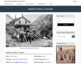
Highland Mary, CO Mining Town. Western Mining History presents a brief summary of Colorado's Historical Mining Towns with links to additional Colorado resources for a mining town database and mines by county. Western Mining History is an historical site that provides information on mining, mining towns, the gold and silver rush, and Photos and maps of the western United States. This is a strong primary source resource that can be used for a variety of class research projects. Consider becoming a member or making a donation to help further the work of the site.

Subject:
Anthropology
Applied Science
Chemistry
Cultural Geography
Earth and Space Science
Economics
English Language Arts
Environmental Science
Geology
Geoscience
History
Physical Geography
Physical Science
Reading Informational Text
Social Science
Sociology
U.S. History
Material Type:
Data Set
Primary Source
Reading
Provider:
Western Mining History
Provider Set:
Colorado Mining Towns
Date Added:
02/06/2023
Hillslope diffusion
Conditional Remix & Share Permitted
CC BY-NC-SA
Rating
0.0 stars

This lab is designed to help students apply hillslope diffusion equations (derived in class prior to the lab) to understand real-world hillslopes. The major goal is a deeper understanding of hillslope processes and the equations used to describe hillslope diffusion by observing the same factors described in the equations on real-world hillslopes.

Subject:
Earth and Space Science
Geology
Physical Geography
Material Type:
Activity/Lab
Provider:
Science Education Resource Center (SERC) at Carleton College
Provider Set:
Teach the Earth
Date Added:
04/12/2023