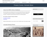
This Western Mining History database uses Mineral Resources Data System to list …
This Western Mining History database uses Mineral Resources Data System to list known Colorado historical mines by county. Each county site has links to the known mines within its borders. Some are known and named, others are unnamed. Mines should be assumed to be on private property unless other research is conducted. Data provided for each mine site include: Name, State, County, Elevation, Primary Mineral Mined, Latitude and Longitude and a link to Google Maps. Photos are provided where available. Additional information for some Mines are satellite photos, and ownership, business and historical records. Mining History is an historical site that provides information on mining, mining towns, the gold and silver rush, and Photos and maps of the western United States. This is a great database for student historical research or data and statistics classes. Consider becoming a member or making a donation to help further the work of the site.
Perigo, CO Mining Town. Western Mining History presents a brief summary of …
Perigo, CO Mining Town. Western Mining History presents a brief summary of Colorado's Historical Mining Towns with links to additional Colorado resources for a mining town database and mines by county. Western Mining History is an historical site that provides information on mining, mining towns, the gold and silver rush, and Photos and maps of the western United States. This is a strong primary source resource that can be used for a variety of class research projects. Consider becoming a member or making a donation to help further the work of the site.
Physical Geography, also called earth science, is the study of our home …
Physical Geography, also called earth science, is the study of our home planet and all of its components: its lands, waters, atmosphere, and interior. In this book, some chapters are devoted to the processes that shape the lands and impact people. Other chapters depict the processes of the atmosphere and its relationship to the planets surface and all our living creatures. For as long as people have been on the planet, humans have had to live within Earths boundaries. Now human life is having a profound effect on the planet. Several chapters are devoted to the effect people have on the planet.The journey to better understanding Earth begins here with an exploration of how scientists learn about the natural world and introduces you to the study of physical geography and earth science.
Piscinas Anquialinas Equipo STEM. Este equipo proporciona recursos para socios del Parque …
Piscinas Anquialinas Equipo STEM. Este equipo proporciona recursos para socios del Parque Histórico Nacional Kaloko-Honokōhau en Hawái. El equipo incluye referencias al idioma nativo hawaiano y la ecología con una entrevista con el tío Fred Cachola, un ambientalista local. El Centro de Extensión y Educación en Ciencias Naturales colabora con la facultad de CSU, los Parques Nacionales y los programas de ciencia ciudadana para traducir su investigación científica actual en experiencias STEM únicas para los estudiantes en forma de kits educativos que se pueden prestar. Cada kit contiene casi todos los materiales necesarios (menos cosas comunes como agua y toallas de papel) para explorar algunos temas de investigación científica realmente interesantes. enviando un formulario de recogida local o un formulario de entrega disponible en el sitio web vinculado. Utilice la información de contacto en la página de descripción general del kit STEM para obtener más información. https://www.cns-eoc.colostate.edu/stem-kits/ Este kit se proporciona de forma gratuita para uso educativo.
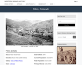
Pitkin, CO Mining Town. Western Mining History presents a brief summary of …
Pitkin, CO Mining Town. Western Mining History presents a brief summary of Colorado's Historical Mining Towns with links to additional Colorado resources for a mining town database and mines by county. Western Mining History is an historical site that provides information on mining, mining towns, the gold and silver rush, and Photos and maps of the western United States. This is a strong primary source resource that can be used for a variety of class research projects. Consider becoming a member or making a donation to help further the work of the site.
This Western Mining History database uses Mineral Resources Data System to list …
This Western Mining History database uses Mineral Resources Data System to list known Colorado historical mines by county. Each county site has links to the known mines within its borders. Some are known and named, others are unnamed. Mines should be assumed to be on private property unless other research is conducted. Data provided for each mine site include: Name, State, County, Elevation, Primary Mineral Mined, Latitude and Longitude and a link to Google Maps. Photos are provided where available. Additional information for some Mines are satellite photos, and ownership, business and historical records. Mining History is an historical site that provides information on mining, mining towns, the gold and silver rush, and Photos and maps of the western United States. This is a great database for student historical research or data and statistics classes. Consider becoming a member or making a donation to help further the work of the site.
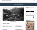
Placerville, CO Mining Town. Western Mining History presents a brief summary of …
Placerville, CO Mining Town. Western Mining History presents a brief summary of Colorado's Historical Mining Towns with links to additional Colorado resources for a mining town database and mines by county. Western Mining History is an historical site that provides information on mining, mining towns, the gold and silver rush, and Photos and maps of the western United States. This is a strong primary source resource that can be used for a variety of class research projects. Consider becoming a member or making a donation to help further the work of the site.
This resource gives information about our solar system which is made up …
This resource gives information about our solar system which is made up of the sun, planets and all the amazing objects that travel around it. Information about the plant sizes, distances in the solar system and the size and shape of orbits is also explained. The universe is filled with billions of star systems. And the star system we are most familiar with is our own.
This is one component of the Seismogenic zone Experiment Mini Lessons This …
This is one component of the Seismogenic zone Experiment Mini Lessons This mini lesson provides an example of how stratigraphy influences tectonics, and vice versa. The magnitude 9 Tohoku earthquake slipped a record 50m along a plate boundary fault comprised of extraordinarily weak smectite-rich pelagic clay [Chester et al., 2013; Ujiie et al., 2013, Fulton et al., 2013]. This clay may also have served as a slip surface for numerous large tsunami and tsunamigenic earthquakes along the subduction zone to the northeast, but it facilitated none along the Japan and Izu-Bonin Trenches to the south. During this lesson students will discover the probable reasons for this dichotomy. Students will be supplied with locations of the Tohoku earthquake ocean drilling site (C0019) and the reference Site (436) as they are back tracked through Pacific Plate motions to their locations of origin. Students will construct the vertical sedimentary sequence that would occur, using Walther's Law (Prothero and Schwab, 1996, p. 329-330).
The student-reconstructed vertical sequence of sedimentary deposits will be compared to that at IODP Site 436. Site 436 includes a conspicuous interval of pelagic clay and is the oceanic reference site for Site C0019 drilled during Exp. 343. Students will compare the vertical succession of sediment lithologies hypothetically accumulated in their backtracked site to those observed at Sites 436, C0019 and others on the oceanic plate incoming to the subduction zone. Students will learn that smooth seafloor correlates with continuity of the pelagic clay layer, whereas, areas of rough seafloor (containing seamounts capped with carbonate and siliceous pelagic sediments) correlate with discontinuity of the pelagic clay layer. They will also learn that large earthquakes and tsunamis occur only in areas of more continuous incoming pelagic clay. Students will be able to speculate on the role of seamounts in interruption of the propagation of seismic slip (e.g. Wang and Bilek, 2011, 2014).
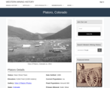
Platoro, CO Mining Town. Western Mining History presents a brief summary of …
Platoro, CO Mining Town. Western Mining History presents a brief summary of Colorado's Historical Mining Towns with links to additional Colorado resources for a mining town database and mines by county. Western Mining History is an historical site that provides information on mining, mining towns, the gold and silver rush, and Photos and maps of the western United States. This is a strong primary source resource that can be used for a variety of class research projects. Consider becoming a member or making a donation to help further the work of the site.
In this unit, students learn the very basics of navigation, including the …
In this unit, students learn the very basics of navigation, including the different kinds of navigation and their purposes. The concepts of relative and absolute location, latitude, longitude and cardinal directions are explored, as well as the use and principles of maps and a compass. Students discover the history of navigation and learn the importance of math and how it ties into navigational techniques. Understanding how trilateration can determine one's location leads to a lesson on the global positioning system and how to use a GPS receiver. The unit concludes with an overview of orbits and spacecraft trajectories from Earth to other planets.
Students use their knowledge of scales and areas to determine the best …
Students use their knowledge of scales and areas to determine the best locations in Alabraska for the underground caverns. They cut out rectangular paper pieces to represent caverns to scale with the maps and place the cut-outs on the maps to determine feasible locations.
Mountain Men Social Studies Lesson 5 The Price is Right! is designed …
Mountain Men Social Studies Lesson 5 The Price is Right! is designed to be used with Mountain Man Artifact Kit. Lessons 1, 2, 3, 4, 5 and 7 can be completed without the artifacts from the kit. These kits are available through Musuems of Western Colorado to D51 Teachers. This lesson can be adapted to use without the kit. Students will be able to: • understand the exchange of goods between trappers and traders by solving mathematical problems.
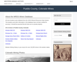
This Western Mining History database uses Mineral Resources Data System to list …
This Western Mining History database uses Mineral Resources Data System to list known Colorado historical mines by county. Each county site has links to the known mines within its borders. Some are known and named, others are unnamed. Mines should be assumed to be on private property unless other research is conducted. Data provided for each mine site include: Name, State, County, Elevation, Primary Mineral Mined, Latitude and Longitude and a link to Google Maps. Photos are provided where available. Additional information for some Mines are satellite photos, and ownership, business and historical records. Mining History is an historical site that provides information on mining, mining towns, the gold and silver rush, and Photos and maps of the western United States. This is a great database for student historical research or data and statistics classes. Consider becoming a member or making a donation to help further the work of the site.
Students in groups of two create a 4-minute educational video, brochure, and …
Students in groups of two create a 4-minute educational video, brochure, and poster on an aspect of soil erosion, soil conservation, and/or watershed health for agricultural regions within the midwestern states. This is a half term project and the materials are presented in a forum towards the end of the semester. The project is aimed to help students learn to pitch science to a wide audience and provide practice (indirectly) applying scientific principles to conservation efforts.
(Note: this resource was added to OER Commons as part of a batch upload of over 2,200 records. If you notice an issue with the quality of the metadata, please let us know by using the 'report' button and we will flag it for consideration.)
This Western Mining History database uses Mineral Resources Data System to list …
This Western Mining History database uses Mineral Resources Data System to list known Colorado historical mines by county. Each county site has links to the known mines within its borders. Some are known and named, others are unnamed. Mines should be assumed to be on private property unless other research is conducted. Data provided for each mine site include: Name, State, County, Elevation, Primary Mineral Mined, Latitude and Longitude and a link to Google Maps. Photos are provided where available. Additional information for some Mines are satellite photos, and ownership, business and historical records. Mining History is an historical site that provides information on mining, mining towns, the gold and silver rush, and Photos and maps of the western United States. This is a great database for student historical research or data and statistics classes. Consider becoming a member or making a donation to help further the work of the site.
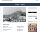
Querida, CO Mining Town. Western Mining History presents a brief summary of …
Querida, CO Mining Town. Western Mining History presents a brief summary of Colorado's Historical Mining Towns with links to additional Colorado resources for a mining town database and mines by county. Western Mining History is an historical site that provides information on mining, mining towns, the gold and silver rush, and Photos and maps of the western United States. This is a strong primary source resource that can be used for a variety of class research projects. Consider becoming a member or making a donation to help further the work of the site.
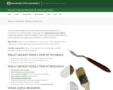
Really Ancient Fossils STEM Kit. The Natural Sciences Education & Outreach Center …
Really Ancient Fossils STEM Kit. The Natural Sciences Education & Outreach Center collaborates with CSU faculty, National Parks and citizen science programs to translate their current scientific research into unique STEM experiences for students in the form of Educational Kits that can be checked out. Each kit contains just about all of the materials needed (minus common things like water and paper towels) to explore some really interesting scientific research topics.The kits are available for teachers and informal educators in Colorado to check out for a duration of a week by submitting either a local pickup form or a delivery form available at the linked website. Due to the extreme weight of the sand used in this Kit, local pickup is the only option. This kit is provided free for educational use. This kit is also available in Spanish.
Reasons for the Seasons. This is the Lesson 3 Digging Deeper activity, …
Reasons for the Seasons. This is the Lesson 3 Digging Deeper activity, from Unit 4 Agriculture and the Seasons, from the DIGS (Developing Individuals, Growing Stewards) AmeriCorps Curriculum from CSU. The curriculum focuses on introducing students in grades 3-5 to Colorado agriculture, industry and environmental issues. The curriculum is matched to State Standards 2021. The curriculum upon request. Visit: https://engagement.colostate.edu/programs-old/developing-individuals-growing-stewards/
No restrictions on your remixing, redistributing, or making derivative works. Give credit to the author, as required.
Your remixing, redistributing, or making derivatives works comes with some restrictions, including how it is shared.
Your redistributing comes with some restrictions. Do not remix or make derivative works.
Most restrictive license type. Prohibits most uses, sharing, and any changes.
Copyrighted materials, available under Fair Use and the TEACH Act for US-based educators, or other custom arrangements. Go to the resource provider to see their individual restrictions.