Students use a variety of tools to explore the interior of the …
Students use a variety of tools to explore the interior of the Earth in this inquiry activity.
(Note: this resource was added to OER Commons as part of a batch upload of over 2,200 records. If you notice an issue with the quality of the metadata, please let us know by using the 'report' button and we will flag it for consideration.)
This Western Mining History database uses Mineral Resources Data System to list …
This Western Mining History database uses Mineral Resources Data System to list known Colorado historical mines by county. Each county site has links to the known mines within its borders. Some are known and named, others are unnamed. Mines should be assumed to be on private property unless other research is conducted. Data provided for each mine site include: Name, State, County, Elevation, Primary Mineral Mined, Latitude and Longitude and a link to Google Maps. Photos are provided where available. Additional information for some Mines are satellite photos, and ownership, business and historical records. Mining History is an historical site that provides information on mining, mining towns, the gold and silver rush, and Photos and maps of the western United States. This is a great database for student historical research or data and statistics classes. Consider becoming a member or making a donation to help further the work of the site.
Each spring, students in a 300-level field course collect samples from urban …
Each spring, students in a 300-level field course collect samples from urban community gardens to monitor soil lead concentrations.
(Note: this resource was added to OER Commons as part of a batch upload of over 2,200 records. If you notice an issue with the quality of the metadata, please let us know by using the 'report' button and we will flag it for consideration.)
Montezuma, CO Mining Town. Western Mining History presents a brief summary of …
Montezuma, CO Mining Town. Western Mining History presents a brief summary of Colorado's Historical Mining Towns with links to additional Colorado resources for a mining town database and mines by county. Western Mining History is an historical site that provides information on mining, mining towns, the gold and silver rush, and Photos and maps of the western United States. This is a strong primary source resource that can be used for a variety of class research projects. Consider becoming a member or making a donation to help further the work of the site.
This Western Mining History database uses Mineral Resources Data System to list …
This Western Mining History database uses Mineral Resources Data System to list known Colorado historical mines by county. Each county site has links to the known mines within its borders. Some are known and named, others are unnamed. Mines should be assumed to be on private property unless other research is conducted. Data provided for each mine site include: Name, State, County, Elevation, Primary Mineral Mined, Latitude and Longitude and a link to Google Maps. Photos are provided where available. Additional information for some Mines are satellite photos, and ownership, business and historical records. Mining History is an historical site that provides information on mining, mining towns, the gold and silver rush, and Photos and maps of the western United States. This is a great database for student historical research or data and statistics classes. Consider becoming a member or making a donation to help further the work of the site.
Montgomery, CO Mining Town. Western Mining History presents a brief summary of …
Montgomery, CO Mining Town. Western Mining History presents a brief summary of Colorado's Historical Mining Towns with links to additional Colorado resources for a mining town database and mines by county. Western Mining History is an historical site that provides information on mining, mining towns, the gold and silver rush, and Photos and maps of the western United States. This is a strong primary source resource that can be used for a variety of class research projects. Consider becoming a member or making a donation to help further the work of the site.
This Western Mining History database uses Mineral Resources Data System to list …
This Western Mining History database uses Mineral Resources Data System to list known Colorado historical mines by county. Each county site has links to the known mines within its borders. Some are known and named, others are unnamed. Mines should be assumed to be on private property unless other research is conducted. Data provided for each mine site include: Name, State, County, Elevation, Primary Mineral Mined, Latitude and Longitude and a link to Google Maps. Photos are provided where available. Additional information for some Mines are satellite photos, and ownership, business and historical records. Mining History is an historical site that provides information on mining, mining towns, the gold and silver rush, and Photos and maps of the western United States. This is a great database for student historical research or data and statistics classes. Consider becoming a member or making a donation to help further the work of the site.
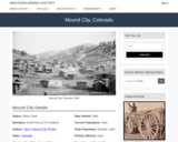
Mound City, CO Mining Town. Western Mining History presents a brief summary …
Mound City, CO Mining Town. Western Mining History presents a brief summary of Colorado's Historical Mining Towns with links to additional Colorado resources for a mining town database and mines by county. Western Mining History is an historical site that provides information on mining, mining towns, the gold and silver rush, and Photos and maps of the western United States. This is a strong primary source resource that can be used for a variety of class research projects. Consider becoming a member or making a donation to help further the work of the site.
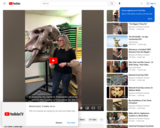
Dinosaur Journey is part of the Mueums of Western Colorado. Our Curator …
Dinosaur Journey is part of the Mueums of Western Colorado. Our Curator of Education Stephanie Lukowski tells us about the unique and unprecedented finds during the 2010 Snowmass fossil excavation. Giving us insight into what life and climate would have been like in Colorado when Mastodons walked the earth.
This activity is designed as a laboratory exercise and to take ~1-1.5 …
This activity is designed as a laboratory exercise and to take ~1-1.5 hours to finish.
On May 18, 1980, Mt. St. Helens in the state of Washington exploded in a cloud of ash, plus lava and mud flows. What had been a beautiful symmetrical snow-covered mountain with heavily forested slopes became a startling landscape of ash, mud, and downed trees surrounding a broken, irregular peak. The power of the initial blast was directed upward and laterally, snapping off trees for miles in the blast zone. In the years since 1980, many people �� geologists, biologists, environmentalists �� have been observing and studying how the landscape recovers after a major volcanic eruption.
In this exercise, students study simplified topographic maps of Mt. St. Helens to interpret the shape of the mountain before and after the 1980 eruption. An option is to have them look at the volcano on Google Earth at this point. Student materials include a graph on which to plot two topographic profiles across Mt. St. Helens to illustrate the change in its shape. The accompanying Instruction file includes calculation of the vertical exaggeration of the profiles, but this section of the exercise may be omitted. Assuming that the material removed by the eruption was in the form of a perfect cone, students use their profiles to measure the height and diameter of the cone to calculate the volume of material removed. Students then compare the result of their calculation with published values for the eruptive material removed from the mountain and identify possible sources of error in their work.
This activity takes place outside of the classroom and requires ~1 hour …
This activity takes place outside of the classroom and requires ~1 hour to complete. Students recreate the map of the Mt. St. Helens ash plume of 1980 and use their maps to answer a series of questions about this ashfall.
Many terrestrial sedimentary processes are not difficult to observe, describe, and interpret. …
Many terrestrial sedimentary processes are not difficult to observe, describe, and interpret. Yet many of these dynamic processes are not limited to the Earth. One example is the formation of mudcracks that provide critical evidence of the presence of liquid water saturating a fine-grained sediment and then evaporating. The documentation and analysis of this process can provide insight into geologic and environmental conditions on other planets (Mars?). Images and video snips are used to engage students who must attend to careful observation, description, and interpretation (qualitative and quantitative) from laboratory and field examples.
Each student or pair of students is provided with an illustration of …
Each student or pair of students is provided with an illustration of a landscape, landform, or geomorphic process and asked to place it in the appropriate location on the timescale answer form (Acrobat (PDF) 8kB Feb28 12) (see the list of landforms and geomorphic processes (Excel 74kB May8 12)). The landforms and processes list includes information on time ranges for each time, time in seconds, and time in years. Note that the time ranges represent approximate values for the processes and that the time in seconds and time in years columns represent low-end values for each respective process. Thus, some processes may fit into multiple locations on the timescale answer form and some revision by students will occur during the initial phase of the activity.
After students have completed their first iteration of the timescale, the instructor will assess the placement of each process on the answer form (Acrobat (PDF) 8kB Feb28 12). The instructor will then determine which processes need further explanation. For some processes, lecture or other learning strategies might be implemented if students do not have a good understanding of the scale in which they occur. For other processes, the instructor may facilitate a discussion to lead students to expand, contract, or alter their perceptions of the time range.
Ultimately, and perhaps towards the end of the lecture period or as a quiz, students will again be asked to complete the timescale answer form.
(Note: this resource was added to OER Commons as part of a batch upload of over 2,200 records. If you notice an issue with the quality of the metadata, please let us know by using the 'report' button and we will flag it for consideration.)
Museums of Western Colorado allow education kits for check out in District …
Museums of Western Colorado allow education kits for check out in District 51. The kits come with a curriculum, teacher training materials and artifacts. Some of which are genuine from the Grand Junction BLM Field Office. Kits local to the Grand Junction/Western Colorado area.
This is an online portal to search photos of items in the …
This is an online portal to search photos of items in the Museums of Western Colorado Collections intended for specific research. The Museums of Western Colorado has the duty to preserve more than 100,000 items related to Mesa County’s cultural and scientific heritage, including historic documents, photographs, objects, works of art, paleontological specimens, and archaeological artifacts. For research access to other primary sources in the collections items visit: https://www.museumofwesternco.com/collections/
The Museum is currently prioritizing creation of an online collections search portal. Digitization is an on-going process but content is being added frequently.
Students locate their homes on local, regional, and global scale geologic maps. …
Students locate their homes on local, regional, and global scale geologic maps. They build up an "address" describing their location in geological terms based on the features of the maps, from local bedrock to regional and global tectonic features.
Students work in small groups to analyze and interpret Global Positioning System …
Students work in small groups to analyze and interpret Global Positioning System (GPS) and seismic data related to "mysterious ground motions" first along the northern California coastline, and then in British Columbia. This activity emphasizes the analysis and synthesis of multiple types of data and introduces a mode of fault behavior known as Episodic Tremor and Slip (ETS) that was discovered less than 20 years ago and has significant implications for understanding megathrust earthquakes in subduction zones.
Students work in small groups to analyze and interpret Global Positioning System …
Students work in small groups to analyze and interpret Global Positioning System (GPS) and seismic data related to "mysterious ground motions" first along the northern California coastline, and then in British Columbia. This activity emphasizes the analysis and synthesis of multiple types of data and introduces a mode of fault behavior known as Episodic Tremor and Slip (ETS).
The Dotsero Crater in western Eagle County, is Colorado’s only active volcano. …
The Dotsero Crater in western Eagle County, is Colorado’s only active volcano. A new report from the United States Geological Survey lists it as a moderate threat to human activity. Don’t worry, Dotsero is not expected to erupt again anytime soon, but it does give us a chance to explore the report, and this mysterious piece of Colorado geology a little further. To help with the details, 9NEWS turned to Richard Busch with the Denver Museum of Nature and Science. He is an archeologist by expertise, but as an educator with the museum, he must be well versed in everything from anthropology to zoology.
Mójate Educación Acuática Equipo STEM (Se require entrenamiento especial). El Centro de …
Mójate Educación Acuática Equipo STEM (Se require entrenamiento especial). El Centro de Extensión y Educación en Ciencias Naturales colabora con la facultad de CSU, los Parques Nacionales y los programas de ciencia ciudadana para traducir su investigación científica actual en experiencias STEM únicas para los estudiantes en forma de kits educativos que se pueden prestar. Cada kit contiene casi todos los materiales necesarios (menos cosas comunes como agua y toallas de papel) para explorar algunos temas de investigación científica realmente interesantes. enviando un formulario de recogida local o un formulario de entrega disponible en el sitio web vinculado. Nota: El acceso a este recurso requiere capacitación adicional del educador. Utilice la información de contacto en la página de descripción general del kit STEM para obtener más información. https://www.cns-eoc.colostate.edu/stem-kits/ Este kit se proporciona de forma gratuita para uso educativo.
No restrictions on your remixing, redistributing, or making derivative works. Give credit to the author, as required.
Your remixing, redistributing, or making derivatives works comes with some restrictions, including how it is shared.
Your redistributing comes with some restrictions. Do not remix or make derivative works.
Most restrictive license type. Prohibits most uses, sharing, and any changes.
Copyrighted materials, available under Fair Use and the TEACH Act for US-based educators, or other custom arrangements. Go to the resource provider to see their individual restrictions.