Students build on their existing air quality knowledge and a description of …
Students build on their existing air quality knowledge and a description of a data set to each develop a hypothesis around how and why air pollutants vary on a daily and seasonal basis. Then they are guided by a worksheet through an Excel-based analysis of the data. This includes entering formulas to calculate statistics and creating plots of the data. As students complete each phase of the analysis, reflection questions guide their understanding of what new information the analysis reveals. At activity end, students evaluate their original hypotheses and “put all of the pieces together.” The activity includes one carbon dioxide worksheet/data set and one ozone worksheet/data set; providing students and/or instructors with a content option. The activity also serves as a good standalone introduction to using Excel.
This is a jigsaw activity in which students are assigned to research …
This is a jigsaw activity in which students are assigned to research one step out of five in the geochemical process stages of the organic carbon cycle. Students then teach their step in cross-step groups until everyone understands all five process stages.
In Unit 2, students apply and evaluate foundational concepts about storm hazards …
In Unit 2, students apply and evaluate foundational concepts about storm hazards and risk in the context of two cases studies: Superstorm Sandy (2012) and the Storm of the Century (1993). Through different activities and assignments, students develop skills for finding, evaluating, and relating data to case studies and build an understanding of preparedness, response, and resilience. The activities include: an analysis of hazard mitigation plans for their local community, examination of storm-related geophysical processes in the context of societal risks, preparation of a press release for community preparedness, and a peer review and revision opportunity for the press releases. Instructors may also end this unit by having students revise their concept maps from Unit 1, applying lessons learned in Units 1 and 2.
(Note: this resource was added to OER Commons as part of a batch upload of over 2,200 records. If you notice an issue with the quality of the metadata, please let us know by using the 'report' button and we will flag it for consideration.)
In this activity, students examine a pair of satellite images of the …
In this activity, students examine a pair of satellite images of the ocean and determine whether there is a relationship between the height of ocean waves and the sea level. Data from the two images are plotted side by side and students discuss the reasons for their findings. The resource includes the images and a student worksheet. Summary background information, data and images supporting the activity are available on the Earth Update data site. To complete the activity, students will need to access the Space Update multimedia collection, which is available for download and purchase for use in the classroom.
In this activity, students analyze regions of sea ice using data and …
In this activity, students analyze regions of sea ice using data and ImageJ software. They measure ice mass and calculate effective albedo, and plot changes in solar energy and water/ice cover percentages. This is part 4 of a four-part activity on polar science. Data access information is provided in the attached appendix. This activity is one of several learning activities connected with the 2007 GLOBE Earth system poster.
This activity demonstrates how to import data from the Internet and make …
This activity demonstrates how to import data from the Internet and make EXCEL graphs. The instructions included were provided by a classroom teacher who used these instructions with high school students.
In this activity, student teams learn about research design and design a …
In this activity, student teams learn about research design and design a controlled experiment exploring the relationship between a hypothetical planet, an energy source, and distance. They analyze the data and derive an equation to describe the observations. Includes student data sheets, a teacher's guide, and a tutorial on how to use the spreadsheet program Excel. This is Activity A in module 3, titled "Using Mathematic Models to Investigate Planetary Habitability," of the resource, Earth Climate Course: What Determines a Planet's Climate? The course aims to help students to develop an understanding of our environment as a system of human and natural processes that result in changes that occur over various space and time scales.
In this activity, students build a simple computer model to determine the …
In this activity, students build a simple computer model to determine the black body surface temperature of planets in our solar system: Mercury, Venus, Earth, Mars, Jupiter, Saturn, Uranus, Neptune and Pluto. Experiments altering the luminosity and distance to the light source will allow students to determine the energy reaching the object and its black body temperature. The activity builds on student outcomes from activity A, "Finding a Mathematical Description of a Physical Relationship." It also supports inquiry into a real-world problem, the effect of urban heat islands and deforestation on climate. Includes a teacher's guide, student worksheets, and an Excel tutorial. This is Activity B of module 3, titled "Using Mathematic Models to Investigate Planetary Habitability," of the resource, Earth Climate Course: What Determines a Planet's Climate? The course aims to help students to develop an understanding of our environment as a system of human and natural processes that result in changes that occur over various space and time scales.
Students explore how mathematical descriptions of the physical environment can be fine-tuned …
Students explore how mathematical descriptions of the physical environment can be fine-tuned through testing using data. In this activity, student teams obtain satellite data measuring the Earth's albedo, and then input this data into a spreadsheet-based radiation balance model, GEEBITT. They validate their results against published the published albedo value of the Earth, and conduct similar comparisons Mercury, Venus and Mars. The resource includes an Excel spreadsheet tutorial, an investigation, student data sheets and a teacher's guide. Students apply their understanding to the real life problem of urban heat islands and deforestation. The activity links builds on student outcomes from activities A and B: "Finding a Mathematical Description of a Physical Relationship," and "Making a Simple Mathematical Model." This is Activity C in module 3, Using Mathematical Models to Investigate Planetary Habitability, of the resource, Earth Climate Course: What Determines a Planet's Climate? The course aims to help students to develop an understanding of our environment as a system of human and natural processes that result in changes that occur over various space and time scales.
In this Earth Exploration Toolbook chapter, students select, explore, and analyze satellite …
In this Earth Exploration Toolbook chapter, students select, explore, and analyze satellite imagery. They do so in the context of a case study of the origins of atmospheric carbon monoxide and aerosols, tiny solid airborne particles such as smoke from forest fires and dust from desert wind storms. They use the software tool ImageJ to animate a year of monthly images of aerosol data and then compare the animation to one created for monthly images of carbon monoxide data. Students select, explore, and analyze satellite imagery using NASA Earth Observatory (NEO) satellite data and NEO Image Composite Explorer (ICE) tool to investigate seasonal and geographic patterns and variations in concentration of CO and aerosols in the atmosphere.
Students explore the increase in atmospheric carbon dioxide over the past 40 …
Students explore the increase in atmospheric carbon dioxide over the past 40 years with an interactive online model. They use the model and observations to estimate present emission rates and emission growth rates. The model is then used to estimate future levels of carbon dioxide using different future emission scenarios. These different scenarios are then linked by students to climate model predictions also used by the Intergovernmental Panel on Climate Change.
This is a teaching activity in which students learn about the connection …
This is a teaching activity in which students learn about the connection between CO2 emissions, CO2 concentration, and average global temperatures. Through a simple online model, students learn about the relationship between these and learn about climate modeling while predicting temperature change over the 21st century.
This is a lesson about the vertical dimension of the atmosphere and …
This is a lesson about the vertical dimension of the atmosphere and includes four activities. Activity 1 Introduces concepts related to distance, including length and height and units of measurement. Students are asked to make comparisons of distances. In activity 2, students learn about the vertical profile of the atmosphere. They work with a graph and plot the heights of objects and the layers of the atmosphere: troposphere, stratosphere, mesosphere, thermosphere, and exosphere. In activity 3, students learn about other forms of visual displays using satellite imagery. They compare images of the same weather feature, a hurricane, using two different images from MODIS and CALIPSO. One image is looking down on the hurricane from space, the other looks through the hurricane to display a profile of the hurricane. Activity 4 reinforces the concept of the vertical nature of the atmosphere. Students will take a CALIPSO satellite image that shows a profile of the atmosphere and use this information to plot mountains and clouds on their own graph of the atmosphere. The recommended order for the activities is to complete the first two activities on day one, and the second two activities on day two. Each day will require approximately 1 to 1.5 hours.
This is an anonymous electronic peer review exercise that utilizes a dropbox, …
This is an anonymous electronic peer review exercise that utilizes a dropbox, where students detail and support their viewpoint on nonhuman-induced global warming.
(Note: this resource was added to OER Commons as part of a batch upload of over 2,200 records. If you notice an issue with the quality of the metadata, please let us know by using the 'report' button and we will flag it for consideration.)
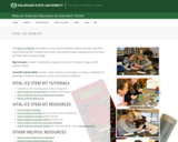
Vital Ice STEM Kit. The Natural Sciences Education & Outreach Center collaborates …
Vital Ice STEM Kit. The Natural Sciences Education & Outreach Center collaborates with CSU faculty, National Parks and citizen science programs to translate their current scientific research into unique STEM experiences for students in the form of Educational Kits that can be checked out. Each kit contains just about all of the materials needed (minus common things like water and paper towels) to explore some really interesting scientific research topics.The kits are available for teachers and informal educators in Colorado to check out for a duration of a week by submitting either a local pickup form or a delivery form available at the linked website. This kit is provided free for educational use. This Kit is available in Spanish. Global Surface Temperatures: https://scratch.mit.edu/projects/283054052/
Atmospheric scientists use computer models to forecast the position of a moving …
Atmospheric scientists use computer models to forecast the position of a moving volcanic cloud, and remote sensing can identify its components, including gases and aerosols. This resource provides ideas for classroom investigation of these topics, and directions for a demonstration of light scattering by aerosols. The lesson ideas are from PUMAS - Practical Uses of Math and Science - a collection of brief examples created by scientists and engineers showing how math and science topics taught in K-12 classes have real world applications.
In this activity, students use satellite imagery to assess potential danger associated …
In this activity, students use satellite imagery to assess potential danger associated with selecting a new and safer location for the town of Villarrica, along with its corresponding communication and evacuation routes. Satellite imagery and a topographic map are included. The resource is from PUMAS - Practical Uses of Math and Science - a collection of brief examples created by scientists and engineers showing how math and science topics taught in K-12 classes have real world applications.
In this activity, learners create a tornado in a bottle to observe …
In this activity, learners create a tornado in a bottle to observe a spiraling, funnel-shaped vortex. A simple connector device allows water to drain from a 2-liter bottle into a second bottle. Learners can observe the whirling water and then repeat the process by inverting the bottle. Use this activity to talk about surface tension, pressure, gravity, friction, angular momentum, and centripetal force.
We will go below the surface and learn how water chemistry plays …
We will go below the surface and learn how water chemistry plays an important role in the Rain Shadow Effect. First, check out the Watershed Council Director video to learn how the Powder Basin Watershed Council is supporting efforts to restore their rivers, streams, and lakes in an arid part of Eastern Oregon. In the Discovery Challenge video, explore and learn how water chemistry plays a role in the rain shadow effect causing Eastern Oregon to not get nearly as much rain as Western Oregon.
This lesson introduces NGSS standards, and those standards are listed in the lesson and is part of the Explore Science Club series, an online Career Connected Learning program developed by the Greater Oregon STEM Hub. To learn more find us at: www.go-stem.org.
No restrictions on your remixing, redistributing, or making derivative works. Give credit to the author, as required.
Your remixing, redistributing, or making derivatives works comes with some restrictions, including how it is shared.
Your redistributing comes with some restrictions. Do not remix or make derivative works.
Most restrictive license type. Prohibits most uses, sharing, and any changes.
Copyrighted materials, available under Fair Use and the TEACH Act for US-based educators, or other custom arrangements. Go to the resource provider to see their individual restrictions.