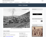
Victor, CO Mining Town. Western Mining History presents a brief summary of …
Victor, CO Mining Town. Western Mining History presents a brief summary of Colorado's Historical Mining Towns with links to additional Colorado resources for a mining town database and mines by county. Western Mining History is an historical site that provides information on mining, mining towns, the gold and silver rush, and Photos and maps of the western United States. This is a strong primary source resource that can be used for a variety of class research projects. Consider becoming a member or making a donation to help further the work of the site.
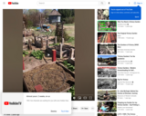
Cross Orchards is a part of the Museums of Western Colorado. Our …
Cross Orchards is a part of the Museums of Western Colorado. Our volunteer Kathy explains the origins of Victory Gardens and the place they can have for us today! A Victory Garden was a small food garden planted for defense and survival at private residences or public parks during WWI to help ensure people had enough to eat during the war.
After watching a video, students classify soils using a ternary soil diagram …
After watching a video, students classify soils using a ternary soil diagram and run online computer models to see how the proportion of sand, silt and clay affect drainage. Students then use the ternary soil diagram to predict how real soils (found from online soil maps) will behave in terms of runoff and infiltration.
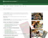
Vital Ice STEM Kit. The Natural Sciences Education & Outreach Center collaborates …
Vital Ice STEM Kit. The Natural Sciences Education & Outreach Center collaborates with CSU faculty, National Parks and citizen science programs to translate their current scientific research into unique STEM experiences for students in the form of Educational Kits that can be checked out. Each kit contains just about all of the materials needed (minus common things like water and paper towels) to explore some really interesting scientific research topics.The kits are available for teachers and informal educators in Colorado to check out for a duration of a week by submitting either a local pickup form or a delivery form available at the linked website. This kit is provided free for educational use. This Kit is available in Spanish. Global Surface Temperatures: https://scratch.mit.edu/projects/283054052/
This activity with a lab report instructs students to solve and plot …
This activity with a lab report instructs students to solve and plot 160,000 years' worth of ice core data from the Vostok ice core using Excel or similar spreadsheets to analyze data. Students learn about ice cores and what they can tell us about past atmospheric conditions and the past atmospheric concentrations of CO2 and CH4.
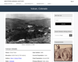
Vulcan, CO Mining Town. Western Mining History presents a brief summary of …
Vulcan, CO Mining Town. Western Mining History presents a brief summary of Colorado's Historical Mining Towns with links to additional Colorado resources for a mining town database and mines by county. Western Mining History is an historical site that provides information on mining, mining towns, the gold and silver rush, and Photos and maps of the western United States. This is a strong primary source resource that can be used for a variety of class research projects. Consider becoming a member or making a donation to help further the work of the site.
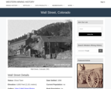
Wall Street, CO Mining Town. Western Mining History presents a brief summary …
Wall Street, CO Mining Town. Western Mining History presents a brief summary of Colorado's Historical Mining Towns with links to additional Colorado resources for a mining town database and mines by county. Western Mining History is an historical site that provides information on mining, mining towns, the gold and silver rush, and Photos and maps of the western United States. This is a strong primary source resource that can be used for a variety of class research projects. Consider becoming a member or making a donation to help further the work of the site.
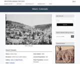
Ward, CO Mining Town. Western Mining History presents a brief summary of …
Ward, CO Mining Town. Western Mining History presents a brief summary of Colorado's Historical Mining Towns with links to additional Colorado resources for a mining town database and mines by county. Western Mining History is an historical site that provides information on mining, mining towns, the gold and silver rush, and Photos and maps of the western United States. This is a strong primary source resource that can be used for a variety of class research projects. Consider becoming a member or making a donation to help further the work of the site.
This Western Mining History database uses Mineral Resources Data System to list …
This Western Mining History database uses Mineral Resources Data System to list known Colorado historical mines by county. Each county site has links to the known mines within its borders. Some are known and named, others are unnamed. Mines should be assumed to be on private property unless other research is conducted. Data provided for each mine site include: Name, State, County, Elevation, Primary Mineral Mined, Latitude and Longitude and a link to Google Maps. Photos are provided where available. Additional information for some Mines are satellite photos, and ownership, business and historical records. Mining History is an historical site that provides information on mining, mining towns, the gold and silver rush, and Photos and maps of the western United States. This is a great database for student historical research or data and statistics classes. Consider becoming a member or making a donation to help further the work of the site.
Social studies is a vital component of education in Washington state. The …
Social studies is a vital component of education in Washington state. The Office of Superintend¬ent of Public Instruction (OSPI) envisions “all students prepared for post-secondary pathways, careers, and civic engagement.†Additionally, the National Council for the Social Studies states, “The primary purpose of social studies is to help young people make informed and reasoned decisions for the public good as citizens of a culturally diverse, democratic society in an inter¬dependent world.â€
Students who receive quality instruction in social studies are engaged in learning that promotes inquiry and thoughtful civic participation. With this in mind, we are pleased to introduce OSPI’s updated Washington State K–12 Learning Standards for Social Studies. Our hope is that you will find these standards to be rigorous, thoughtful, inquiry-driven, and organized for easy accessibility.
We will go below the surface and learn how water chemistry plays …
We will go below the surface and learn how water chemistry plays an important role in the Rain Shadow Effect. First, check out the Watershed Council Director video to learn how the Powder Basin Watershed Council is supporting efforts to restore their rivers, streams, and lakes in an arid part of Eastern Oregon. In the Discovery Challenge video, explore and learn how water chemistry plays a role in the rain shadow effect causing Eastern Oregon to not get nearly as much rain as Western Oregon.
This lesson introduces NGSS standards, and those standards are listed in the lesson and is part of the Explore Science Club series, an online Career Connected Learning program developed by the Greater Oregon STEM Hub. To learn more find us at: www.go-stem.org.
This Western Mining History database uses Mineral Resources Data System to list …
This Western Mining History database uses Mineral Resources Data System to list known Colorado historical mines by county. Each county site has links to the known mines within its borders. Some are known and named, others are unnamed. Mines should be assumed to be on private property unless other research is conducted. Data provided for each mine site include: Name, State, County, Elevation, Primary Mineral Mined, Latitude and Longitude and a link to Google Maps. Photos are provided where available. Additional information for some Mines are satellite photos, and ownership, business and historical records. Mining History is an historical site that provides information on mining, mining towns, the gold and silver rush, and Photos and maps of the western United States. This is a great database for student historical research or data and statistics classes. Consider becoming a member or making a donation to help further the work of the site.
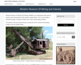
Western Mining History presents a short tour of the Western Museum of …
Western Mining History presents a short tour of the Western Museum of Mining and Industry (WMMI). Visit the Museum website for more information: https://wmmi.org/ Western Mining History is an historical site that provides databases, information on mining, mining towns, gold and Photos and maps of the western United States. Consider becoming a member or making a donation to help further the work of the site. Visit the Museum website at: www.WMMI.org
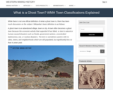
Western Mining History describes the term "ghost town" and how they apply …
Western Mining History describes the term "ghost town" and how they apply the description in their database. The site shows the importance of defining terms in a collection. Western Mining History is an historical site that provides databases, information on mining, mining towns, gold and Photos and maps of the western United States. This photo gallery provide an excellent collection of primary sources for historical analysis in the classroom. Consider becoming a member or making a donation to help further the work of the site.
This animation starts with a schematic illustration of glacier growth and then …
This animation starts with a schematic illustration of glacier growth and then introduces six different methods that researchers use when studying ice cores in order to deduce the climate of the past. The research methods that are briefly introduced are ice layering, pollen, oxygen isotopes, ice crystals and gases trapped inside, and other chemistry.
Students learn of the impending asteroid impact scenario, form teams and begin …
Students learn of the impending asteroid impact scenario, form teams and begin to study the situation in depth. A simple in-class simulation shows them the potential for destruction and disaster. They complete worksheets and look at maps to help them define and understand the problem: What is the needed cavern size and depth? What are the geographical areas and natural features? A homework measurement assignment prepares them for the next lesson/activity.
In this assignment students use real world data to solve an applied …
In this assignment students use real world data to solve an applied problem in geomorphology. They use ArcGIS and time sequential aerial photography to determine when a marina on Lake Mead must be moved to avoid problems of sedimentation related to a major drawdown of the lake. Students must estimate the rate of delta progradation and come up with a timeframe for when the marina will become unusable. It is set up as a realistic consulting project, based on a project completed by the author.
In a student-led and fairly independent fashion, data collected in the associated …
In a student-led and fairly independent fashion, data collected in the associated field trip activity are organized by student groups to create useful and informative Google Earth maps. Each team creates a map, uses that map to analyze the results, adjusts the map to include the analysis results, and then writes a brief summary of findings. Primarily, questions of fate-and-transport of plastics are are explored. If data was gathered in the field trip but the teacher does not desire to do the mapping activity, then alternative data presentation and analysis methods are suggested.
In this lesson, students are shown the very basics of navigation. The …
In this lesson, students are shown the very basics of navigation. The concepts of relative and absolute location, latitude, longitude and cardinal directions are discussed, as well as the use and principles of a map and compass.
This classroom activity helps students understand the benefits and drawback of globes, …
This classroom activity helps students understand the benefits and drawback of globes, Mercator maps, and polar map projections. After closely examining all three, students discuss how we represent a spherical object like the Earth on flat surface. The printable five-page handout includes a series of inquiry-based questions related to the representation of Antarctica on the three types of maps.
No restrictions on your remixing, redistributing, or making derivative works. Give credit to the author, as required.
Your remixing, redistributing, or making derivatives works comes with some restrictions, including how it is shared.
Your redistributing comes with some restrictions. Do not remix or make derivative works.
Most restrictive license type. Prohibits most uses, sharing, and any changes.
Copyrighted materials, available under Fair Use and the TEACH Act for US-based educators, or other custom arrangements. Go to the resource provider to see their individual restrictions.