Updating search results...

Search Resources

2602 Results

View
Selected filters:
  • Earth and Space Science
Crater Counting Lab exercise
Conditional Remix & Share Permitted
CC BY-NC-SA
Rating
0.0 stars

This lab focuses on the identification of impact features, and how they can used to estimate the age of planetary surfaces. Key comcepts include understanding how the crater process has changed over geologic time; how those changes manifest themselves in the surficial record of planetary landforms; how other planetary processes modify surficial landforms; how the conditions of the Solar System have changed over time.

(Note: this resource was added to OER Commons as part of a batch upload of over 2,200 records. If you notice an issue with the quality of the metadata, please let us know by using the 'report' button and we will flag it for consideration.)

Subject:
Biology
Earth and Space Science
Geology
Life Science
Material Type:
Activity/Lab
Provider:
Science Education Resource Center (SERC) at Carleton College
Provider Set:
Teach the Earth
Date Added:
09/30/2022
The Crayon Rock Cycle
Conditional Remix & Share Permitted
CC BY-NC-SA
Rating
0.0 stars

In this activity, learners use crayons to draw conclusions about rocks and the rock cycle. Learners form crayons ((which can be "weathered"--heated, compressed and cooled--like rocks) into models of sedimentary, metamorphic, and igneous rocks.

Subject:
Earth and Space Science
Geology
Material Type:
Activity/Lab
Provider:
Exploratorium
Date Added:
11/07/2004
Crazy Kites, Americorp STEM in a Bag
Read the Fine Print
Educational Use
Rating
0.0 stars

Make a kite. See if it flies. Adjust your design. Activity from Weekly STEM in a Bag. Colorado Americorp agents in Araphahoe, Denver, Garfield, Larimer, and Weld Counties. Work supported by the Corporation for National and Community Service under Americorps grant number 18AFHCO0010008. Opinions or points of view expressed in this lesson are those of the authors and do not necessarily represent the official position of or a position that is endorsed by the Corporation or the Americorps program. This resource is also available in Spanish in the linked file.

Subject:
Applied Science
Atmospheric Science
Design
Earth and Space Science
Engineering
Physical Science
Physics
STEAM
Visual Arts and Design
Material Type:
Activity/Lab
Lesson Plan
Provider:
Americorps
Provider Set:
STEM in a bag weekly activity
Date Added:
02/24/2023
Crea Tu Propia Constelación, Americorp Bolsa de STEM
Read the Fine Print
Educational Use
Rating
0.0 stars

Usa piedras para modelar las estrellas en una constelación. Actividad de Bolsa de STEM Semanal. Agentes de Colorado Americorp en los condados de Araphahoe, Denver, Garfield, Larimer y Weld. Trabajo apoyado por la Corporación para el Servicio Nacional y Comunitario bajo el número de subvención 18AFHCO0010008 de Americorps. Las opiniones o puntos de vista expresados en esta lección pertenecen a los autores y no representan necesariamente la posición oficial o una posición respaldada por la Corporación o el programa Americorps.

Subject:
Applied Science
Astronomy
Design
Earth and Space Science
STEAM
Visual Arts
Visual Arts and Design
Material Type:
Activity/Lab
Lesson Plan
Provider:
Americorps
Provider Set:
STEM in a bag weekly activity
Date Added:
02/24/2023
Create Your Own Astro-Music
Unrestricted Use
CC BY
Rating
0.0 stars

In this activity, students learn about astronomical phenomena we can see in the universe and create their own music inspired by astronomical images. By performing original musical improvisations, students enhance their knowledge of what astronomical phenomena are represented in images and experiment with creative ways of representing these using music. This activity engages students in first hand exploration of music and astronomy connections.

Subject:
Arts and Humanities
Astronomy
Earth and Space Science
Material Type:
Activity/Lab
Provider:
International Astronomical Union
Provider Set:
astroEDU
Date Added:
12/09/2016
Create Your Own Balloon Rocket, Americorp STEM in a Bag
Read the Fine Print
Educational Use
Rating
0.0 stars

Create a balloon rocket. Test your design. Activity from Weekly STEM in a Bag. Colorado Americorp agents in Araphahoe, Denver, Garfield, Larimer, and Weld Counties. Work supported by the Corporation for National and Community Service under Americorps grant number 18AFHCO0010008. Opinions or points of view expressed in this lesson are those of the authors and do not necessarily represent the official position of or a position that is endorsed by the Corporation or the Americorps program. This resource is also available in Spanish in the linked file.

Subject:
Applied Science
Design
Earth and Space Science
Engineering
Physical Science
Physics
STEAM
Space Science
Visual Arts and Design
Material Type:
Activity/Lab
Lesson Plan
Provider:
Americorps
Provider Set:
STEM in a bag weekly activity
Date Added:
02/24/2023
Create Your Own Constellation, Americorp STEM in a Bag
Read the Fine Print
Educational Use
Rating
0.0 stars

Use rocks to model the stars in a constellation. Activity from Weekly STEM in a Bag. Colorado Americorp agents in Araphahoe, Denver, Garfield, Larimer, and Weld Counties. Work supported by the Corporation for National and Community Service under Americorps grant number 18AFHCO0010008. Opinions or points of view expressed in this lesson are those of the authors and do not necessarily represent the official position of or a position that is endorsed by the Corporation or the Americorps program. This resource is also available in Spanish in the linked file.

Subject:
Applied Science
Astronomy
Design
Earth and Space Science
STEAM
Visual Arts
Visual Arts and Design
Material Type:
Activity/Lab
Lesson Plan
Provider:
Americorps
Provider Set:
STEM in a bag weekly activity
Date Added:
02/24/2023
Creating Asteroids
Unrestricted Use
CC BY
Rating
0.0 stars

In this activity, students familiarise themselves with asteroids. They discuss and build their own model asteroids. They learn how asteroids are formed in the Solar System. At the end of the activity, each student has their own model asteroid made from clay.

Subject:
Astronomy
Earth and Space Science
Material Type:
Activity/Lab
Provider:
International Astronomical Union
Provider Set:
astroEDU
Date Added:
04/14/2023
Creating Comics | Media Arts Toolkit
Read the Fine Print
Educational Use
Rating
0.0 stars

Reading and creating comic strips and comic books are engaging ways to promote literacy at any grade level and across content areas. The students in this video are members of a high school comic book club and have access to drawing tablets and Adobe Photoshop, so they can achieve sophisticated results. Even without such software, however, teachers can still integrate digital comics into a wide range of teaching situations.

There are a number of comic books, especially contemporary ones, that are not “school appropriate,” so you might want to guide students’ web research on comic books.

Subject:
Earth and Space Science
Geoscience
Mathematics
Trigonometry
Material Type:
Activity/Lab
Provider:
PBS LearningMedia
Date Added:
05/12/2023
Creating Understanding: How Metamorphic Rock is Formed
Conditional Remix & Share Permitted
CC BY-NC-SA
Rating
0.0 stars

This activity gives a visual representation of how we are able to see the different layers of metamorphic rocks.

Subject:
Earth and Space Science
Geology
Material Type:
Activity/Lab
Lesson Plan
Simulation
Provider:
Science Education Resource Center (SERC) at Carleton College
Provider Set:
Pedagogy in Action
Date Added:
04/12/2023
Creating a Natural Disaster Blog/VoiceThread to Understand Resilience
Conditional Remix & Share Permitted
CC BY-NC-SA
Rating
0.0 stars

Student groups create blogs or VoiceThreads on selected natural disaster events including a description of the event, the cause of the disaster, response & recovery, prediction & prevention and resilience to the event.

(Note: this resource was added to OER Commons as part of a batch upload of over 2,200 records. If you notice an issue with the quality of the metadata, please let us know by using the 'report' button and we will flag it for consideration.)
Subject:
Agriculture and Natural Resources
Biology
Earth and Space Science
Environmental Studies
Geology
Life Science
Material Type:
Activity/Lab
Provider:
Science Education Resource Center (SERC) at Carleton College
Provider Set:
Teach the Earth
Date Added:
12/11/2020
Creating a Water Table Map for Newark Road Prairie
Conditional Remix & Share Permitted
CC BY-NC-SA
Rating
0.0 stars

Because many students are familiar with contouring methods, they can mechanically construct water table maps from canned data sets with ease. However, their contouring abilities may mask their level of understanding. This field exercise aims to instill a deeper understanding of the nature of a water table surface as students also learn fundamental hydrogeological field techniques.

The exercise is based at Newark Road Prairie, which is owned and managed by Beloit College and located approximately five miles from campus. The property contains native prairie, wetlands, and a small stream. Although many schools may not own similar types of properties, land managers are often willing to allow the installation of shallow wells on public lands (e.g., county parks, state wildlife areas). Seven shallow monitoring wells and four staff gages are currently installed at Newark Road Prairie.

When we arrive at the field site, we begin by making observations on the subtle changes in topography and the direction of stream flow. Although we have just carried in all of the field equipment, I ask what type of information we will need to create a water table map. Handouts for the exercise are distributed after this discussion (see Supplementary Materials below).

Students are divided into groups of three for the field portion of the exercise, although each student ultimately drafts their own map using group and class data. Each group gets an electronic water level meter, a GPS unit, and a measuring tape, and we discuss the magnitude of error incorporated into the measurements taken by each of the instruments. We then review basic operation procedures for the water level meters and the GPS units, and students confirm that their GPS units are using the correct coordinate system and datum (UTM, NAD83).

We discuss surveying techniques as a class, and supplemental instructions are also provided in the handout (see Supplementary Materials below). We establish a centrally-located, bench mark (usually one of the staff gages) from which the students survey the wells and other staff gages. Each group is responsible for surveying at least two wells or staff gages. Groups distribute their surveying results to the rest of the class when we return to campus. Each group checks their results in the field, which reduces the chance of propagating surveying errors throughout the class.

Groups need to take water level measurements, survey wells, and record GPS coordinates for each well and staff gage. Additionally, because Newark Road Prairie has an established grid system with posts and markers at ten meter intervals, students measure the distance of each well/staff gage from at least three markers in order to evaluate the accuracy of their GPS measurements. Groups rotate the surveying equipment and are responsible for collecting all of the necessary data within the two lab periods. Two three-hour lab periods provide ample time for each group to collect the necessary data sets, including the time required to load/unload equipment and drive to/from the site. One 50-minute class period is provided for distributing survey results, compiling and printing base maps using ArcGIS, and contouring the water table maps.

(Note: this resource was added to OER Commons as part of a batch upload of over 2,200 records. If you notice an issue with the quality of the metadata, please let us know by using the 'report' button and we will flag it for consideration.)
Subject:
Biology
Earth and Space Science
Hydrology
Life Science
Material Type:
Activity/Lab
Provider:
Science Education Resource Center (SERC) at Carleton College
Provider Set:
Teach the Earth
Date Added:
08/27/2019
Crea tu Propia Actividad de Cohetes Globo, Americorp Bolsa de STEM
Read the Fine Print
Educational Use
Rating
0.0 stars

Crea un globo cohete. Pruebe su diseño. Actividad de Bolsa de STEM Semanal. Agentes de Colorado Americorp en los condados de Araphahoe, Denver, Garfield, Larimer y Weld. Trabajo apoyado por la Corporación para el Servicio Nacional y Comunitario bajo el número de subvención 18AFHCO0010008 de Americorps. Las opiniones o puntos de vista expresados en esta lección pertenecen a los autores y no representan necesariamente la posición oficial o una posición respaldada por la Corporación o el programa Americorps.

Subject:
Applied Science
Design
Earth and Space Science
Engineering
Physical Science
Physics
STEAM
Space Science
Visual Arts and Design
Material Type:
Activity/Lab
Lesson Plan
Provider:
Americorps
Provider Set:
STEM in a bag weekly activity
Date Added:
02/24/2023
Creede, CO Mining Town
Read the Fine Print
Educational Use
Rating
0.0 stars

Creede, CO Mining Town. Western Mining History presents a brief summary of Colorado's Historical Mining Towns with links to additional Colorado resources for a mining town database and mines by county. Western Mining History is an historical site that provides information on mining, mining towns, the gold and silver rush, and Photos and maps of the western United States. This is a strong primary source resource that can be used for a variety of class research projects. Consider becoming a member or making a donation to help further the work of the site.

Subject:
Anthropology
Applied Science
Chemistry
Cultural Geography
Earth and Space Science
Economics
English Language Arts
Environmental Science
Geology
Geoscience
History
Physical Geography
Physical Science
Reading Informational Text
Social Science
Sociology
U.S. History
Material Type:
Data Set
Primary Source
Reading
Provider:
Western Mining History
Provider Set:
Colorado Mining Towns
Date Added:
02/06/2023
Crested Butte, CO Mining Town
Read the Fine Print
Educational Use
Rating
0.0 stars

Crested Butte, CO Mining Town. Western Mining History presents a brief summary of Colorado's Historical Mining Towns with links to additional Colorado resources for a mining town database and mines by county. Western Mining History is an historical site that provides information on mining, mining towns, the gold and silver rush, and Photos and maps of the western United States. This is a strong primary source resource that can be used for a variety of class research projects. Consider becoming a member or making a donation to help further the work of the site.

Subject:
Anthropology
Applied Science
Chemistry
Cultural Geography
Earth and Space Science
Economics
English Language Arts
Environmental Science
Geology
Geoscience
History
Physical Geography
Physical Science
Reading Informational Text
Social Science
Sociology
U.S. History
Material Type:
Data Set
Primary Source
Reading
Provider:
Western Mining History
Provider Set:
Colorado Mining Towns
Date Added:
02/06/2023
Crestone, CO Mining Town
Read the Fine Print
Educational Use
Rating
0.0 stars

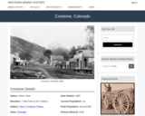
Crestone, CO Mining Town. Western Mining History presents a brief summary of Colorado's Historical Mining Towns with links to additional Colorado resources for a mining town database and mines by county. Western Mining History is an historical site that provides information on mining, mining towns, the gold and silver rush, and Photos and maps of the western United States. This is a strong primary source resource that can be used for a variety of class research projects. Consider becoming a member or making a donation to help further the work of the site.

Subject:
Anthropology
Applied Science
Chemistry
Cultural Geography
Earth and Space Science
Economics
English Language Arts
Environmental Science
Geology
Geoscience
History
Physical Geography
Physical Science
Reading Informational Text
Social Science
Sociology
U.S. History
Women's Studies
Material Type:
Data Set
Primary Source
Reading
Provider:
Western Mining History
Provider Set:
Colorado Mining Towns
Date Added:
02/06/2023
Cretaceous:Tectonics and Paleoclimate
Restricted Use
Copyright Restricted
Rating
0.0 stars

As part of the Berkeley Museum of Paleontology site, this page provides general information about earth systems of the Cretaceous Period. The site contains text, supporting diagrams and links to more detailed resources concerned with plate tectonics and past climates. Specific topics covered in this site include the rifting of Pangea, global climate, appearance and diversification of angiosperms, end of Cretaceous extinction and Chicxulub impact.

Subject:
Biology
Earth and Space Science
Geology
Life Science
Material Type:
Reading
Provider:
Science Education Resource Center (SERC) at Carleton College
Provider Set:
Teach the Earth
Date Added:
04/12/2023
Criple Creek, CO Mining Town
Read the Fine Print
Educational Use
Rating
0.0 stars

Criple Creek, CO Mining Town. Western Mining History presents a brief summary of Colorado's Historical Mining Towns with links to additional Colorado resources for a mining town database and mines by county. Western Mining History is an historical site that provides information on mining, mining towns, the gold and silver rush, and Photos and maps of the western United States. This is a strong primary source resource that can be used for a variety of class research projects. Consider becoming a member or making a donation to help further the work of the site.

Subject:
Anthropology
Applied Science
Chemistry
Cultural Geography
Earth and Space Science
Economics
English Language Arts
Environmental Science
Geology
Geoscience
History
Physical Geography
Physical Science
Reading Informational Text
Social Science
Sociology
U.S. History
Material Type:
Data Set
Primary Source
Reading
Provider:
Western Mining History
Provider Set:
Colorado Mining Towns
Date Added:
02/06/2023
Criple Creek and Victor: Gold Camps with a Thin Veneer of Civility
Read the Fine Print
Educational Use
Rating
0.0 stars

Western Mining History presents a short social history of two Colorado mining towns, Cripple Creek and Victor Western Mining History is an historical site that provides databases, information on mining, mining towns, gold and Photos and maps of the western United States. Consider becoming a member or making a donation to help further the work of the site.

Subject:
Anthropology
Business and Communication
Cultural Geography
Earth and Space Science
Economics
English Language Arts
Finance
History
Physical Geography
Physical Science
Reading Informational Text
Social Science
Sociology
U.S. History
Women's Studies
Material Type:
Primary Source
Reading
Provider:
Western Mining History
Provider Set:
Mining History
Date Added:
02/06/2023