This project is a way to assemble information about geology, hydrogeology, and …
This project is a way to assemble information about geology, hydrogeology, and soils into a coherent whole in a way that may otherwise not happen in any one class. The "critical zone" concept ties the pieces together. This project is not tied to a course but I have used it as a component of a senior assessment for geology students.
(Note: this resource was added to OER Commons as part of a batch upload of over 2,200 records. If you notice an issue with the quality of the metadata, please let us know by using the 'report' button and we will flag it for consideration.)
In this learning activity, students use a web-based geologic timeline to examine …
In this learning activity, students use a web-based geologic timeline to examine temperature, CO2 concentration, and ice cover data to investigate how climate has changed during the last 715 million years.
Zebulon Miracle from Museums of Western Colorado discusses rock art interpretation efforts …
Zebulon Miracle from Museums of Western Colorado discusses rock art interpretation efforts over centuries and examines how researchers have approached studying rock art over time.
In this activity, students graph and analyze methane data, extracted from an …
In this activity, students graph and analyze methane data, extracted from an ice core, to examine how atmospheric methane has changed over the past 109,000 years in a case study format. Calculating the rate of change of modern methane concentrations, they compare the radiative forcing of methane and carbon dioxide and make predictions about the future, based on what they have learned from the data and man's role in that future.
Learn how scientists have pieced together a continuous 800,000-year record of atmospheric …
Learn how scientists have pieced together a continuous 800,000-year record of atmospheric carbon dioxide levels and ocean temperatures in these videos from NOVA: Decoding the Weather Machine. Use this resource to review the difference between inference and observation and to consider the relationships between carbon dioxide, Earth's temperature, and climate change.
To learn ArcExplorer GIS, students perform these four exercises using data sets …
To learn ArcExplorer GIS, students perform these four exercises using data sets of Brooklyn and water quality data collected at various locations in Prospect Park, Brooklyn. Through these exercises, the students gain an understanding of how GIS works and what can be done. Ideally, the students should collect the water data and locate the sampling sites using a GPS. If lab time is limited, water data and site locations can be provided. Combining field data with existing data sets helps make the GIS applications more understandable and relevant to the students. As a final product, students create a map using a variety of GIS data layers. They also examine spatial patterns and use GIS to generate questions and hypotheses. Uses online and/or real-time data Addresses student fear of quantitative aspect and/or inadequate quantitative skills
The primary goal of this lab is to develop basic ArcGIS skills …
The primary goal of this lab is to develop basic ArcGIS skills for geomorphology students and give them a taste of what is possible in GIS. The lab is written for the GIS novice, and thus includes detailed instructions for small tasks. The GIS basics are taught via an exploration of river meandering and bank and bluff erosion in a local (turbidity-impaired) stream in Duluth, Minnesota: Amity Creek. The students visited Amity Creek the previous week and mapped in all locations along the river corridor with clear evidence of recent landsliding. This lab leads them through how to bring those field-collected GPS data into ArcGIS to both create maps and make measurements. They also look at river meandering over time at a single site where recent bluff stabilization work was completed to slow channel migration and lower the amount of fine sediment from entering the stream.This lab could be adapted to other locations, although I have also included all of the data specific to this site.
This activity introduces students to using Google Earth and adding layers to …
This activity introduces students to using Google Earth and adding layers to google earth, while re-enforcing plate tectonic concepts and evidence for plate tectonics. Outcomes: 1. Download Google Earth onto computer 2. Turn on/off layers within Google Earth 3. Be able to change measurement and use ruler within Google Earth 4. Determine latitude and longitude of ocean basin features 5. Be able to search for locations within Google Earth 6. Learn to upload new layers into Google Earth from .kmz files 7. Describe different plate boundaries, their locations and boundary interactions 8. Explain evidence for Plate Tectonics
This activity has students use an Earth Systems perspective to identify the …
This activity has students use an Earth Systems perspective to identify the various causes associated with changes to Earth's forests as they review Landsat imagery of site locations from around the world.
This activity is a field investigation where students will be able to …
This activity is a field investigation where students will be able to observe sinkholes located in the southeastern Minnesota area and a cave system in Forestville State Park which will assist them in defining Karst topography.
Clues from the Landscape Social Studies Lesson 2 Discovering Public Lands as …
Clues from the Landscape Social Studies Lesson 2 Discovering Public Lands as Living Museums is designed to be used with Clues from the Landscape Artifact Kit. Lessons 1, 2 and 4 can be completed without the artifacts from the kit. These kits are available through Musuems of Western Colorado to D51 Teachers. This lesson can be adapted to use without the kit. Students will be able to: • Observe and analyze historical photographs • Predict future events based on historical photographs • Pose relevant questions about events they encounter in historical photographs • Compare and contrast life in the Grand Valley in the past with life today.
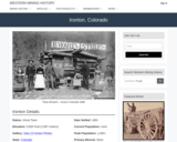
Ironton, CO Mining Town. Western Mining History presents a brief summary of …
Ironton, CO Mining Town. Western Mining History presents a brief summary of Colorado's Historical Mining Towns with links to additional Colorado resources for a mining town database and mines by county. Western Mining History is an historical site that provides information on mining, mining towns, the gold and silver rush, and Photos and maps of the western United States. This is a strong primary source resource that can be used for a variety of class research projects. Consider becoming a member or making a donation to help further the work of the site.
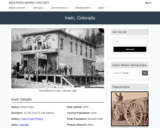
Irwin, CO Mining Town. Western Mining History presents a brief summary of …
Irwin, CO Mining Town. Western Mining History presents a brief summary of Colorado's Historical Mining Towns with links to additional Colorado resources for a mining town database and mines by county. Western Mining History is an historical site that provides information on mining, mining towns, the gold and silver rush, and Photos and maps of the western United States. This is a strong primary source resource that can be used for a variety of class research projects. Consider becoming a member or making a donation to help further the work of the site.
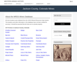
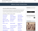
This Western Mining History database uses Mineral Resources Data System to list …
This Western Mining History database uses Mineral Resources Data System to list known Colorado historical mines by county. Each county site has links to the known mines within its borders. Some are known and named, others are unnamed. Mines should be assumed to be on private property unless other research is conducted. Data provided for each mine site include: Name, State, County, Elevation, Primary Mineral Mined, Latitude and Longitude and a link to Google Maps. Photos are provided where available. Additional information for some Mines are satellite photos, and ownership, business and historical records. Mining History is an historical site that provides information on mining, mining towns, the gold and silver rush, and Photos and maps of the western United States. This is a great database for student historical research or data and statistics classes. Consider becoming a member or making a donation to help further the work of the site.
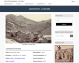
Jamestown, CO Mining Town. Western Mining History presents a brief summary of …
Jamestown, CO Mining Town. Western Mining History presents a brief summary of Colorado's Historical Mining Towns with links to additional Colorado resources for a mining town database and mines by county. Western Mining History is an historical site that provides information on mining, mining towns, the gold and silver rush, and Photos and maps of the western United States. This is a strong primary source resource that can be used for a variety of class research projects. Consider becoming a member or making a donation to help further the work of the site.
Jasper, CO Mining Town. Western Mining History presents a brief summary of …
Jasper, CO Mining Town. Western Mining History presents a brief summary of Colorado's Historical Mining Towns with links to additional Colorado resources for a mining town database and mines by county. Western Mining History is an historical site that provides information on mining, mining towns, the gold and silver rush, and Photos and maps of the western United States. This is a strong primary source resource that can be used for a variety of class research projects. Consider becoming a member or making a donation to help further the work of the site.
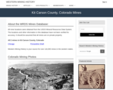
This Western Mining History database uses Mineral Resources Data System to list …
This Western Mining History database uses Mineral Resources Data System to list known Colorado historical mines by county. Each county site has links to the known mines within its borders. Some are known and named, others are unnamed. Mines should be assumed to be on private property unless other research is conducted. Data provided for each mine site include: Name, State, County, Elevation, Primary Mineral Mined, Latitude and Longitude and a link to Google Maps. Photos are provided where available. Additional information for some Mines are satellite photos, and ownership, business and historical records. Mining History is an historical site that provides information on mining, mining towns, the gold and silver rush, and Photos and maps of the western United States. This is a great database for student historical research or data and statistics classes. Consider becoming a member or making a donation to help further the work of the site.
This laboratory exercise examines the linkages between ground and surface water hydrology …
This laboratory exercise examines the linkages between ground and surface water hydrology and landscape evolution in the Interior Low Plateaus Region of Kentucky. The exercise focuses upon the origin of Mammoth Cave.
This Western Mining History database uses Mineral Resources Data System to list …
This Western Mining History database uses Mineral Resources Data System to list known Colorado historical mines by county. Each county site has links to the known mines within its borders. Some are known and named, others are unnamed. Mines should be assumed to be on private property unless other research is conducted. Data provided for each mine site include: Name, State, County, Elevation, Primary Mineral Mined, Latitude and Longitude and a link to Google Maps. Photos are provided where available. Additional information for some Mines are satellite photos, and ownership, business and historical records. Mining History is an historical site that provides information on mining, mining towns, the gold and silver rush, and Photos and maps of the western United States. This is a great database for student historical research or data and statistics classes. Consider becoming a member or making a donation to help further the work of the site.
No restrictions on your remixing, redistributing, or making derivative works. Give credit to the author, as required.
Your remixing, redistributing, or making derivatives works comes with some restrictions, including how it is shared.
Your redistributing comes with some restrictions. Do not remix or make derivative works.
Most restrictive license type. Prohibits most uses, sharing, and any changes.
Copyrighted materials, available under Fair Use and the TEACH Act for US-based educators, or other custom arrangements. Go to the resource provider to see their individual restrictions.