This short video, is the fifth in the National Academies Climate Change, …
This short video, is the fifth in the National Academies Climate Change, Lines of Evidence series. It focuses on greenhouse gases, climate forcing (natural and human-caused), and global energy balance.
With this activity, students use a globe to learn how a position …
With this activity, students use a globe to learn how a position on Earth can be described. They investigate how latitude can be found using the stars. Students learn what latitude and longitude are and how to use them to indicate a position on Earth. They investigate how in some locations on Earth, the direction of the midday sun can change over the year.
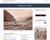
Howardsville, CO Mining Town. Western Mining History presents a brief summary of …
Howardsville, CO Mining Town. Western Mining History presents a brief summary of Colorado's Historical Mining Towns with links to additional Colorado resources for a mining town database and mines by county. Western Mining History is an historical site that provides information on mining, mining towns, the gold and silver rush, and Photos and maps of the western United States. This is a strong primary source resource that can be used for a variety of class research projects. Consider becoming a member or making a donation to help further the work of the site.
In this multi-step lab, students explore the concepts of seismic wave propagation …
In this multi-step lab, students explore the concepts of seismic wave propagation through materials with different mechanical properties, and examine seismic evidence from a recent earthquake to infer Earth's internal structure and composition. They calculate the diameter of Earth's core by comparing a model to recorded seismic data, then explore mechanical differences between the lithosphere and the asthenosphere, and then examine models of the boundary between the lithosphere and the asthenosphere. This lab is designed to be done with an instructor present to answer questions and guide students to conclusions.
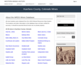
This Western Mining History database uses Mineral Resources Data System to list …
This Western Mining History database uses Mineral Resources Data System to list known Colorado historical mines by county. Each county site has links to the known mines within its borders. Some are known and named, others are unnamed. Mines should be assumed to be on private property unless other research is conducted. Data provided for each mine site include: Name, State, County, Elevation, Primary Mineral Mined, Latitude and Longitude and a link to Google Maps. Photos are provided where available. Additional information for some Mines are satellite photos, and ownership, business and historical records. Mining History is an historical site that provides information on mining, mining towns, the gold and silver rush, and Photos and maps of the western United States. This is a great database for student historical research or data and statistics classes. Consider becoming a member or making a donation to help further the work of the site.
This activity was an educator created resource to accompany the Hominid skull …
This activity was an educator created resource to accompany the Hominid skull set from CSU's Natural Sciences Education & Outreach Center. This activity focuses on reassembling broken skull pieces and using clay to fill in the missing pieces then collecting data. The resource can be used with the Hominid Skull Set, The Skull Anatomy Glossary, and the Hominid Evolution Activity from CSU's Natural Sciences Education & Outreach Center. See this link for all associated resources: https://www.cns-eoc.colostate.edu/stem-kits/hominid-skull-set/. At the linked site you can also download a rubric for grading this student activity.
Create a human sundial to measure time using shadows. Activity from Weekly …
Create a human sundial to measure time using shadows. Activity from Weekly STEM in a Bag. Colorado Americorp agents in Araphahoe, Denver, Garfield, Larimer, and Weld Counties. Work supported by the Corporation for National and Community Service under Americorps grant number 18AFHCO0010008. Opinions or points of view expressed in this lesson are those of the authors and do not necessarily represent the official position of or a position that is endorsed by the Corporation or the Americorps program. This resource is also available in Spanish in the linked file.
Geography 430 is an active, creative learning community focused around understanding the …
Geography 430 is an active, creative learning community focused around understanding the changing relationships between people and their environments, the causes and consequences of environmental degradation, strategies for building a more sustainable world, and the methods and approaches that scholars have used to understand human-environment interactions. The primary course objectives are to help geographers, earth scientists, and other professionals to deepen their appreciation for the complexity of human-environment systems and to develop skills that allow them to interpret, analyze, and communicate effectively regarding human-environment interactions in their lives as students, professionals, and citizens.
This activity was an educator created resource to accompany the Hominid skull …
This activity was an educator created resource to accompany the Hominid skull set from CSU's Natural Sciences Education & Outreach Center. The resource can be used with the Hominid Skull Set, The Skull Anatomy Glossary, and the Hominid Evolution Activity from CSU's Natural Sciences Education & Outreach Center. See this link for all associated resources: https://www.cns-eoc.colostate.edu/stem-kits/hominid-skull-set/.
The flow or discharge value in a river does not mean much …
The flow or discharge value in a river does not mean much to a lay person or a decision maker because this flow can be insignificant on a big river or can be dangerous on a small creek. Thus, we must know how to translate this flow value into the water depth, velocity, and the corresponding extent to understand its impact. The objective of this unit is to perform hydraulic modeling on a reach of Wabash River near Lafayette, Indiana, to estimate water surface elevation and extent corresponding to a 100 year flow. Students will learn the basics of hydraulic modeling using HEC-RAS to simulate the flow hydraulics using one-dimensional steady state assumption. The outcome will be the inundation extent corresponding to the 100-year event along the reach of the Wabash River near Lafayette, IN. Make sure you have HEC-RAS available on school or personal computers prior to the start of the unit.
Dinosaur Journey is part of the Mueums of Western Colorado. Dinosaur Journey …
Dinosaur Journey is part of the Mueums of Western Colorado. Dinosaur Journey Curator of Education Stephanie Lukowski talks about the Saber-Tooth Cat found at the La Brea Tar Pits and other predators from the last Ice Age. She explains why we don't always find bones from these animals but have indirect evidence that they were in an area.
Dinosaur Journey is part of the Mueums of Western Colorado. What do …
Dinosaur Journey is part of the Mueums of Western Colorado. What do you think lived in the Grand Valley during the Ice Age? Curator of Education Stephanie Lukowski shows us some Ice Age fossils we have on display at Dinosaur Journey and talks about how these species differ from the fossils found up in the iconic Snowmass dig near Aspen, CO.
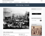
Idaho Springs, CO Mining Town. Western Mining History presents a brief summary …
Idaho Springs, CO Mining Town. Western Mining History presents a brief summary of Colorado's Historical Mining Towns with links to additional Colorado resources for a mining town database and mines by county. Western Mining History is an historical site that provides information on mining, mining towns, the gold and silver rush, and Photos and maps of the western United States. This is a strong primary source resource that can be used for a variety of class research projects. Consider becoming a member or making a donation to help further the work of the site.
This is an online activity introducing students to the basic identification and …
This is an online activity introducing students to the basic identification and classification of the textural and compositional characteristics of sedimentary rocks in thin section.
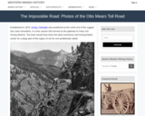
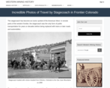
Western Mining History presents Historical|Photographs of stagecoach transportation in the Old West. …
Western Mining History presents Historical|Photographs of stagecoach transportation in the Old West. Western Mining History is an historical site that provides databases, information on mining, mining towns, gold and Photos and maps of the western United States. Consider becoming a member or making a donation to help further the work of the site.
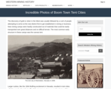
Western Mining History presents a short tour of tent towns from the …
Western Mining History presents a short tour of tent towns from the frontier west during the gold and silver rush. The resources shows Photos of miner's cabins and living conditions. Western Mining History is an historical site that provides databases, information on mining, mining towns, gold and Photos and maps of the western United States. Consider becoming a member or making a donation to help further the work of the site.
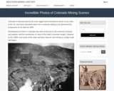
Western Mining History presents Historical|Photographs of Colorado mining towns and mines. Western …
Western Mining History presents Historical|Photographs of Colorado mining towns and mines. Western Mining History is an historical site that provides databases, information on mining, mining towns, gold and Photos and maps of the western United States. This photo gallery provide an excellent collection of primary sources for historical analysis in the classroom. Consider becoming a member or making a donation to help further the work of the site. Suggested use: Students might do a "then/now" comparison of well known towns, analyze the photos for historical details, consider the working conditions for the miners and/or environmental impact of early mines.
Western Mining History presents Historical|Photographs of stagecoach transportation in the Old West. …
Western Mining History presents Historical|Photographs of stagecoach transportation in the Old West. Western Mining History is an historical site that provides databases, information on mining, mining towns, gold and Photos and maps of the western United States. Consider becoming a member or making a donation to help further the work of the site.
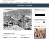
Independence, CO Mining Town. Western Mining History presents a brief summary of …
Independence, CO Mining Town. Western Mining History presents a brief summary of Colorado's Historical Mining Towns with links to additional Colorado resources for a mining town database and mines by county. Western Mining History is an historical site that provides information on mining, mining towns, the gold and silver rush, and Photos and maps of the western United States. This is a strong primary source resource that can be used for a variety of class research projects. Consider becoming a member or making a donation to help further the work of the site.
In Indiana, major rivers and their tributaries cross much of the state. …
In Indiana, major rivers and their tributaries cross much of the state. These rivers can produce significant hazards related to flooding and erosion, which threaten nearby residents and infrastructure. Rivers are dynamic landforms, and they naturally shift their position on the landscape over time. The path of a river may change rapidly during a flood, or it may slowly evolve over long periods of time. In this exercise, students use hillshade images derived from airborne lidar (light detection and ranging) from a section of the White River in Indiana to map how the river has changed over the span of five years. Students learn to identify and describe how river meanders and oxbow lakes evolve by comparing the form of the river from 2013 and 2018. Students also use the lidar hillshade to evaluate the longer-term evolution of the river's form and assess how local infrastructure may be impacted. Students are additionally given a plot of river discharge measured from a stream gage station just north of the mapped section of river. They learn how to evaluate changes and trends in river discharge and assess how river discharge can be related to river morphology.
No restrictions on your remixing, redistributing, or making derivative works. Give credit to the author, as required.
Your remixing, redistributing, or making derivatives works comes with some restrictions, including how it is shared.
Your redistributing comes with some restrictions. Do not remix or make derivative works.
Most restrictive license type. Prohibits most uses, sharing, and any changes.
Copyrighted materials, available under Fair Use and the TEACH Act for US-based educators, or other custom arrangements. Go to the resource provider to see their individual restrictions.