In this activity, students learn about the urban heat island effect by …
In this activity, students learn about the urban heat island effect by investigating which areas of their schoolyard have higher temperatures - trees, grass, asphalt, and other materials. Based on their results, they hypothesize how concentrations of surfaces that absorb heat might affect the temperature in cities - the urban heat island effect. Then they analyze data about the history of Los Angeles heat waves and look for patterns in the Los Angeles climate data and explore patterns.
The assignments consists of three essay questions, of which the students were …
The assignments consists of three essay questions, of which the students were required to complete two of their choice. During a trip to the Field Museum, Chicago, the students were required to use the museum exhibits to explore the questions posed in the assignment. The main goal was to familiarize the students with using museums as a resource, as well as use observation-based techniques of specimens to answer scientific questions.
Preparation for this activity is done during the class discussion on current …
Preparation for this activity is done during the class discussion on current events. Prior to this class, students are required to look through the newspapers and browse the internet for a list of events. During the class, student groups share their list with the class. Each group then categorizes the larger list. This discussion is extremely useful for shedding light on the connectivity and complexity of human relationships from the individual to nations. Students are then asked to propose why these current events are occurring. For example, immigrant students in my course discuss scarcity of resources leading to conflict and civil war in their home countries. Other students will bring the idea of global economy and the effects of globalization on their cultures. The discussions that emerge from this activity are significant for all students involved. In addition to increased student awareness, this activity underscores the importance of integrated learning. Uses geophysics to solve problems in other fields
This online lesson provides perspectives from Native American community members and their …
This online lesson provides perspectives from Native American community members and their supporters, images, news footage, an interactive timeline, and other sources about an important campaign to secure the treaty rights and sovereignty of Native Nations of the Pacific Northwest. Scroll to begin an exploration of the actions Native Nations took to address injustices.
This activity was an educator created resource to accompany the Hominid skull …
This activity was an educator created resource to accompany the Hominid skull set from CSU's Natural Sciences Education & Outreach Center. The resource can be used with the Hominid Skull Set, The Skull Anatomy Glossary, and the Hominid Evolution Activity from CSU's Natural Sciences Education & Outreach Center. See this link for all associated resources: https://www.cns-eoc.colostate.edu/stem-kits/hominid-skull-set/.
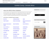
Freeland, CO Mining Town. Western Mining History presents a brief summary of …
Freeland, CO Mining Town. Western Mining History presents a brief summary of Colorado's Historical Mining Towns with links to additional Colorado resources for a mining town database and mines by county. Western Mining History is an historical site that provides information on mining, mining towns, the gold and silver rush, and Photos and maps of the western United States. This is a strong primary source resource that can be used for a variety of class research projects. Consider becoming a member or making a donation to help further the work of the site.
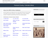
This Western Mining History database uses Mineral Resources Data System to list …
This Western Mining History database uses Mineral Resources Data System to list known Colorado historical mines by county. Each county site has links to the known mines within its borders. Some are known and named, others are unnamed. Mines should be assumed to be on private property unless other research is conducted. Data provided for each mine site include: Name, State, County, Elevation, Primary Mineral Mined, Latitude and Longitude and a link to Google Maps. Photos are provided where available. Additional information for some Mines are satellite photos, and ownership, business and historical records. Mining History is an historical site that provides information on mining, mining towns, the gold and silver rush, and Photos and maps of the western United States. This is a great database for student historical research or data and statistics classes. Consider becoming a member or making a donation to help further the work of the site.
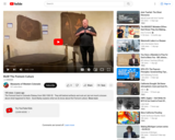
The Fremont Culture: Stop 3 Museum of the West Virtual Tour. Watch …
The Fremont Culture: Stop 3 Museum of the West Virtual Tour. Watch this short video to learn about a Museum of the West exhibit or collection to preview your field trip or for a virtual field trip if you are unable to attend in person. The Museum of the West is part of the Museums of Westen Colorado. The Fremont lived in Colorado Plateau from 500-1300 CE. They left behind artifacts and rock art, but not much is known about what happened to them. David Bailey explains what we do know about the Fremont culture.
In this activity, students will use oxygen isotope values of two species …
In this activity, students will use oxygen isotope values of two species of modern coral to reconstruct ambient water temperature over a four-year period. They use Microsoft Excel, or similar application, to create a spreadsheet of temperature values calculated from the isotope values of the corals by means of an algebraic equation. Students then use correlation and regression techniques to determine whether isotope records can be considered to be good proxies for records of past temperatures.
Trail Guide for hiking trail near where important fossil finds occured in …
Trail Guide for hiking trail near where important fossil finds occured in Western Colorado. When visiting these trails it is important to visit with respect by staying on the trail and leaving fossils where you find them. These fossils and tracks are protected under the Paleontological Resources Preservation Act (PRPA) of 2009. The act prohibits an attempt to excavate, remove, damage, or otherwise alter or deface any paleontological resources located on Federal land. In order to collect any fossils (plants, invertebrates, vertebrates) at these sites, a proper permit must be obtained. If you are interested in excavating fossils with our scientists at Dinosaur Journey, check out our Dinosaur Digs and Expeditions! https://museumofwesternco.com/things-to-do/dino-digs/
Dinosaur Journey is part of the Mueums of Western Colorado. Curator of …
Dinosaur Journey is part of the Mueums of Western Colorado. Curator of Education Stephanie Lukowski talks about the Ceratosaurus and many of the other prehistoric life forms found at the very special Fruita Paleo Area, part of the McInnis Canyons National Conservation Area on the Western Slope.
Dinosaur Journey is part of the Mueums of Western Colorado. Dinosaur Journey …
Dinosaur Journey is part of the Mueums of Western Colorado. Dinosaur Journey paleontologit Dr. Julia McHugh shows us the Fruitadens on display at Dinosaur Journey, and talks about the discovery of this very small species!
Fósiles Realmente Antiguos Equipo STEM. El Centro de Extensión y Educación en …
Fósiles Realmente Antiguos Equipo STEM. El Centro de Extensión y Educación en Ciencias Naturales colabora con la facultad de CSU, los Parques Nacionales y los programas de ciencia ciudadana para traducir su investigación científica actual en experiencias STEM únicas para los estudiantes en forma de kits educativos que se pueden prestar. Cada kit contiene casi todos los materiales necesarios (menos cosas comunes como agua y toallas de papel) para explorar algunos temas de investigación científica realmente interesantes. enviando un formulario de recogida local disponible en el sitio web vinculado. Utilice la información de contacto en la página de descripción general del kit STEM para obtener más información. https://www.cns-eoc.colostate.edu/stem-kits/ Debido al peso extremo de la arena utilizada en este kit, la única opción es la recogida local. Este kit se proporciona de forma gratuita para uso educativo.
The Digital Shoreline Analysis System (DSAS) is a software extension for ArcGIS …
The Digital Shoreline Analysis System (DSAS) is a software extension for ArcGIS that allows for automated shoreline change calculations along the coast. The user must supply the shoreline data and the software helps the user create measurement locations (transects) and completes the shoreline change calculations at each location. The result is a visual representation of the shoreline change along a coastline. This representation is far more useful for analysis that one overall average. Unusually high rates of erosion/accretion are easily recognized from the resulting map. The study location is Rodanthe, NC. The data used in this exercise is the sample data provided by the USGS.
In GEOG 489, you will learn advanced applications of Python for developing …
In GEOG 489, you will learn advanced applications of Python for developing and customizing GIS software, designing user interfaces, solving complex geoprocessing tasks, and leveraging open source. The course consists of readings, walkthroughs, projects, quizzes, and discussions about advanced GIS programming concepts and techniques, and a final term project. It complements the material covered in GEOG 485: GIS Programming and Customization. Software covered in the course includes: Esri ArcGIS Pro/arcpy, Jupyter Notebook, Esri ArcGIS API for Python, QGIS, GDAL/OGR. Students will also use of the Git version control software for code management, and learn techniques for distributing Python applications to end users.
This Western Mining History database uses Mineral Resources Data System to list …
This Western Mining History database uses Mineral Resources Data System to list known Colorado historical mines by county. Each county site has links to the known mines within its borders. Some are known and named, others are unnamed. Mines should be assumed to be on private property unless other research is conducted. Data provided for each mine site include: Name, State, County, Elevation, Primary Mineral Mined, Latitude and Longitude and a link to Google Maps. Photos are provided where available. Additional information for some Mines are satellite photos, and ownership, business and historical records. Mining History is an historical site that provides information on mining, mining towns, the gold and silver rush, and Photos and maps of the western United States. This is a great database for student historical research or data and statistics classes. Consider becoming a member or making a donation to help further the work of the site.
During this activity, the instructor introduces a miniature watershed, named a GeoSandbox, …
During this activity, the instructor introduces a miniature watershed, named a GeoSandbox, to provide a conceptual bridge between the schema created in the soup can water budget activity and the schoolyard watershed activity to follow. Students introduce known quantities of water to the GeoSandbox using spray bottles and measure the resulting surface flow and infiltration. The concepts of topography and land use are also introduced. Additional instructional materials are provided to firmly establish the concept of a watershed for students who need the support.
In this data rich world, we need to understand how things are …
In this data rich world, we need to understand how things are organized on the Earth's surface. Those things are represented by spatial data and necessarily depend upon what surrounds them. Spatial statistics provide insights into explaining processes that create patterns in spatial data. In geographical information analysis, spatial statistics such as point pattern analysis, spatial autocorrelation, and spatial interpolation will analyze the spatial patterns, spatial processes, and spatial association that characterize spatial data. Understanding spatial analysis will help you realize what makes spatial data special and why spatial analysis reveals a truth about spatial data.
This lab is part of a Lunar and Planetary Geology course offered …
This lab is part of a Lunar and Planetary Geology course offered to both geology and non-geology majors, and it involves basic geological mapping of an area within the Tyrrhena Patera region on Mars. Students are encouraged to work in groups to prepare a geological map from a photomosaic map and to interpret the geologic stratigraphy from a geological map of the greater area. This activity reinforces mapping skills as well as group work skills, and aims to teach students more about Martian stratigraphy and geology through a hands-on activity.
(Note: this resource was added to OER Commons as part of a batch upload of over 2,200 records. If you notice an issue with the quality of the metadata, please let us know by using the 'report' button and we will flag it for consideration.)
No restrictions on your remixing, redistributing, or making derivative works. Give credit to the author, as required.
Your remixing, redistributing, or making derivatives works comes with some restrictions, including how it is shared.
Your redistributing comes with some restrictions. Do not remix or make derivative works.
Most restrictive license type. Prohibits most uses, sharing, and any changes.
Copyrighted materials, available under Fair Use and the TEACH Act for US-based educators, or other custom arrangements. Go to the resource provider to see their individual restrictions.