Using planetary maps, students will be able to read cartographic information and …
Using planetary maps, students will be able to read cartographic information and compare the environmental conditions of Titan to those Earth. They will understand the conditions needed for life to exist, and be able to explain why it cannot exist on Titan.
Using planetary maps, students will be able to read cartographic information and …
Using planetary maps, students will be able to read cartographic information and compare the environmental conditions of Venus to those Earth. They will understand the conditions needed for life to exist, and be able to explain why it cannot exist on Venus.
Click to watch Alain Plattner discuss his activity or watch the full webinar.We use MATLAB functions available from https://github.com/NSGeophysics/Seism-O to simulate the superimposition of different seismic waves recorded in a simple near-surface geophysics setting. The choice of the geophone layout influences how easy it is to discern the different wave types, which is crucial for the success of a near-surface seismics survey. Students learn which parameters they should try to estimate before the survey, why these parameters are crucial, and how they influence the setup of the survey.
(Note: this resource was added to OER Commons as part of a batch upload of over 2,200 records. If you notice an issue with the quality of the metadata, please let us know by using the 'report' button and we will flag it for consideration.)
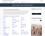
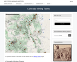
This Western Mining History database uses Mineral Resources Data System to list …
This Western Mining History database uses Mineral Resources Data System to list known Colorado historical mines by county. Each county site has links to the known mines within its borders. Some are known and named, others are unnamed. Mines should be assumed to be on private property unless other research is conducted. Data provided for each mine site include: Name, State, County, Elevation, Primary Mineral Mined, Latitude and Longitude and a link to Google Maps. Photos are provided where available. Additional information for some Mines are satellite photos, and ownership, business and historical records. Mining History is an historical site that provides information on mining, mining towns, the gold and silver rush, and Photos and maps of the western United States. This is a great database for student historical research or data and statistics classes. Consider becoming a member or making a donation to help further the work of the site.
Average inquiry level: Guided inquiry In this laboratory exercise for introductory geology …
Average inquiry level: Guided inquiry In this laboratory exercise for introductory geology or environmental science courses, students use data to examine climate change in their local environment. They compare local changes to global data over different time scales. As an assessment, students create an infographic to demonstrate their understanding of how local climate change may affect their region and what people can do to be better prepared. This lab was originally designed for online instruction, but may be used in face-to-face instruction as well.
(Note: this resource was added to OER Commons as part of a batch upload of over 2,200 records. If you notice an issue with the quality of the metadata, please let us know by using the 'report' button and we will flag it for consideration.)
This unit introduces high school students to climate change, the carbon cycle, …
This unit introduces high school students to climate change, the carbon cycle, and the effects of increasing atmospheric carbon dioxide on Earth's climate. Students create a model from string, toss bean bags, and sort chemical cards to review key processes in the carbon cycle. Then they quantitatively model the carbon cycle by playing a board game.
This activity covers the role that the oceans may play in climate …
This activity covers the role that the oceans may play in climate change and how climate change may affect the oceans. It is lesson 8 in a nine-lesson module Visualizing and Understanding the Science of Climate Change.
Cokedale, CO Mining Town. Western Mining History presents a brief summary of …
Cokedale, CO Mining Town. Western Mining History presents a brief summary of Colorado's Historical Mining Towns with links to additional Colorado resources for a mining town database and mines by county. Western Mining History is an historical site that provides information on mining, mining towns, the gold and silver rush, and Photos and maps of the western United States. This is a strong primary source resource that can be used for a variety of class research projects. Consider becoming a member or making a donation to help further the work of the site.
In this Earth Science activity, students will investigate rocks in an outdoor …
In this Earth Science activity, students will investigate rocks in an outdoor field trip. Students will be divided into groups and given a Ziploc bag to collect rocks. We will then return to the classroom, and the students will put their rocks into different groups. The different groups could be the size, shape, color, and texture of the rocks. We will then talk about the Rock Cycle and the three main types of rocks. Students will record their observations in their science journals.
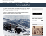
Western Mining History presents a brief summary of The Colorado Gold Rush …
Western Mining History presents a brief summary of The Colorado Gold Rush with links to additional Colorado information pages. Western Mining History is an historical site that provides databases, information on mining, mining towns, gold and Photos and maps of the western United States. Consider becoming a member or making a donation to help further the work of the site.
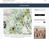
This Western Mining History site uses Mineral Resources Data System to list …
This Western Mining History site uses Mineral Resources Data System to list known Colorado historical mines by county. Mining History is an historical site that provides information on mining, mining towns, the gold and silver rush, and Photos and maps of the western United States. Consider becoming a member or making a donation to help further the work of the site. This is a rich database for student research projects and integrated units.
Western Mining History presents a brief summary of Colorado Mining Towns with …
Western Mining History presents a brief summary of Colorado Mining Towns with links to additional Colorado resources for a mining town database and mines by county. Western Mining History is an historical site that provides information on mining, mining towns, gold and Photos and maps of the western United States. Consider becoming a member or making a donation to help further the work of the site.
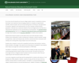
The Colorado Science and Engineering Fair is the premier STEM education experience …
The Colorado Science and Engineering Fair is the premier STEM education experience in Colorado. It is hosted by the College of Natural Sciences Education and Outreach Center at Colorado State University each year in early April. For more information visit: https://www.cns-eoc.colostate.edu/science-fair/
The Colorado Science and Engineering Fair is the premier STEM education experience …
The Colorado Science and Engineering Fair is the premier STEM education experience in Colorado. It is hosted by the College of Natural Sciences Education and Outreach Center at Colorado State University each year in early April. For more information visit: https://www.youtube.com/watch?v=KwqSL6z6_NY&list=PLJ_83ppVw-aQ2yQeuVBBxbd09vU4m6LAm&index=6
Spreadsheets Across the Curriculum module/Geology of National Parks course. Students study how …
Spreadsheets Across the Curriculum module/Geology of National Parks course. Students study how discharge per unit area varies with elevation in the high country of Glacier National Park from USGS hydrograph data from Swiftcurrent Creek and its tributary Grinnell Creek..
In this activity students synthesize ideas from lecture, reading, and viewing two …
In this activity students synthesize ideas from lecture, reading, and viewing two PBS NOVA videos on hurricanes.
(Note: this resource was added to OER Commons as part of a batch upload of over 2,200 records. If you notice an issue with the quality of the metadata, please let us know by using the 'report' button and we will flag it for consideration.)
The software package known as SHAPE (Shape Software 521 Hidden Valley Road, …
The software package known as SHAPE (Shape Software 521 Hidden Valley Road, Kingsport, TN 37663) provides an excellent method for accurately drawing crystals. The following three boxes describe the basic steps involved in using SHAPE. Refer to these instructions when completing the exercises.
(Note: this resource was added to OER Commons as part of a batch upload of over 2,200 records. If you notice an issue with the quality of the metadata, please let us know by using the 'report' button and we will flag it for consideration.)
The intent is to provide a map-based framework, complete with animations showing …
The intent is to provide a map-based framework, complete with animations showing the geologic evolution of the area to be visited, so that students can then better appreciate the observations made at the various stops along the way and see how they each relate to the other and the big picture.
(Note: this resource was added to OER Commons as part of a batch upload of over 2,200 records. If you notice an issue with the quality of the metadata, please let us know by using the 'report' button and we will flag it for consideration.)
No restrictions on your remixing, redistributing, or making derivative works. Give credit to the author, as required.
Your remixing, redistributing, or making derivatives works comes with some restrictions, including how it is shared.
Your redistributing comes with some restrictions. Do not remix or make derivative works.
Most restrictive license type. Prohibits most uses, sharing, and any changes.
Copyrighted materials, available under Fair Use and the TEACH Act for US-based educators, or other custom arrangements. Go to the resource provider to see their individual restrictions.