This is an activity about transport of sediment contaminated by copper, arsenic, …
This is an activity about transport of sediment contaminated by copper, arsenic, and other heavy metals that was deposited into the Clark Fork River channel as the result of historical mining activity. The Clark Fork River between Butte and Milltown, Montana has been the focus of several large superfund projects designed to address the impacts of this legacy of mining in the watershed. This activity is used in an introductory physical geology lab (primarily non-majors) with students who may have limited experience working with quantitative analysis and analyzing graphs.
(Note: this resource was added to OER Commons as part of a batch upload of over 2,200 records. If you notice an issue with the quality of the metadata, please let us know by using the 'report' button and we will flag it for consideration.)
The purpose of this project is to develop students' field skills by …
The purpose of this project is to develop students' field skills by starting at the outcrop scale and then building on these experiences to create a regional picture of events by visiting multiple sites across NY. Students become proficient and efficient at measuring stratigraphic sections in teams after 5 weeks of field work. We visit eight outcrops within 5 weeks and measure detailed stratigraphic sections at each site. We begin by learning how to measure a detailed ~6 m thick stratigraphic section of siliciclastic rocks exposed in a local state park (that students visited during their introductory physical geology course) using a Jacob staff and Brunton. The outcrop is comprised of only 3 lithologies, but many sedimentary structures (bioturbation, flute casts, drag marks, groove casts, asymmetric ripples (plan view) and trough cross-beds). These lithofacies repeat several times even within the ~6 m measured section as these are turbidite deposits. We return to the lab after measuring the section and students work up their field data to construct a detailed, hand-drawn stratigraphic section for the first time. Students also make paleocurrent measurements in the field when possible and learn to plot these pooled class data during the next class meeting. For the other local sections, students perform the same field observations and measurements. At these locales, several formations crop out and students learn to recognize them based on their lithologic and paleontologic composition. Both carbonate and siliciclastic rocks occur at these sites. During the 3-day weekend field trip, students measure three stratigraphic sections of Lower Devonian through Middle Devonian strata and recognize that, for example, western NY lacks the Helderberg carbonate sequence and that the Oriskany Sandstone is thicker and laterally continuous in eastern NY rather than the lenses that crop out in central-western NY. Students also realize that the Hamilton Group changes character as they march across NY, building on their reading of Walther's Law in Boggs (2006) and their in-class stratigraphic correlation (lithostratigraphy, biostratigraphy) exercises from Fichter and Poche (2001) completed prior to the weekend field trip.
(Note: this resource was added to OER Commons as part of a batch upload of over 2,200 records. If you notice an issue with the quality of the metadata, please let us know by using the 'report' button and we will flag it for consideration.)
This activity describes the flow of carbon in the environment and focuses …
This activity describes the flow of carbon in the environment and focuses on how much carbon is stored in trees. It goes on to have students analyze data and make calculations about the amount of carbon stored in a set of trees at three sites in a wooded area that were to be cut down to build a college dormitory.
In this dynamic data science activity, students use data to build binary …
In this dynamic data science activity, students use data to build binary trees for decision-making and prediction. Prediction trees are the first steps towards linear regression, which plays an important role in machine learning for future data scientists. Students begin by manually putting "training data" through an algorithm. They can then automate the process to test their ability to predict which alien creatures are sick and which are healthy. Students can "level up" to try more difficult scenarios.
This lab explores ontogenetic differences in trilobites, requiring students to measure and …
This lab explores ontogenetic differences in trilobites, requiring students to measure and describe differences in the sizes of different morphological features as trilobites age. Students will also reinforce concepts of allometry, isometry, and morphology of trilobites.
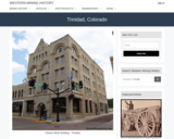
Trinidad, CO Mining Town. Western Mining History presents a brief summary of …
Trinidad, CO Mining Town. Western Mining History presents a brief summary of Colorado's Historical Mining Towns with links to additional Colorado resources for a mining town database and mines by county. Western Mining History is an historical site that provides information on mining, mining towns, the gold and silver rush, and Photos and maps of the western United States. This is a strong primary source resource that can be used for a variety of class research projects. Consider becoming a member or making a donation to help further the work of the site.
There is a 40% chance that the lower ⅓ of the of …
There is a 40% chance that the lower ⅓ of the of the Cascadia subduction zone will rupture in the next 50 years, generating a large earthquake and ensuing tsunami. In this project, students will work collaboratively to design and test a model of a vertical evacuation structure. They will evaluate the performance of their models and propose further modifications to improve their design. Students will then make a scale drawing and a model to apply math concepts of scale to designing and creating an ideal model of a vertical evacuation structure. Finally, students will present their findings and proposed final design to their peers and an adult audience. The entire process takes about 2 weeks, and was expanded to include more information and activities with earthquake/tsunami prediction and application of scale. The unit is a great fit for standards within Earth Science (specifically plate tectonics and human mitigation) as well as Engineering and Design standards.
Lectures and previous brief assignments dealt with plate tectonics, earthquakes, volcanoes and …
Lectures and previous brief assignments dealt with plate tectonics, earthquakes, volcanoes and tsunamis. For the assignment, students read several articles describing potential sources for tsunamis on the east coast, including volcanic eruptions on the Canary Islands, underwater landslides off the shelf, and earthquakes. Their task is to summarize these potential sources, evaluate the risk of a tsunami on the east coast, and compare them with previously discussed risks for the west coast and Hawaii.
(Note: this resource was added to OER Commons as part of a batch upload of over 2,200 records. If you notice an issue with the quality of the metadata, please let us know by using the 'report' button and we will flag it for consideration.)
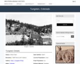
Tungsten, CO Mining Town. Western Mining History presents a brief summary of …
Tungsten, CO Mining Town. Western Mining History presents a brief summary of Colorado's Historical Mining Towns with links to additional Colorado resources for a mining town database and mines by county. Western Mining History is an historical site that provides information on mining, mining towns, the gold and silver rush, and Photos and maps of the western United States. This is a strong primary source resource that can be used for a variety of class research projects. Consider becoming a member or making a donation to help further the work of the site.
Students apply their knowledge about mountains and rocks to transportation engineering, with …
Students apply their knowledge about mountains and rocks to transportation engineering, with the task of developing a model mountain tunnel that simulates the principles behind real-life engineering design. Student teams design and create model tunnels through a clay mountain, working within design constraints and testing for success; the tunnels must meet specific design requirements and withstand a certain load.
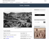
Turret, CO Mining Town. Western Mining History presents a brief summary of …
Turret, CO Mining Town. Western Mining History presents a brief summary of Colorado's Historical Mining Towns with links to additional Colorado resources for a mining town database and mines by county. Western Mining History is an historical site that provides information on mining, mining towns, the gold and silver rush, and Photos and maps of the western United States. This is a strong primary source resource that can be used for a variety of class research projects. Consider becoming a member or making a donation to help further the work of the site.
Overview of the field of Paleontology for teachers. The resource covers a …
Overview of the field of Paleontology for teachers. The resource covers a definition, career, fossils, dinosaurs, laws about collecting fossils, dating fossils, evolution, extinction events, and taxonomic diversity.
This activity is a guided investigation into the process of plate tectonics …
This activity is a guided investigation into the process of plate tectonics and resulting features. It's a look at the resulting effects which we see as volcanoes, earthquakes, and mountains.
This is an exercise in which students are reintroduced to geologic maps …
This is an exercise in which students are reintroduced to geologic maps and encouraged to "deconstruct" the map into constituent elements in order to understand the geologic history of the area. The preceding lectures in the course have recapitulated material that the students have covered in Introduction to Physical Geology. During class, the students work through the maps that were part of lab exercises in the Intro level course, so that basic concepts are recalled (superposition, cross-cutting relationships, basic faults and folds). The final product is a geologic history of this map area.
(Note: this resource was added to OER Commons as part of a batch upload of over 2,200 records. If you notice an issue with the quality of the metadata, please let us know by using the 'report' button and we will flag it for consideration.)
PowerPoint module leading students through creation and manipulation of spreadsheet to forward …
PowerPoint module leading students through creation and manipulation of spreadsheet to forward model an example of exponential decay -- the number of remaining unpopped kernels of popcorn in a bag of popping popcorn.
(Note: this resource was added to OER Commons as part of a batch upload of over 2,200 records. If you notice an issue with the quality of the metadata, please let us know by using the 'report' button and we will flag it for consideration.)
In this activity, students are introduced to the concept of ecosystem services, …
In this activity, students are introduced to the concept of ecosystem services, provided with a tool for exploring these services in particular landscapes, and led through a few examples so that they will be comfortable using the tool. Google Earth is presented as a tool for exploring landscapes and evaluating the ecosystem services provided by those landscapes, including spatial and temporal variability. Students use Google Earth to identify and classify ecosystem services according to the Millennium Ecosystem Assessment (MA) categories, first by looking at an example landscape along the the Missouri River, and then by looking at an example specific to their location.
(Note: this resource was added to OER Commons as part of a batch upload of over 2,200 records. If you notice an issue with the quality of the metadata, please let us know by using the 'report' button and we will flag it for consideration.)
In this activity, students focus on ecosystem services specifically related to the …
In this activity, students focus on ecosystem services specifically related to the hydrologic cycle. Using rainfall-runoff data for a small watershed in Ohio, students are introduced to the technical vocabulary associated with watersheds, watershed hydrology, and water balance. Working with hydrologic data will enable the students to test their understanding of watershed hydrology and the water balance equation, which is a measure of how much water is stored within different parts of the watershed.
(Note: this resource was added to OER Commons as part of a batch upload of over 2,200 records. If you notice an issue with the quality of the metadata, please let us know by using the 'report' button and we will flag it for consideration.)
The term "Earth system science" is typically used to describe the science …
The term "Earth system science" is typically used to describe the science (especially quantitative modeling) of the interactions between the atmosphere, hydrosphere, and cryosphere, and biosphere---the addition of lithosphere to that list provides all of the main generalized components ("spheres") of the Critical Zone. In this lesson, students will consider basic concepts of system science (studying complex systems), specifically as it can be applied to Critical Zone science. Students will engage in developing a qualitative systems model graphic of the Critical Zone. The knowledge gained here will be applied later in the semester to more in-depth systems thinking of the Critical Zone.
(Note: this resource was added to OER Commons as part of a batch upload of over 2,200 records. If you notice an issue with the quality of the metadata, please let us know by using the 'report' button and we will flag it for consideration.)
In this activity, students examine the impact of land use on runoff. …
In this activity, students examine the impact of land use on runoff. Using rainfall-runoff data for two small watersheds in Ohio, one dominated by agricultural land uses and the other dominated by urban land uses, students evaluate natural and human factors that impact watershed hydrology and water balance, and generate potential provisioning and regulating services provided by natural ecosystems within watersheds.
(Note: this resource was added to OER Commons as part of a batch upload of over 2,200 records. If you notice an issue with the quality of the metadata, please let us know by using the 'report' button and we will flag it for consideration.)
How are rising sea levels already influencing different regions? This unit offers …
How are rising sea levels already influencing different regions? This unit offers case study examples for a coastal developing country (Bangladesh), a major coastal urban area (southern California), and an island nation (Maldives). What are the anticipated consequences of additional sea-level rise this century in these different places? This introduction to the module is designed to prompt student consideration of the economic and social impacts of sea-level change. As a class, students conduct a stakeholder analysis for one or more of the case study regions in order to better understand how different segments of a society affect and will be affected by sea-level change.
Show more about Online Teaching suggestions Hide Online-adaptable: This exercise could be converted to online whole-class discussions and a breakout group activity. At least the whole-class portion would probably need to be done synchronously.
(Note: this resource was added to OER Commons as part of a batch upload of over 2,200 records. If you notice an issue with the quality of the metadata, please let us know by using the 'report' button and we will flag it for consideration.)
No restrictions on your remixing, redistributing, or making derivative works. Give credit to the author, as required.
Your remixing, redistributing, or making derivatives works comes with some restrictions, including how it is shared.
Your redistributing comes with some restrictions. Do not remix or make derivative works.
Most restrictive license type. Prohibits most uses, sharing, and any changes.
Copyrighted materials, available under Fair Use and the TEACH Act for US-based educators, or other custom arrangements. Go to the resource provider to see their individual restrictions.