The Plate Tectonics module "What will Earth look like in 500 million …
The Plate Tectonics module "What will Earth look like in 500 million years?" helps students build a systems view of plate tectonics through focused case studies and interactions with the Seismic Explorer and Tectonic Explorer models. As students explore data about plate boundaries on Earth today, they make connections to what happened in Earth's past. Finally, they use their understanding of how Earth's plate system exists today to make predictions about what Earth may look like in 500 million years.
Average inquiry level: Guided inquiry This is a series of scaffolded modules …
Average inquiry level: Guided inquiry This is a series of scaffolded modules to guide students in understanding Plate Tectonic Theory, from its history to modern applications, and is designed for the asynchronous class. These modules may be used as individual classroom assignments or as labs. They were written with the intention of students working from 12-16 hours during an asynchronous week. They can also be used in classes with different modalities. This is not designed for one 3-hour lab session, although individual modules could be used as labs.
(Note: this resource was added to OER Commons as part of a batch upload of over 2,200 records. If you notice an issue with the quality of the metadata, please let us know by using the 'report' button and we will flag it for consideration.)
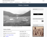
Platoro, CO Mining Town. Western Mining History presents a brief summary of …
Platoro, CO Mining Town. Western Mining History presents a brief summary of Colorado's Historical Mining Towns with links to additional Colorado resources for a mining town database and mines by county. Western Mining History is an historical site that provides information on mining, mining towns, the gold and silver rush, and Photos and maps of the western United States. This is a strong primary source resource that can be used for a variety of class research projects. Consider becoming a member or making a donation to help further the work of the site.
This activity utilizes kinestetic learning by having students make models of geologic …
This activity utilizes kinestetic learning by having students make models of geologic concepts, landscapes and processes using playdough in the classroom.
Key words: kinestetic learning, playdough
(Note: this resource was added to OER Commons as part of a batch upload of over 2,200 records. If you notice an issue with the quality of the metadata, please let us know by using the 'report' button and we will flag it for consideration.)
This is a fairly short exercise that can be used for an …
This is a fairly short exercise that can be used for an in-class cooperative learning project or as homework. It includes LOTS of explanation and so is sort of a tutorial. The goal is to get students to understand how compositions can be ploted on a line (2 components) or a triangle (3 components). I use it in my petrology class because it works better than lecturing.
(Note: this resource was added to OER Commons as part of a batch upload of over 2,200 records. If you notice an issue with the quality of the metadata, please let us know by using the 'report' button and we will flag it for consideration.)
This 15-question problem set challenges students to determine the point group Hermann-Mauguin …
This 15-question problem set challenges students to determine the point group Hermann-Mauguin symbol and crystal system for each crystal stereogram.
(Note: this resource was added to OER Commons as part of a batch upload of over 2,200 records. If you notice an issue with the quality of the metadata, please let us know by using the 'report' button and we will flag it for consideration.)
Use valley and slope deposits to reconstruct recent landscape erosion and sedimentation …
Use valley and slope deposits to reconstruct recent landscape erosion and sedimentation history.
(Note: this resource was added to OER Commons as part of a batch upload of over 2,200 records. If you notice an issue with the quality of the metadata, please let us know by using the 'report' button and we will flag it for consideration.)
This optional homework asks students to investigate some of the impacts of …
This optional homework asks students to investigate some of the impacts of previous mines, mining, and/or mineral resources processing on the surrounding environment and human health. Many of the sites were operated prior to significant changes in the U.S. regulation of mines that was instituted in the late 1960s. Through the investigation of an Abandoned Mine Lands (AML) National Priority List (NPL) website (aka Superfund), students will explore not only the impacts but also the amount of time, effort, and resources it takes to remediate the sites. This background can be referred to in later parts of the module when discussing mining in other countries where the regulations are not as stringent as those in the United States.
(Note: this resource was added to OER Commons as part of a batch upload of over 2,200 records. If you notice an issue with the quality of the metadata, please let us know by using the 'report' button and we will flag it for consideration.)
This activity provides examples of (1) a student experience survey and (2) …
This activity provides examples of (1) a student experience survey and (2) an assessment quiz that can be used on the first day of class. The survey reveals students' backgrounds in terms of related coursework, computer skills, and geologic experiences that the instructor can draw upon throughout the semester. The quiz gives helps to determine students' familiarity with selected concepts and terminology of sedimentary geology and their ability to apply simple mathematical skills (algebra and trig) to relevant problems. Both tools can be used to identify students who may need extra attention early in the course and to plan for supplementary instructional sessions on topics for which many students are deficient.
(Note: this resource was added to OER Commons as part of a batch upload of over 2,200 records. If you notice an issue with the quality of the metadata, please let us know by using the 'report' button and we will flag it for consideration.)
By supplementing existing traditional labs on mineral and rock identification, and on …
By supplementing existing traditional labs on mineral and rock identification, and on interpreting geologic maps, and creating a lab time for analyzing data available on the web, the students will determine if indoor radon levels correlate best to bedrock geology or to glacial deposits in New York State.
(Note: this resource was added to OER Commons as part of a batch upload of over 2,200 records. If you notice an issue with the quality of the metadata, please let us know by using the 'report' button and we will flag it for consideration.)
Students gesture the orientations of cross-bedded sandstones, and in particular the relationship …
Students gesture the orientations of cross-bedded sandstones, and in particular the relationship between a single cross bed and the bed sets. They do this for photos of undeformed and deformed cross-bedding.
(Note: this resource was added to OER Commons as part of a batch upload of over 2,200 records. If you notice an issue with the quality of the metadata, please let us know by using the 'report' button and we will flag it for consideration.)
In this exercise, students relate large-scale features on Earth's surface to lithospheric …
In this exercise, students relate large-scale features on Earth's surface to lithospheric plates, the underlying asthenosphere, earthquakes, and volcanoes. After creating a cross section showing elevation using GeoMapApp, students add additional features by hand.
(Note: this resource was added to OER Commons as part of a batch upload of over 2,200 records. If you notice an issue with the quality of the metadata, please let us know by using the 'report' button and we will flag it for consideration.)
This problem set is used as a homework assignment to assess students' …
This problem set is used as a homework assignment to assess students' understanding of the properties of light. Students are asked to calculate velocity through media with different index of refractions, wavelengths, frequencies, and reflection/refraction behaviors.
(Note: this resource was added to OER Commons as part of a batch upload of over 2,200 records. If you notice an issue with the quality of the metadata, please let us know by using the 'report' button and we will flag it for consideration.)
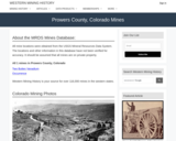
This Western Mining History database uses Mineral Resources Data System to list …
This Western Mining History database uses Mineral Resources Data System to list known Colorado historical mines by county. Each county site has links to the known mines within its borders. Some are known and named, others are unnamed. Mines should be assumed to be on private property unless other research is conducted. Data provided for each mine site include: Name, State, County, Elevation, Primary Mineral Mined, Latitude and Longitude and a link to Google Maps. Photos are provided where available. Additional information for some Mines are satellite photos, and ownership, business and historical records. Mining History is an historical site that provides information on mining, mining towns, the gold and silver rush, and Photos and maps of the western United States. This is a great database for student historical research or data and statistics classes. Consider becoming a member or making a donation to help further the work of the site.
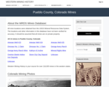
The four exercises give students an opportunity to use their knowledge of …
The four exercises give students an opportunity to use their knowledge of graphs, algebra, and maps to solve simple geological problems.
(Note: this resource was added to OER Commons as part of a batch upload of over 2,200 records. If you notice an issue with the quality of the metadata, please let us know by using the 'report' button and we will flag it for consideration.)
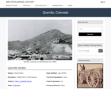
Querida, CO Mining Town. Western Mining History presents a brief summary of …
Querida, CO Mining Town. Western Mining History presents a brief summary of Colorado's Historical Mining Towns with links to additional Colorado resources for a mining town database and mines by county. Western Mining History is an historical site that provides information on mining, mining towns, the gold and silver rush, and Photos and maps of the western United States. This is a strong primary source resource that can be used for a variety of class research projects. Consider becoming a member or making a donation to help further the work of the site.
Students analyze the interplay between science and politics on the issue of …
Students analyze the interplay between science and politics on the issue of drilling for oil in the Arctic National Wildlife Refuge.
(Note: this resource was added to OER Commons as part of a batch upload of over 2,200 records. If you notice an issue with the quality of the metadata, please let us know by using the 'report' button and we will flag it for consideration.)
No restrictions on your remixing, redistributing, or making derivative works. Give credit to the author, as required.
Your remixing, redistributing, or making derivatives works comes with some restrictions, including how it is shared.
Your redistributing comes with some restrictions. Do not remix or make derivative works.
Most restrictive license type. Prohibits most uses, sharing, and any changes.
Copyrighted materials, available under Fair Use and the TEACH Act for US-based educators, or other custom arrangements. Go to the resource provider to see their individual restrictions.