This Western Mining History database uses Mineral Resources Data System to list …
This Western Mining History database uses Mineral Resources Data System to list known Colorado historical mines by county. Each county site has links to the known mines within its borders. Some are known and named, others are unnamed. Mines should be assumed to be on private property unless other research is conducted. Data provided for each mine site include: Name, State, County, Elevation, Primary Mineral Mined, Latitude and Longitude and a link to Google Maps. Photos are provided where available. Additional information for some Mines are satellite photos, and ownership, business and historical records. Mining History is an historical site that provides information on mining, mining towns, the gold and silver rush, and Photos and maps of the western United States. This is a great database for student historical research or data and statistics classes. Consider becoming a member or making a donation to help further the work of the site.
This lecture/activity allows students to "play with" a toy Slinky in order …
This lecture/activity allows students to "play with" a toy Slinky in order to recognize the implications of an elastic rheology to deformation at shallow crustal levels. Building on already-covered concepts of elasticity and friction, this module adds seismic first motions and earthquake locations to the students conceptual tool bag. As such, this module can be used to segue into other areas of geophyics that are of importance in structural geology (e.g., active tectonics, hazards).
(Note: this resource was added to OER Commons as part of a batch upload of over 2,200 records. If you notice an issue with the quality of the metadata, please let us know by using the 'report' button and we will flag it for consideration.)
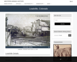
Leadville, CO Mining Town. Western Mining History presents a brief summary of …
Leadville, CO Mining Town. Western Mining History presents a brief summary of Colorado's Historical Mining Towns with links to additional Colorado resources for a mining town database and mines by county. Western Mining History is an historical site that provides information on mining, mining towns, the gold and silver rush, and Photos and maps of the western United States. This is a strong primary source resource that can be used for a variety of class research projects. Consider becoming a member or making a donation to help further the work of the site.
This exercise set explores marine sediments using core photos and authentic datasets …
This exercise set explores marine sediments using core photos and authentic datasets in an inquiry-based approach. Students' prior knowledge of sea floor sediments is explored in Part 1. In Parts 2-3 students observe and describe the physical characteristics of sediment cores and determine the composition using smear slide data and a decision tree. In Part 4 students develop a map showing the distribution of the primary marine sediment types of the Pacific and North Atlantic Oceans and develop hypotheses to explain the distribution of the sediment types shown on their map.
(Note: this resource was added to OER Commons as part of a batch upload of over 2,200 records. If you notice an issue with the quality of the metadata, please let us know by using the 'report' button and we will flag it for consideration.)
In this activity, students are asked to consider three different rocks: granite, …
In this activity, students are asked to consider three different rocks: granite, shale and schist. Can these rocks become one of the others through geologic processes? Students are asked to describe the relationships between the rock types, the geologic processes involved and the geologic evidence for these relationships. Diagrams to help support their answers are suggested but not required.
(Note: this resource was added to OER Commons as part of a batch upload of over 2,200 records. If you notice an issue with the quality of the metadata, please let us know by using the 'report' button and we will flag it for consideration.)
Based on a schematic diagram of an outcrop provided in the first …
Based on a schematic diagram of an outcrop provided in the first question, students are asked to list the relative ages of the four different rock units and provide the reasoning behind their interpretation based on the principles of relative age and the processes involved in the formation of each rock. Students are told that there are two possible solutions and must describe both. The second part of question one asks students to describe the geologic evidence they would look for in the outcrop to determine which of the solutions was likely correct.
The second question of the assignment is about numerical age dating. Students are asked to list what could be dated in each rock (e.g. minerals, fossils) and which particular process during the formation of each rock would be dated in doing so.
(Note: this resource was added to OER Commons as part of a batch upload of over 2,200 records. If you notice an issue with the quality of the metadata, please let us know by using the 'report' button and we will flag it for consideration.)
At the end of the semester, students are asked to create a …
At the end of the semester, students are asked to create a concept map of the four main concepts covered over the duration of the course. They are provided with a grading rubric and 4 the main nodes that are required on the map (plate tectonics, the rock cycle, geologic time and scientific research). The four concepts can be arranged in any manner, and the connecting lines must be labelled with appropriate terms and examples. Students have the option of creating a paper map (11'' x 17'' or larger) or a digital map using a free software program, VUE.
(Note: this resource was added to OER Commons as part of a batch upload of over 2,200 records. If you notice an issue with the quality of the metadata, please let us know by using the 'report' button and we will flag it for consideration.)
Given a cross-sectional diagram of two rock outcrops (From Earth: Portrait of …
Given a cross-sectional diagram of two rock outcrops (From Earth: Portrait of a Planet 4th edition by Stephan Marshak. Copyright �� 2012, 2008, 2005, 2001 by W.W. Norton & Company, Inc. Used by permission of W. W. Norton & Company, Inc.), Part 1 of this activity asks students to sketch a fault structure that would explain the rock configuration. Labels for all important parts of the fault are required (hanging wall, foot wall, arrows indicating movement and the maximum stress direction). The fault must be identified as either normal or reverse. Only one of two possible solutions is required.
Given a map template, Part 2 asks students to sketch a geological map of the outcrops based on their fault from Part 1. Required elements include all lithological contacts, strike/dip symbols, structural labels and a proper legend.
Part 3 of this activity gives students the same schematic cross-section as in Part 1, except now they have to draw folds that would explain the rock configuration. Labels for the hinge line, axial plane and maximum stress direction must be included.
"Lifelines and Earth lines" is the first lab activity of the semester …
"Lifelines and Earth lines" is the first lab activity of the semester in an undergraduate, introductory-level geoscience course for non-majors and majors. It requires no homework or preparation by students. The first goal is for students to get to know one another and the instructor. Students work in teams of 2, construct lines representing the length of their lives on large easel paper, mark important life events on their lines, and introduce their partners to the class (about 25 minutes total). Students then construct lines representing the length of earth history and mark important geologic events, and answer questions about geologic time and events (about 25 minutes). This part of the lab has the goal of helping students gain a better understanding of geological time scales and the current scientific models that attempt to explain the evolution and future of our planet. The questions ask them to think about why we "count" time differently for people (moving forward from birth) and geology (going back from the present). The events chosen relate to appearances of major life forms and mass extinctions; questions ask them to think about these events and what evidence for them might be preserved in the geologic record. These questions serve as a springboard for discussion of geologic time and evolution as controversial topics.
(Note: this resource was added to OER Commons as part of a batch upload of over 2,200 records. If you notice an issue with the quality of the metadata, please let us know by using the 'report' button and we will flag it for consideration.)
This is a classroom activity about the forcing mechanisms for the most …
This is a classroom activity about the forcing mechanisms for the most recent cold period: the Little Ice Age (1350-1850). Students receive data about tree ring records, solar activity, and volcanic eruptions during this time period. By comparing and contrasting time intervals when tree growth was at a minimum, solar activity was low, and major volcanic eruptions occurred, they draw conclusions about possible natural causes of climate change and identify factors that may indicate climate change.
This activity introduces students to the interdisciplinary field of geoarchaeology through a …
This activity introduces students to the interdisciplinary field of geoarchaeology through a case study of the eruption of Mt. Vesuvius in 79 CE. It combines short lectures with questions requiring analyses of a variety of data sets relating to volcanic hazards. It requires no background in geoscience or archaeology and is aimed at students from both the physical sciences and the humanities, from high school through freshman year.
(Note: this resource was added to OER Commons as part of a batch upload of over 2,200 records. If you notice an issue with the quality of the metadata, please let us know by using the 'report' button and we will flag it for consideration.)
This Western Mining History database uses Mineral Resources Data System to list …
This Western Mining History database uses Mineral Resources Data System to list known Colorado historical mines by county. Each county site has links to the known mines within its borders. Some are known and named, others are unnamed. Mines should be assumed to be on private property unless other research is conducted. Data provided for each mine site include: Name, State, County, Elevation, Primary Mineral Mined, Latitude and Longitude and a link to Google Maps. Photos are provided where available. Additional information for some Mines are satellite photos, and ownership, business and historical records. Mining History is an historical site that provides information on mining, mining towns, the gold and silver rush, and Photos and maps of the western United States. This is a great database for student historical research or data and statistics classes. Consider becoming a member or making a donation to help further the work of the site.
Students will receive a written material describing how various well logs can …
Students will receive a written material describing how various well logs can be used in a synergistic way to yield more useful information about possible gas presence in sedimentary layers.
A detailed description of the method is done by the instructor and an example is fully worked in class. Then, either all students receive Figure 3 as a homework or (if possible) each student will receive an individual set of logs. For the latter situation, the student will then make an oral presentation of his/her findings and a class discussion will follow under instructor's guidance. Uses online and/or real-time data Addresses student fear of quantitative aspect and/or inadequate quantitative skills Uses geophysics to solve problems in other fields
(Note: this resource was added to OER Commons as part of a batch upload of over 2,200 records. If you notice an issue with the quality of the metadata, please let us know by using the 'report' button and we will flag it for consideration.)
College-level adaptation of the Earth Exploration Toolbook chapter. Students work with a …
College-level adaptation of the Earth Exploration Toolbook chapter. Students work with a free GIS program, ArcVoyager SE, to explore earthquake data and plate tectonics.
(Note: this resource was added to OER Commons as part of a batch upload of over 2,200 records. If you notice an issue with the quality of the metadata, please let us know by using the 'report' button and we will flag it for consideration.)
This simulation is intended to help students use what they already know …
This simulation is intended to help students use what they already know (elementary probability) to the concept of radioactive decay and how it can be used to determine the absolute age of an igneous rock. The students will be simulating atoms of a radioactive isotope such as radiocarbon or uranium with M & M's or some other flattish object with differently-marked sides.
They simulate a half-life by shaking the M & M's and dropping them onto a sheet of paper. Roughly half of them will fall with the blank side up, just as half of the radioactive atoms decay into another element during a half-life. The students will remove the blank M & M's, graph the number of undecayed ones, and shake those, simulating another half-life. The students will pool their data, examine the effect of sample size, and assess how many half-lives it takes to run out of countable undecayed atoms. This model explains why real radiometric dating labs require minimal starting sample sizes and cannot give dates beyond a certain range (>40,000 yrs) for radiocarbon.
(Note: this resource was added to OER Commons as part of a batch upload of over 2,200 records. If you notice an issue with the quality of the metadata, please let us know by using the 'report' button and we will flag it for consideration.)
This is an interactive lecture where students answer questions about demonstrations shown …
This is an interactive lecture where students answer questions about demonstrations shown in several movie files. They learn to connect what they have learned about molecules, phases of matter, silicate crystal structures, and igneous rock classification with magma viscosity, and to connect magma viscosity with volcano explosiveness and morphology.
No restrictions on your remixing, redistributing, or making derivative works. Give credit to the author, as required.
Your remixing, redistributing, or making derivatives works comes with some restrictions, including how it is shared.
Your redistributing comes with some restrictions. Do not remix or make derivative works.
Most restrictive license type. Prohibits most uses, sharing, and any changes.
Copyrighted materials, available under Fair Use and the TEACH Act for US-based educators, or other custom arrangements. Go to the resource provider to see their individual restrictions.