The goal of this assignment is to introduce students to the degree …
The goal of this assignment is to introduce students to the degree to which ecosystems, climate, and geography have varied through Earth history. It requires students to work in groups (which many resist) and to research each geologic period using the Paleo Portal website and external websites.
(Note: this resource was added to OER Commons as part of a batch upload of over 2,200 records. If you notice an issue with the quality of the metadata, please let us know by using the 'report' button and we will flag it for consideration.)
By presenting the students with fossils and other earth materials and giving …
By presenting the students with fossils and other earth materials and giving clues as to their origin, they will be able to identify the fossils and materials and be able to form a hypothesis as to how they were formed and what it was before preservation.
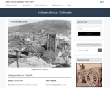
Independence, CO Mining Town. Western Mining History presents a brief summary of …
Independence, CO Mining Town. Western Mining History presents a brief summary of Colorado's Historical Mining Towns with links to additional Colorado resources for a mining town database and mines by county. Western Mining History is an historical site that provides information on mining, mining towns, the gold and silver rush, and Photos and maps of the western United States. This is a strong primary source resource that can be used for a variety of class research projects. Consider becoming a member or making a donation to help further the work of the site.
In this lab, students investigate a hotly debated topic relevant in the …
In this lab, students investigate a hotly debated topic relevant in the political, economic, and scientific arenas. They will examine the processes involved in unconventional oil and gas resource production, including hydraulic fracturing. In particular, they will examine nearby seismic activity and will be asked to determine if correlations can be established between fluid injection, related to hydrofracking or wastewater disposal, and earthquake activity. As an option, students can also investigate geothermal activity at the Geysers in California, to illustrate the difficulty in assessing natural versus induced seismicity in such a geologically complex region.
inquiryHub high school and middle school curricula, guided by the Next Generation …
inquiryHub high school and middle school curricula, guided by the Next Generation Science Standards (NGSS) and STEM standards in computer science and AI education, uses research-based approaches to teach science in a deeply digital environment, where students apply science and engineering ideas and practices to explain phenomena and solve problems.
The inquiryHub team led the development of courses in three- Biology, Chemistry, and Physics with Earth and space science integrated into each course. Featuring storyline instructional models and exciting new anchors, the units were selected using interest data from students. Additionally, all materials were field tested in more than 300 schools across the country to ensure they meet high standards for student engagement and learning. Through a collaboration with the Learning in Places Collaborative, we have integrated ethical decision making into phenomena and design challenges. Additionally, an integral component of the development process has been external validation of alignment to the NGSS by NextGenScience’s Science Peer Review Panel using the EQuIP rubric and reviews by educators who are part of Science Educators for Equity, Diversity, and Social Justice.
Students in our online, introductory geoscience courses are given the opportunity to …
Students in our online, introductory geoscience courses are given the opportunity to participate in an environmental service learning project, led by the Center for Earth and Environmental Science (cees.iupui.edu), and reflect on the local and global impact of their service in a short writing assignment. The goals of the optional service learning participation are to (1) provide hands-on field experiences to students in online classes, (2) allow opportunities to connect course concepts to real-life environmental issues, and (3) increase students' environmental awareness, and (4) apply an understanding of sustainability to participation in environmental restoration projects. As part of a larger study with CEES, students complete a pre- and post-environmental awareness survey.
(Note: this resource was added to OER Commons as part of a batch upload of over 2,200 records. If you notice an issue with the quality of the metadata, please let us know by using the 'report' button and we will flag it for consideration.)
Zebulon Miracle from Museums of Western Colorado discusses rock art interpretation efforts …
Zebulon Miracle from Museums of Western Colorado discusses rock art interpretation efforts over centuries and examines how researchers have approached studying rock art over time.
The is a two part lesson designed to given in-service teacher an …
The is a two part lesson designed to given in-service teacher an experience in field geology. The lesson is designed by Canyon de Chelly, AZ but can be used anywhere there are outcrops of two or more rock types.
(Note: this resource was added to OER Commons as part of a batch upload of over 2,200 records. If you notice an issue with the quality of the metadata, please let us know by using the 'report' button and we will flag it for consideration.)
This activity provides an introduction to 3D sketching. Students sketch a cube, …
This activity provides an introduction to 3D sketching. Students sketch a cube, boxes, and cylinders. They watch a video about how to sketch boxes and cylinders, and then sketch a few more.
This investigation introduces students to system dynamics modeling. It assumes that students …
This investigation introduces students to system dynamics modeling. It assumes that students have completed Introduction to Static Equilibrium Modeling as a pre-requisite.
In this lab I simply have students dissolve halite and sylvite in …
In this lab I simply have students dissolve halite and sylvite in water at various temperatures. I use this experiment to introduce students to the principles of equilibrium thermodynamics, as well as basic lab skills, data analysis, and lab report writing. Students use basic laboratory skills to conduct their experiments then analyze their data using a spreadsheet program such as Excel. They then write up their results and discussion in a formal lab report.
(Note: this resource was added to OER Commons as part of a batch upload of over 2,200 records. If you notice an issue with the quality of the metadata, please let us know by using the 'report' button and we will flag it for consideration.)
This is a guided question note sheet with interactive elements linked within …
This is a guided question note sheet with interactive elements linked within for an online course in Earth History or Historical Geology. NOVA evolution lab is one component, along with other introductory videos and links to useful websites on common misconceptions about evolution and others, compiled in one place with questions for students to answer to confirm understanding of main ideas.
(Note: this resource was added to OER Commons as part of a batch upload of over 2,200 records. If you notice an issue with the quality of the metadata, please let us know by using the 'report' button and we will flag it for consideration.)
This undergraduate level course presents a basic study in geology. It introduces …
This undergraduate level course presents a basic study in geology. It introduces major minerals and rock types, rock-forming processes, and time scales; temperatures, pressures, compositions, structure of the Earth, and measurement techniques; geologic structures and relationships observable in the field; sediment movement and landform development by moving water, wind, and ice; crustal processes and planetary evolution in terms of global plate tectonics with an emphasis on ductile and brittle processes.
This activity introduces students to using Google Earth and adding layers to …
This activity introduces students to using Google Earth and adding layers to google earth, while re-enforcing plate tectonic concepts and evidence for plate tectonics. Outcomes: 1. Download Google Earth onto computer 2. Turn on/off layers within Google Earth 3. Be able to change measurement and use ruler within Google Earth 4. Determine latitude and longitude of ocean basin features 5. Be able to search for locations within Google Earth 6. Learn to upload new layers into Google Earth from .kmz files 7. Describe different plate boundaries, their locations and boundary interactions 8. Explain evidence for Plate Tectonics
Students continue their introduction to Excel by building spreadsheets that estimate the …
Students continue their introduction to Excel by building spreadsheets that estimate the risk of a major earthquake along the Cascadia Subduction Zone to Benton County, Oregon.
This activity introduces students to loading and plotting data in MATLAB. Students …
This activity introduces students to loading and plotting data in MATLAB. Students explore scalar and vector time series and profile data commonly used in the field of Oceanography using data sets from publicly available sources or that they collected in local waters.
This is a series of three lab exercises integrating seismic interpretation and …
This is a series of three lab exercises integrating seismic interpretation and sedimentary geology. Each lab uses freely available software from dGB Earth Sciences, OpendTect. The seismic volume is the F3 Block in the North Sea, which is publicly available via dGB's Seismic Repository. The software is very user-friendly. The exercises are written so that no experience is needed using the software prior to the labs. Students are guided through the program as they answer questions on sedimentology, stratigraphy, geomorphology, structural geology and petroleum geology.
This investigation will introduce students to systems, systems modeling and computational thinking …
This investigation will introduce students to systems, systems modeling and computational thinking using static equilibrium modeling with SageModeler. This (or the 5-day version of this activity) is a pre-requisite for Introduction to Dynamic Modeling. This 2-day version jumps into student modeling more quickly and relies more heavily on the teacher to scaffold concepts of systems, modeling, and SageModeler.
This investigation will introduce students to systems, systems modeling and computational thinking …
This investigation will introduce students to systems, systems modeling and computational thinking using static equilibrium modeling with SageModeler. This (or the 2-day version of this activity) is a pre-requisite for Introduction to Dynamic Modeling. This 5-day version has more scaffolding of the concepts of systems, modeling, and SageModeler built into the student activity, but still requires teacher guidance.
Students construct structure contour lines for a "dipping bed" in our classroom …
Students construct structure contour lines for a "dipping bed" in our classroom and on a geologic map. In my class, this is a multi-day activity. In part 1 of this exercise, students use "topographic contours" and "outcrop locations" marked on the side walls of the classroom (mimicking a slot canyon) to develop their conceptual understanding of structure contours lines. They sketch a structure contour map of the "outcropping unit" and use this map to calculate the dip of the unit. The unit in question is a planar dipping bed.
Play-Doh model, structure contour lines marking a dipping contact
Provenance: Carol Ormand Ph.D., Carleton College Reuse: This item is offered under a Creative Commons Attribution-NonCommercial-ShareAlike license http://creativecommons.org/licenses/by-nc-sa/3.0/ You may reuse this item for non-commercial purposes as long as you provide attribution and offer any derivative works under a similar license. In part 2, I revisit the definition of structure contour lines and pass around Play-Doh models of a dipping contact, cut by a valley, with structure contour lines marked by toothpicks. In part 3, students construct structure contours for one unit on a geologic map. It is a map of several planar dipping beds, with some modest topography. In preparation for this, we spend significant time talking through the process of analyzing the geologic map to make sure we understand it correctly. After this discussion, I show them a Play-Doh model of the map area.
(Note: this resource was added to OER Commons as part of a batch upload of over 2,200 records. If you notice an issue with the quality of the metadata, please let us know by using the 'report' button and we will flag it for consideration.)
No restrictions on your remixing, redistributing, or making derivative works. Give credit to the author, as required.
Your remixing, redistributing, or making derivatives works comes with some restrictions, including how it is shared.
Your redistributing comes with some restrictions. Do not remix or make derivative works.
Most restrictive license type. Prohibits most uses, sharing, and any changes.
Copyrighted materials, available under Fair Use and the TEACH Act for US-based educators, or other custom arrangements. Go to the resource provider to see their individual restrictions.