Assemble a regional geologic history by compiling observations made a several sites. …
Assemble a regional geologic history by compiling observations made a several sites.
(Note: this resource was added to OER Commons as part of a batch upload of over 2,200 records. If you notice an issue with the quality of the metadata, please let us know by using the 'report' button and we will flag it for consideration.)
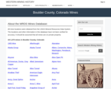
This Western Mining History database uses Mineral Resources Data System to list …
This Western Mining History database uses Mineral Resources Data System to list known Colorado historical mines by county. Each county site has links to the known mines within its borders. Some are known and named, others are unnamed. Mines should be assumed to be on private property unless other research is conducted. Data provided for each mine site include: Name, State, County, Elevation, Primary Mineral Mined, Latitude and Longitude and a link to Google Maps. Photos are provided where available. Additional information for some Mines are satellite photos, and ownership, business and historical records. Mining History is an historical site that provides information on mining, mining towns, the gold and silver rush, and Photos and maps of the western United States. This is a great database for student historical research or data and statistics classes. Consider becoming a member or making a donation to help further the work of the site.
In this project, students interpret a high-resolution image of result from an …
In this project, students interpret a high-resolution image of result from an experimental run of the Jurrasic Tank sedimentation simulator at the St. Anthony Falls Lab at the University of Minnesota. They are expected to interpret depositional environments, characterize simulated stratigraphic sections, and interpret the overall sedimentary architecture of the simulated basin. All of these observations are to put together onto a poster which is the final product of the project.
(Note: this resource was added to OER Commons as part of a batch upload of over 2,200 records. If you notice an issue with the quality of the metadata, please let us know by using the 'report' button and we will flag it for consideration.)
This is one component of the Rupturing Continental Lithosphere suite of mini-lessons. …
This is one component of the Rupturing Continental Lithosphere suite of mini-lessons. Students investigate the morphology of rifted margins by creating topographic/bathymetric maps and profiles across the Red Sea and the Gulf of California (using GeoMapApp ), and describe north-to-south variations in basin morphology in the Gulf of California (including making graphs using Excel). This lab exercise will allow students to examine the roles of structural evolution, sedimentation, and physical and chemical evolution of the crust in the rifting process. This lesson can act as an introduction to more detailed examinations of the roles of sedimentation and obliquity in rifted margins.
Clues from the Landscape Social Studies Lesson 1 Becoming a Homesteader is …
Clues from the Landscape Social Studies Lesson 1 Becoming a Homesteader is designed to be used with Clues from the Landscape Artifact Kit. Lessons 1, 2 and 4 can be completed without the artifacts from the kit. These kits are available through Musuems of Western Colorado to D51 Teachers. This lesson can be adapted to use without the kit. Students will be able to: • Describe the requirements for homesteaders under the Homestead Act of 1862 • Discuss the hardships faced by homesteaders • Defend their decision whether or not they would choose to become homesteaders.
This Western Mining History database uses Mineral Resources Data System to list …
This Western Mining History database uses Mineral Resources Data System to list known Colorado historical mines by county. Each county site has links to the known mines within its borders. Some are known and named, others are unnamed. Mines should be assumed to be on private property unless other research is conducted. Data provided for each mine site include: Name, State, County, Elevation, Primary Mineral Mined, Latitude and Longitude and a link to Google Maps. Photos are provided where available. Additional information for some Mines are satellite photos, and ownership, business and historical records. Mining History is an historical site that provides information on mining, mining towns, the gold and silver rush, and Photos and maps of the western United States. This is a great database for student historical research or data and statistics classes. Consider becoming a member or making a donation to help further the work of the site.
Working with data, students develop 3-D understandings of Earth structures using inference …
Working with data, students develop 3-D understandings of Earth structures using inference to construct a block diagram from a collection of 2-D information.
(Note: this resource was added to OER Commons as part of a batch upload of over 2,200 records. If you notice an issue with the quality of the metadata, please let us know by using the 'report' button and we will flag it for consideration.)
X-ray diffraction is a quick and valuable tool for identifying minerals. Minerals …
X-ray diffraction is a quick and valuable tool for identifying minerals. Minerals are an integral portion of our everyday life, in addition to composing our planet! They help bring electricity into our homes and remove our bathtub rings. In this lab, students analyze the X-ray diffraction patterns of three household cleansers, Ajax, White Magic, and Soft Scrub, in order to identify the abrasive minerals in each.
(Note: this resource was added to OER Commons as part of a batch upload of over 2,200 records. If you notice an issue with the quality of the metadata, please let us know by using the 'report' button and we will flag it for consideration.)
Dinosaur Journey is a part of the Museums of Western Colorado. Dinosaur …
Dinosaur Journey is a part of the Museums of Western Colorado. Dinosaur Journey director of Paleontology Dr. Julia McHugh talks about amphibians. Ever noticed the large red rock base of Independence Monument?! It is from the Chinle formation in the Triassic period. That's the age of the rock these amazing amphbian creatures were discovered.
The 50-minute group-based activity for hundreds of students starts by constructing bio-zones …
The 50-minute group-based activity for hundreds of students starts by constructing bio-zones for a given set of fossil ranges. Results are reviewed using a sequence of clicker questions to discuss the optimal biostratigraphic decisions, the necessary types of thinking, and how to articulate a concise yet complete textual description of corresponding biozones.
A set of stratigraphic logs is then used to interpret changes in depositional environment across space and time. Students also decide (and justify decisions) on the optimal choice of fossils for use when interpreting variations in depositional environment. The final result is an interpreted geologic section based on stratigraphic and biostratigraphic data.
This interpretive exercise is only three weeks into a first course on Earth and life through time, so guidance is provided using carefully designed question sequences posed using "clicker" (personal response system) and/or for individual or whole class discussion.
(Note: this resource was added to OER Commons as part of a batch upload of over 2,200 records. If you notice an issue with the quality of the metadata, please let us know by using the 'report' button and we will flag it for consideration.)
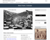
Black Hawk, CO Mining Town. Western Mining History presents a brief summary …
Black Hawk, CO Mining Town. Western Mining History presents a brief summary of Colorado's Historical Mining Towns with links to additional Colorado resources for a mining town database and mines by county. Western Mining History is an historical site that provides information on mining, mining towns, the gold and silver rush, and Photos and maps of the western United States. This is a strong primary source resource that can be used for a variety of class research projects. Consider becoming a member or making a donation to help further the work of the site.
Storms can have devastating impacts on coastal communities. Typically, tropical storms like …
Storms can have devastating impacts on coastal communities. Typically, tropical storms like hurricanes get the most attention, but there are other types of storms that occur at more northern latitudes that can be just as destructive. For example, in January of 2018, Winter Storm Grayson caused more than 300,000 power outages and $1.1 billion in damage, and resulted in 22 confirmed casualties along the eastern seaboard. In this module, students will learn how barometric pressure changes during a storm, analyze the effect of storms on oceanographic variables, classify a storm as a bomb cyclone, and compare a bomb cyclone to a hurricane. Ultimately students will use their quantitative reasoning skills to manipulate and visualize data during storms in the northeastern United States.
(Note: this resource was added to OER Commons as part of a batch upload of over 2,200 records. If you notice an issue with the quality of the metadata, please let us know by using the 'report' button and we will flag it for consideration.)
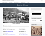
Bonanza, CO Mining Town. Western Mining History presents a brief summary of …
Bonanza, CO Mining Town. Western Mining History presents a brief summary of Colorado's Historical Mining Towns with links to additional Colorado resources for a mining town database and mines by county. Western Mining History is an historical site that provides information on mining, mining towns, the gold and silver rush, and Photos and maps of the western United States. This is a strong primary source resource that can be used for a variety of class research projects. Consider becoming a member or making a donation to help further the work of the site.
Question Suppose that you are building a new house. It will take …
Question Suppose that you are building a new house. It will take about 90 kg (198 pounds) of copper to do the electrical wiring. In order to get the copper in the first place, someone needs to mine solid rock that contains copper, extract the copper minerals, throw away the waste rock, and smelt the copper minerals to produce copper metal. Rocks mined for copper typically contain only very small percentages of copper -- about 0.7% in the case of most of the big porphyry copper deposits of the world. How much rock would someone have to mine in order to extract enough copper to wire your new house?
(Note: this resource was added to OER Commons as part of a batch upload of over 2,200 records. If you notice an issue with the quality of the metadata, please let us know by using the 'report' button and we will flag it for consideration.)
This Western Mining History database uses Mineral Resources Data System to list …
This Western Mining History database uses Mineral Resources Data System to list known Colorado historical mines by county. Each county site has links to the known mines within its borders. Some are known and named, others are unnamed. Mines should be assumed to be on private property unless other research is conducted. Data provided for each mine site include: Name, State, County, Elevation, Primary Mineral Mined, Latitude and Longitude and a link to Google Maps. Photos are provided where available. Additional information for some Mines are satellite photos, and ownership, business and historical records. Mining History is an historical site that provides information on mining, mining towns, the gold and silver rush, and Photos and maps of the western United States. This is a great database for student historical research or data and statistics classes. Consider becoming a member or making a donation to help further the work of the site.
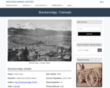
Breckenridge, CO Mining Town. Western Mining History presents a brief summary of …
Breckenridge, CO Mining Town. Western Mining History presents a brief summary of Colorado's Historical Mining Towns with links to additional Colorado resources for a mining town database and mines by county. Western Mining History is an historical site that provides information on mining, mining towns, the gold and silver rush, and Photos and maps of the western United States. This is a strong primary source resource that can be used for a variety of class research projects. Consider becoming a member or making a donation to help further the work of the site.
Buckskin Joe, CO Mining Town. Western Mining History presents a brief summary …
Buckskin Joe, CO Mining Town. Western Mining History presents a brief summary of Colorado's Historical Mining Towns with links to additional Colorado resources for a mining town database and mines by county. Western Mining History is an historical site that provides information on mining, mining towns, the gold and silver rush, and Photos and maps of the western United States. This is a strong primary source resource that can be used for a variety of class research projects. Consider becoming a member or making a donation to help further the work of the site.
Students design and construct devices to trap insects that are present in …
Students design and construct devices to trap insects that are present in the area around the school. The objective is to ask the right design questions and conduct the right tests to determine if the traps work .
In association with rock and mineral ID tables, this lab introduces students …
In association with rock and mineral ID tables, this lab introduces students to basic rocks and minerals via grouping and comparison, rather than as individual samples. I use this lab in my environmental geology course, where we don't have enough lab time to examine each set of rocks and minerals separately, but students need a basic familiarity with these materials and a context in which to place them. I find these groupings teach them how to look at rocks and minerals and give them the cursory experience identifying geologic materials necessary to go on successfully in the course.
(Note: this resource was added to OER Commons as part of a batch upload of over 2,200 records. If you notice an issue with the quality of the metadata, please let us know by using the 'report' button and we will flag it for consideration.)
No restrictions on your remixing, redistributing, or making derivative works. Give credit to the author, as required.
Your remixing, redistributing, or making derivatives works comes with some restrictions, including how it is shared.
Your redistributing comes with some restrictions. Do not remix or make derivative works.
Most restrictive license type. Prohibits most uses, sharing, and any changes.
Copyrighted materials, available under Fair Use and the TEACH Act for US-based educators, or other custom arrangements. Go to the resource provider to see their individual restrictions.