This Western Mining History database uses Mineral Resources Data System to list …
This Western Mining History database uses Mineral Resources Data System to list known Colorado historical mines by county. Each county site has links to the known mines within its borders. Some are known and named, others are unnamed. Mines should be assumed to be on private property unless other research is conducted. Data provided for each mine site include: Name, State, County, Elevation, Primary Mineral Mined, Latitude and Longitude and a link to Google Maps. Photos are provided where available. Additional information for some Mines are satellite photos, and ownership, business and historical records. Mining History is an historical site that provides information on mining, mining towns, the gold and silver rush, and Photos and maps of the western United States. This is a great database for student historical research or data and statistics classes. Consider becoming a member or making a donation to help further the work of the site.
This site provides graphs that illustrate gold production for every five years …
This site provides graphs that illustrate gold production for every five years from 1970 to 2004, and gold production by country. Links are also included to quarterly mine gold and silver production data, and yearly and cumulative gold and silver production.
This is one component of the Source to Sink Mini Lesson Set …
This is one component of the Source to Sink Mini Lesson Set This module is part of a larger set of mini-lessons that explores the variations in water and particulate mass flux from rivers that result from changing climate patterns and human activity in the Holocene. Long-period variations in runoff will be explored in this module on the Holocene Climatic Optimum, when intensification of the Southwest monsoon affected massively increased river discharge in South Asia. The exercise will detail the operation of the Asian monsoon and interpret stratigraphic evidence for increased sediment discharge during the Holocene Climatic Optimum using the Ganges-Brahmaputra as an example.
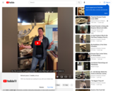
Dinosaur Journey is part of the Mueums of Western Colorado. Dr. Julia …
Dinosaur Journey is part of the Mueums of Western Colorado. Dr. Julia McHugh from Museums of Western Colorado’s Dinosaur Journey talks about what Holotype Fossils are, and how paleontologist use them to lay the foundation for new species discoveries. She talks specifically about the Mymorapelta dinosaur and it’s discovery.
Students are introduced to concepts in the course that give them the …
Students are introduced to concepts in the course that give them the skills to understand geologic maps. These include structural geology, weathering processes, the geologic time scale, types of rocks and minerals, glacial geology, etc. They also look at several quadrangle maps as lab activities, including the Williamsville Quadrangle from Virginia and the Bright Angel Quadrangle from the Grand Canyon. This independent exercise allows students to further investigate their hometown or other areas of interest, and report on the geologic history. This further prepares them for more advanced courses and also gives them an appreciation of their surroundings, a key part of a geologist's training.
(Note: this resource was added to OER Commons as part of a batch upload of over 2,200 records. If you notice an issue with the quality of the metadata, please let us know by using the 'report' button and we will flag it for consideration.)
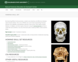
This activity was an educator created resource to accompany the Hominid skull …
This activity was an educator created resource to accompany the Hominid skull set from CSU's Natural Sciences Education & Outreach Center. This activity focuses on identifying distinct hominid traits and creating a Phylogenitc Tree to map human evolution. The resource can be used with the Hominid Skull Set, The Skull Anatomy Glossary, and the Hominid Evolution Activity from CSU's Natural Sciences Education & Outreach Center. See this link for all associated resources: https://www.cns-eoc.colostate.edu/stem-kits/hominid-skull-set/. At the linked site you can also download a rubric for grading this student activity.
Hominid Skull Set. This is not an Educational Kit, but rather a …
Hominid Skull Set. This is not an Educational Kit, but rather a collection of Hominid skulls that can be checked out in person for classroom use. Teachers should feel free to combine the artifacts with lessons of their choice or creation. The Natural Sciences Education & Outreach Center collaborates with CSU faculty, National Parks and citizen science programs to translate their current scientific research into unique STEM experiences for students in the form of Educational Kits that can be checked out. Each kit contains just about all of the materials needed (minus common things like water and paper towels) to explore some really interesting scientific research topics.The kits are available for teachers and informal educators in Colorado to check out by submitting a local pickup form at the linked website. This collection is provided free for educational use. This collection is not availably for delivery. This Kit is available in Spanish.
Science investigation of Homologous traits. Homologous traits are structures that look similar …
Science investigation of Homologous traits. Homologous traits are structures that look similar but function differently in different organisms. Homologous traits occur when organism inherit traits from a common ancestor, but evolve different uses of the traits, an example would be a human arm and a bat wing. Activity uses a phylogenetic tree to examine traits within a lineage.
This lesson introduces the theory of mantle plumes and possible ways of …
This lesson introduces the theory of mantle plumes and possible ways of finding evidence to support the theory.
(Note: this resource was added to OER Commons as part of a batch upload of over 2,200 records. If you notice an issue with the quality of the metadata, please let us know by using the 'report' button and we will flag it for consideration.)
This activity is a investigation where students observe soil and rocks, record …
This activity is a investigation where students observe soil and rocks, record their similarities and differences, interpret their findings, and are guided to develop a new investigable question.
SSAC Physical Volcanology module. Students build a spreadsheet to examine how magma …
SSAC Physical Volcanology module. Students build a spreadsheet to examine how magma viscosity varies with temperature, fraction of crystals, and water content using the non-Arrhenian VFT model.
This activity introduces geoscientific thinking to a primarily non-geoscience audience. This is …
This activity introduces geoscientific thinking to a primarily non-geoscience audience. This is the introductory activity of a module designed for pre-service secondary science teachers in a secondary science teaching methods course. Initially, students explore their conceptions of the scientific method. Through readings and discussion, the activity attempts to broaden the students' view of the nature of science by showing how geoscience methods differ from stereotypical experimental science. This introductory activity uses a seminar format (writing/reading/discussing/writing).
Roger Steinberg, Department of Natural Sciences, Del Mar College 5000 Dots by …
Roger Steinberg, Department of Natural Sciences, Del Mar College 5000 Dots by Computer (Click image to enlarge and download.)
(Note: this resource was added to OER Commons as part of a batch upload of over 2,200 records. If you notice an issue with the quality of the metadata, please let us know by using the 'report' button and we will flag it for consideration.)
Every week, numerous potentially damaging earthquakes occur around the world. To demonstrate …
Every week, numerous potentially damaging earthquakes occur around the world. To demonstrate the frequency geography of these earthquakes, you will use U.S. GEOLOGICAL SURVEY's Earthquake Tracker, an online resource, to list the locations / facts of all the magnitude 5.0 or higher earthquakes for the 4-day period. You will record information about the earthquakes (e.g., magnitude, date/time, depth, nearest city) in a word processing document and save as a pdf. Once you have completed this assignment, you will save your file and submit it as an attachment. LEARNING OUTCOMES 1. Successfully interact with the USGS Earthquake Tracker to identify a subset of earthquakes based on magnitude. 2. Understand the relationship between earthquakes and Plate Tectonics.
Students investigate how mountains are formed. Concepts include the composition and structure …
Students investigate how mountains are formed. Concepts include the composition and structure of the Earth's tectonic plates and tectonic plate boundaries, with an emphasis on plate convergence as it relates to mountain formation. Students learn that geotechnical engineers design technologies to measure movement of tectonic plates and mountain formation, as well as design to alter the mountain environment to create safe and dependable roadways and tunnels.
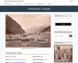
Howardsville, CO Mining Town. Western Mining History presents a brief summary of …
Howardsville, CO Mining Town. Western Mining History presents a brief summary of Colorado's Historical Mining Towns with links to additional Colorado resources for a mining town database and mines by county. Western Mining History is an historical site that provides information on mining, mining towns, the gold and silver rush, and Photos and maps of the western United States. This is a strong primary source resource that can be used for a variety of class research projects. Consider becoming a member or making a donation to help further the work of the site.
Despite what we have learned from the theory of plate tectonics, the …
Despite what we have learned from the theory of plate tectonics, the specifics of how those plate motions contribute to movement along faults remain a matter of much debate. Since the discovery of plate tectonics, scientists have recognized that earthquake activity, both the orientation and magnitude, is related to plate motions. However, efforts to total up the motion simply associated with earthquakes often falls far short of the plate motions. This suggests that plates have a way to slide past one another along faults without generating earthquakes, and discovering what controls whether faults produce earthquakes is critical for better characterizing seismic hazards around the world. Scientists are using a combination of GPS and seismometer recordings to investigate this issue. Some portions of a fault reveal traditional earthquake stick-slip behavior where gradual GPS motions show the fault is locked for a long time while plate motions cause stress to accumulate at the fault until the rocks break and the fault moves over the span of minutes generating large seismic signals and an abrupt GPS motion. In 2003, researchers discovered that portions of a fault also release accumulated stress more gradually over the course of several weeks in the form of a slow slip event that is accompanied by weak seismic tremors observed in a narrow frequency range that requires specific filtering to observe. These new phenomena are described as episodic tremor and slip as they recur on nearly an annual basis, much more frequently than large earthquakes which can have recurrence intervals of 50-5000 years. To better understand how faults move, this activity will examine both GPS and seismic data in the Cascadia region to identify key observations and build interpretation from them.
(Note: this resource was added to OER Commons as part of a batch upload of over 2,200 records. If you notice an issue with the quality of the metadata, please let us know by using the 'report' button and we will flag it for consideration.)
No restrictions on your remixing, redistributing, or making derivative works. Give credit to the author, as required.
Your remixing, redistributing, or making derivatives works comes with some restrictions, including how it is shared.
Your redistributing comes with some restrictions. Do not remix or make derivative works.
Most restrictive license type. Prohibits most uses, sharing, and any changes.
Copyrighted materials, available under Fair Use and the TEACH Act for US-based educators, or other custom arrangements. Go to the resource provider to see their individual restrictions.