The Nature of Geographic Information is an orientation to the properties of …
The Nature of Geographic Information is an orientation to the properties of geographic data and the practice of distance learning. The purpose of this course is to promote understanding of the Geographic Information Science and Technology (GIS&T) enterprise. GIS&T is the intersection of professions, institutions, and technologies that produce geographic data and render information from it. It is a rapidly growing and evolving field. Learning is a way of life for all GIS&T professionals. With this in mind, I hope that this text may contribute to your lifelong exploration of how geospatial technologies can be used to improve the quality of life-yours and your neighbors', locally and globally, now and in the future.
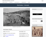
Manhattan, CO Mining Town. Western Mining History presents a brief summary of …
Manhattan, CO Mining Town. Western Mining History presents a brief summary of Colorado's Historical Mining Towns with links to additional Colorado resources for a mining town database and mines by county. Western Mining History is an historical site that provides information on mining, mining towns, the gold and silver rush, and Photos and maps of the western United States. This is a strong primary source resource that can be used for a variety of class research projects. Consider becoming a member or making a donation to help further the work of the site.
In this classroom activity, students will work in groups to observe how …
In this classroom activity, students will work in groups to observe how patterns of topography, bathymetry, earthquake locations and depths, and the location of volcanoes vary across regions of the Earth. They will then use this data to predict and map the locations and types of major plate tectonic boundaries. Finally, they should begin to form an intuition about the 3D nature of these plate tectonic boundaries by sketching a cross sectional concept diagram through a convergent boundary, plotting surface topography, earthquakes' locations below the surface, the position of volcanoes at the surface, and inferring the location of the plate tectonic boundary at depth.
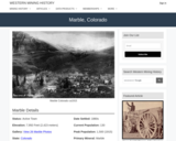
Marble, CO Mining Town. Western Mining History presents a brief summary of …
Marble, CO Mining Town. Western Mining History presents a brief summary of Colorado's Historical Mining Towns with links to additional Colorado resources for a mining town database and mines by county. Western Mining History is an historical site that provides information on mining, mining towns, the gold and silver rush, and Photos and maps of the western United States. This is a strong primary source resource that can be used for a variety of class research projects. Consider becoming a member or making a donation to help further the work of the site.
Students should research and define terminology included in the exercise (example - …
Students should research and define terminology included in the exercise (example - drainage basin) prior to lab. Pre-lab lecture should include basic concepts of hydrology (stream networks, basins) and an example of Strahler Stream Order. Students in a GIS-capable class can follow the instructions to create relevant maps and datasets. Students in introductory (non-GIS) classes should use pre-printed figures and tracing paper to complete the exercises.
(Note: this resource was added to OER Commons as part of a batch upload of over 2,200 records. If you notice an issue with the quality of the metadata, please let us know by using the 'report' button and we will flag it for consideration.)
Upon arrival in the lab, students are designated as an engineer, a …
Upon arrival in the lab, students are designated as an engineer, a biologist, or a geologist. Working in these groups, each group uses available Mars data (including, but not limited to, Mars geologic maps, topography, thermal inertia data) to identify their top three landing sites on the basis of provided criteria. In jig-saw fashion, new groups are generated consisting of one geologist, one engineer, and one geologist. These new groups must agree on their top three landing sites. Finally, the entire class must agree on a landing site.
(Note: this resource was added to OER Commons as part of a batch upload of over 2,200 records. If you notice an issue with the quality of the metadata, please let us know by using the 'report' button and we will flag it for consideration.)
Middle School Paleontology Kit Module from Museums of the West in Grand …
Middle School Paleontology Kit Module from Museums of the West in Grand Junction, CO. Lesson 5 on Mass Extinction. Students will learn about the causes of the "Big 5" mass extinctions in Earth's history and the effects of biodiversity over time. Lessons 1, 2, 3 and 5 can be completed without access to the Fossil Kit from Museums of Western Colorado. Lesson 4 uses fossile from the kit. District 51 personnel can request a kit to complete Lesson 4. See this URL for an overview of the module and a link to the Teacher's guide to Paleontology: https://www.museumofwesternco.com/classroom-resources/stem-lessons/
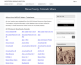
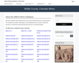
This Western Mining History database uses Mineral Resources Data System to list …
This Western Mining History database uses Mineral Resources Data System to list known Colorado historical mines by county. Each county site has links to the known mines within its borders. Some are known and named, others are unnamed. Mines should be assumed to be on private property unless other research is conducted. Data provided for each mine site include: Name, State, County, Elevation, Primary Mineral Mined, Latitude and Longitude and a link to Google Maps. Photos are provided where available. Additional information for some Mines are satellite photos, and ownership, business and historical records. Mining History is an historical site that provides information on mining, mining towns, the gold and silver rush, and Photos and maps of the western United States. This is a great database for student historical research or data and statistics classes. Consider becoming a member or making a donation to help further the work of the site.
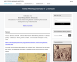
Western Mining History provides a database of metal mining districts in Colorado …
Western Mining History provides a database of metal mining districts in Colorado organized by county. Individual links by county link out to the mining districts in each county. The mining districts summarize boundaries, the geology of the region and the minerals that can be found in each district. This is a good source to identify the minerals prevalent in each county. Western Mining History is an historical site that provides databases, information on mining, mining towns, gold and Photos and maps of the western United States. Consider becoming a member or making a donation to help further the work of the site.
Dinosaur Journey is part of the Mueums of Western Colorado. Learn how …
Dinosaur Journey is part of the Mueums of Western Colorado. Learn how scientists used meteorites to age the solar system. Curator of Paleontology Dr. Julia McHugh shows you meteorites on display at Dinosaur Journey.
The Original Coloradans Social Studies Lesson 2 designed to be used with …
The Original Coloradans Social Studies Lesson 2 designed to be used with The Original Coloradans Artifact Kit. Lessons 1, 2 and 4 can be completed without the artifacts from the kit. These kits are available through Musuems of Western Colorado to D51 Teachers. This lesson can be adapted to use without the kit. Students will be able to: • Describe the potential routes the first people took to arrive in North America • Develop and defend an argument based on facts regarding the first migration into North America • Summarize the origin stories of several groups of Native people.
This Western Mining History database uses Mineral Resources Data System to list …
This Western Mining History database uses Mineral Resources Data System to list known Colorado historical mines by county. Each county site has links to the known mines within its borders. Some are known and named, others are unnamed. Mines should be assumed to be on private property unless other research is conducted. Data provided for each mine site include: Name, State, County, Elevation, Primary Mineral Mined, Latitude and Longitude and a link to Google Maps. Photos are provided where available. Additional information for some Mines are satellite photos, and ownership, business and historical records. Mining History is an historical site that provides information on mining, mining towns, the gold and silver rush, and Photos and maps of the western United States. This is a great database for student historical research or data and statistics classes. Consider becoming a member or making a donation to help further the work of the site.
Mineral Point, CO Mining Town. Western Mining History presents a brief summary …
Mineral Point, CO Mining Town. Western Mining History presents a brief summary of Colorado's Historical Mining Towns with links to additional Colorado resources for a mining town database and mines by county. Western Mining History is an historical site that provides information on mining, mining towns, the gold and silver rush, and Photos and maps of the western United States. This is a strong primary source resource that can be used for a variety of class research projects. Consider becoming a member or making a donation to help further the work of the site.
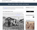
Western Mining History presents a short tour of miner's cabin's from the …
Western Mining History presents a short tour of miner's cabin's from the frontier west during the gold and silver rush. This resource focuses on the resourcefulness of miners to establish shelter. The resources shows Photos of miner's cabins and living conditions. Western Mining History is an historical site that provides databases, information on mining, mining towns, gold and Photos and maps of the western United States. Consider becoming a member or making a donation to help further the work of the site.
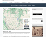
Western Mining History presents a brief summary of Historical Mining Towns in …
Western Mining History presents a brief summary of Historical Mining Towns in the Western United States with links to each states mining towns. The site includes an interative map and video. Western Mining History is an historical site that provides information on mining, mining towns, gold and Photos and maps of the western United States. Consider becoming a member or making a donation to help further the work of the site.
This NASA animation shows the levels of atmospheric carbon dioxide over different …
This NASA animation shows the levels of atmospheric carbon dioxide over different time scales. Viewers can compare the last 400,000 years, last 1000 years, and last 25 years. The data come from the Lake Vostok ice cores (400,000 BC to about 4000 BC), Law Dome ice cores (1010 AD to 1975 AD) and Mauna Loa observations (1980 to 2005).
This activity uses a physical model to facilitate students' understanding of elastic …
This activity uses a physical model to facilitate students' understanding of elastic deformation of rocks and the episodic nature of motion on a fault, which leads to earthquakes and aftershocks.
This Western Mining History database uses Mineral Resources Data System to list …
This Western Mining History database uses Mineral Resources Data System to list known Colorado historical mines by county. Each county site has links to the known mines within its borders. Some are known and named, others are unnamed. Mines should be assumed to be on private property unless other research is conducted. Data provided for each mine site include: Name, State, County, Elevation, Primary Mineral Mined, Latitude and Longitude and a link to Google Maps. Photos are provided where available. Additional information for some Mines are satellite photos, and ownership, business and historical records. Mining History is an historical site that provides information on mining, mining towns, the gold and silver rush, and Photos and maps of the western United States. This is a great database for student historical research or data and statistics classes. Consider becoming a member or making a donation to help further the work of the site.
No restrictions on your remixing, redistributing, or making derivative works. Give credit to the author, as required.
Your remixing, redistributing, or making derivatives works comes with some restrictions, including how it is shared.
Your redistributing comes with some restrictions. Do not remix or make derivative works.
Most restrictive license type. Prohibits most uses, sharing, and any changes.
Copyrighted materials, available under Fair Use and the TEACH Act for US-based educators, or other custom arrangements. Go to the resource provider to see their individual restrictions.