Updating search results...

Search Resources

999 Results

View
Selected filters:
  • Geology
Exploring sea level change in Google Earth
Conditional Remix & Share Permitted
CC BY-NC-SA
Rating
0.0 stars

This is a short activity that uses Google Earth to explore sea-level change as measured by tidal gauges around the world

Subject:
Earth and Space Science
Geology
Oceanography
Physical Geography
Material Type:
Activity/Lab
Provider:
Science Education Resource Center (SERC) at Carleton College
Provider Set:
Teach the Earth
Date Added:
04/12/2023
Exploring the nature of geoscience using cartoon cards
Conditional Remix & Share Permitted
CC BY-NC-SA
Rating
0.0 stars

In this activity, students work in groups to put a set of cartoon cards in order, much in the way that we might assemble a geologic history. The primary goal of the activity is to explore the nature of science in general and the nature of geoscience or historical science specifically, without requiring any content knowledge.

(Note: this resource was added to OER Commons as part of a batch upload of over 2,200 records. If you notice an issue with the quality of the metadata, please let us know by using the 'report' button and we will flag it for consideration.)

Subject:
Biology
Earth and Space Science
Geology
Life Science
Material Type:
Activity/Lab
Provider:
Science Education Resource Center (SERC) at Carleton College
Provider Set:
Teach the Earth
Date Added:
08/17/2021
Exploring topographic steady-state in Taiwan
Conditional Remix & Share Permitted
CC BY-NC-SA
Rating
0.0 stars

This activity is designed as both an introduction to GIS and an exploration of topographic steady-state. Students analyze DEMs from Taiwan to extract topographic profiles across the range. They reconstruct a series of datasets presented in Stolar et al., (2007), showing the progression of the range to steady-state as a space-for-time substitution from south to north. Students are expected to relate their observations from the topography to theoretical concepts discussed in class including accretion and uplift, steady-state, and critical wedge theory.

An extension involves developing a simple numerical model in Excel of a mountain range as it progresses to topographic steady-state landscape, allowing students to investigate the rise of a mountain range to steady-state both from Taiwan data and from their numerical model.

Subject:
Computer Science
Computer, Networking and Telecommunications Systems
Earth and Space Science
Geology
Physical Geography
Material Type:
Activity/Lab
Provider:
Science Education Resource Center (SERC) at Carleton College
Provider Set:
Teach the Earth
Date Added:
04/11/2023
Extra Terrestrial Plate Tectonics
Conditional Remix & Share Permitted
CC BY-NC-SA
Rating
0.0 stars

students are engaged in reflecting on whether plate tectonics is a general theory of planetary organization and evolution. Students use topographic, magnetic, spectral, and other data from NASA and ESA missions to determine whether "Earth-style" plate tectonics is functional on planets and moons elsewhere in the solar system. Students are engaged in a data-rich environment from which they must formulate and test multiple hypotheses. Throughout the process, students are engaged in small groups to identify what they need to learn to answer their questions, what resources are available to them, how best to report their findings, and how they can assess the amount of learning that is taking place.

Subject:
Earth and Space Science
Geology
Physical Geography
Material Type:
Activity/Lab
Provider:
Science Education Resource Center (SERC) at Carleton College
Provider Set:
Teach the Earth
Date Added:
04/12/2023
Faint Young Sun, Radiocarbon dating
Conditional Remix & Share Permitted
CC BY-NC-SA
Rating
0.0 stars

The first problem in this assignment is the culmination of the unit on energy balance and greenhouse gases. The students have already calculated blackbody temperatures as a function of albedo, sun's luminosity and distance from sun. They have also already calculated the magnitude of the greenhouse effect (optical thickness) of the modern atmosphere. In this first problem, the students apply these same calculations to the Faint Young Sun hypothesis and infer what can account for the geological evidence for liquid water on earth since 4.3 Ga. The second problem follows an introductory lecture on radiometric decay and radiometric dating. The students have seen the decay equation and learned what are decay constants and stable versus radioactive isotopes. In this problem, the students apply these concepts to radiocarbon.

(Note: this resource was added to OER Commons as part of a batch upload of over 2,200 records. If you notice an issue with the quality of the metadata, please let us know by using the 'report' button and we will flag it for consideration.)

Subject:
Biology
Earth and Space Science
Geology
Life Science
Material Type:
Activity/Lab
Provider:
Science Education Resource Center (SERC) at Carleton College
Provider Set:
Teach the Earth
Date Added:
08/04/2022
Fairplay, CO Mining Town
Read the Fine Print
Educational Use
Rating
0.0 stars

Fairplay, CO Mining Town. Western Mining History presents a brief summary of Colorado's Historical Mining Towns with links to additional Colorado resources for a mining town database and mines by county. Western Mining History is an historical site that provides information on mining, mining towns, the gold and silver rush, and Photos and maps of the western United States. This is a strong primary source resource that can be used for a variety of class research projects. Consider becoming a member or making a donation to help further the work of the site.

Subject:
Anthropology
Applied Science
Chemistry
Cultural Geography
Earth and Space Science
Economics
English Language Arts
Environmental Science
Geology
Geoscience
History
Physical Geography
Physical Science
Reading Informational Text
Social Science
Sociology
U.S. History
Material Type:
Data Set
Primary Source
Reading
Provider:
Western Mining History
Provider Set:
Colorado Mining Towns
Date Added:
02/06/2023
Famous Fossil Sites
Read the Fine Print
Educational Use
Rating
0.0 stars

Short history of fossils and dig locations of the Morrison Formation in Western Colorado with text, photos, timelines and diagrams.

Subject:
Anatomy/Physiology
Earth and Space Science
Geology
Geoscience
History
Life Science
Physical Geography
U.S. History
Material Type:
Primary Source
Reading
Provider:
Museums of Western Colorado
Provider Set:
Dinosaur Journey
Date Added:
02/06/2023
Faulty Movement
Read the Fine Print
Educational Use
Rating
0.0 stars

In this activity, students are introduced to faults. They will learn about different kinds of faults and understand their relationship to earthquakes. The students will build cardboard models of the three different types of faults as they learn about how earthquakes are formed.

Subject:
Applied Science
Earth and Space Science
Engineering
Geology
Material Type:
Activity/Lab
Provider:
TeachEngineering
Provider Set:
TeachEngineering
Date Added:
10/14/2015
The Fidelity of the Fossil Record: Using Preservational Characteristics of Fossils within an Assemblage to Interpret the Relative State of Spatial and Temporal Fidelity
Conditional Remix & Share Permitted
CC BY-NC-SA
Rating
0.0 stars

This exercise introduces students to the concept of temporal and spatial fidelity, to the different types of fossil assemblages, and how the taphonomic characteristics of an assemblage can be used to assess the relative state of fidelity. The exercise is suitable when introducing the discipline of taphonomy, typically covered near the beginning of a course in paleontology or paleobiology.

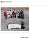
Because most universities lack appropriate collections of fossils, particularly collections from assemblages with unusual states of preservation, this exercise provides digital images of fossils from a Middle Devonian obrution deposit (or smothered assemblage) found within thin bedded limestones of the Hamilton Group of western New York State.

Students are asked to make predictions concerning the relative states of preservation likely to be found in life assemblages (biocoenoses) and death assemblages (thanatocoenoses and taphocoenoses). A biocoenosis is an assemblage that contains virtually all of the species that existed when the community was alive. A thanatocoenosis is a death assemblage where all the fossils represented existed within the community, but not all community members are present as fossils (species are missing). Finally, a taphocoenosis is an assemblage where not all species present in the community are represented as fossils, and not all the fossil species within the assemblage lived in the community (i.e., there is temporal or spatial mixing). Students are then presented with a PowerPoint presentation of the Hamilton Group strata, the limestones possessing the unusual fossil assemblage, and finally images of fossils with their preservational characteristics highlighted. The slides are annotated to provide observational descriptions and not interpretations. The exercise works best with students working in small groups with each group supplied with a laptop containing the PowerPoint presentation. Finally, each group is asked to interpret the assemblage type represented (bio-, thanato-, or taphocoenosis) and present a cogent argument citing supportive preservational evidence. (Because the assemblage is created through obrution, the assemblage is correctly interpreted as a thanatocoenosis �� the fossils present were found within the community with many individuals preserved in life position and with behaviors represented; not all species in the community, however, are preserved as fossils.)

If time allows, students could be asked to make predictions concerning the preservational characteristics expected for each assemblage type in advance of the exercise. (A table is attached that I use to help frame their predictions.) Their interpretation and evidential argument could be written up as a short essay. I've asked students to do this individually and other times as a collaborative writing assignment for the group.

Once the correct assemblage interpretation is revealed to the students, they could be asked to speculate about the mechanism leading to this style of preservation (i.e., recognizing it as an obrution deposit). A few figures are provided that are helpful in explaining obrution.

The following files are uploaded as supportive teaching materials:
1. Discussion Assemblage Types.doc: Notes to guide a discussion to acquire predictions for taphonomic characteristics for each assemblage type.
2. Fossil Assemblages Exercise.ppt: PowerPoint presentation that describes the unknown fossil assemblage.
3. Exercise Assemblage Fidelity Assignment.doc: The handout provided students describing the exercise.
4. Obrution Deposits.ppt: PowerPoint presentation explaining obrution deposits.

Subject:
Archaeology
Earth and Space Science
Geology
Social Science
Material Type:
Activity/Lab
Homework/Assignment
Provider:
Science Education Resource Center (SERC) at Carleton College
Provider Set:
Teach the Earth
Date Added:
04/12/2023
Field Activity:  Exploring Glaciers, Ancient Seas, and Volcanism
Conditional Remix & Share Permitted
CC BY-NC-SA
Rating
0.0 stars

In a field investigation to Interstate State Park, students determine lava flow boundaries and observe an ancient rift valley. They also examine differential erosion rates that create a waterfall, and examine the local basalts for evidence of glaciation, including the world-famous potholes.

Subject:
Earth and Space Science
Geology
Material Type:
Activity/Lab
Provider:
Science Education Resource Center (SERC) at Carleton College
Provider Set:
Pedagogy in Action
Date Added:
04/12/2023
Field Guide to the Dutchess County, NY, Barrovian Sequence
Conditional Remix & Share Permitted
CC BY-NC-SA
Rating
0.0 stars

This is a field guide with road log to the classic Barrovian sequence in Dutchess County, New York. The field trip starts near Poughkeepsie, NY, and ends near the Connecticut border. The guide will lead you to key outcrops starting at the protolith, with one stop each in the chlorite, biotite, garnet, lower staurolite, upper staurolite, kyanite, sillimanite, and silimanite-kspar zones in the regionally metamorphosed pelitic sequence. Files include the road log with stop locations and descriptions, a regional map, and Google Earth .kmz file.

(Note: this resource was added to OER Commons as part of a batch upload of over 2,200 records. If you notice an issue with the quality of the metadata, please let us know by using the 'report' button and we will flag it for consideration.)

Subject:
Biology
Earth and Space Science
Geology
Life Science
Material Type:
Activity/Lab
Provider:
Science Education Resource Center (SERC) at Carleton College
Provider Set:
Teach the Earth
Date Added:
03/03/2022
Field Museum Assignment
Conditional Remix & Share Permitted
CC BY-NC-SA
Rating
0.0 stars

The assignments consists of three essay questions, of which the students were required to complete two of their choice. During a trip to the Field Museum, Chicago, the students were required to use the museum exhibits to explore the questions posed in the assignment. The main goal was to familiarize the students with using museums as a resource, as well as use observation-based techniques of specimens to answer scientific questions.

Subject:
Biology
Earth and Space Science
Geology
Life Science
Physical Geography
Material Type:
Activity/Lab
Provider:
Science Education Resource Center (SERC) at Carleton College
Provider Set:
Teach the Earth
Date Added:
04/12/2023
Field Notes
Conditional Remix & Share Permitted
CC BY-NC-SA
Rating
0.0 stars

Field Notes provides instructors with helpful tips for a successful field trip. The tips include a well-developed literature review for designing and assessing field trips.

(Note: this resource was added to OER Commons as part of a batch upload of over 2,200 records. If you notice an issue with the quality of the metadata, please let us know by using the 'report' button and we will flag it for consideration.)

Subject:
Biology
Earth and Space Science
Geology
Life Science
Material Type:
Activity/Lab
Provider:
Science Education Resource Center (SERC) at Carleton College
Provider Set:
Teach the Earth
Date Added:
08/09/2019
Field Trip Comics
Conditional Remix & Share Permitted
CC BY-NC-SA
Rating
0.0 stars

This project is based on either a class field trip, or an assigned topic in structural geology. In either case, the students are responsible for representing their experiences in the form of a comic or graphic novel. The experience is therefore largely visual, but it gives students an opportunity to translate their thoughts into a non-traditional medium.

(Note: this resource was added to OER Commons as part of a batch upload of over 2,200 records. If you notice an issue with the quality of the metadata, please let us know by using the 'report' button and we will flag it for consideration.)

Subject:
Biology
Earth and Space Science
Geology
Life Science
Material Type:
Activity/Lab
Provider:
Science Education Resource Center (SERC) at Carleton College
Provider Set:
Teach the Earth
Date Added:
08/23/2019
The Floating Lithosphere - Cross Section of North America
Conditional Remix & Share Permitted
CC BY-NC-SA
Rating
0.0 stars

In this module, students calculate the pressure at the depth of compensation along a cross section of North America.

(Note: this resource was added to OER Commons as part of a batch upload of over 2,200 records. If you notice an issue with the quality of the metadata, please let us know by using the 'report' button and we will flag it for consideration.)

Subject:
Biology
Earth and Space Science
Geology
Life Science
Mathematics
Measurement and Data
Statistics and Probability
Material Type:
Activity/Lab
Provider:
Science Education Resource Center (SERC) at Carleton College
Provider Set:
Teach the Earth
Date Added:
09/05/2019
Flood Frequency Analysis
Conditional Remix & Share Permitted
CC BY-NC-SA
Rating
0.0 stars

This assignment asks students to do a flood frequency analysis to determine the size and stage of various floods and determine if the town of Crawford, OH is likely to be flooded or not. Outcomes: learn to work with quantitative data, learn to use Excel, be able to use USGS data.

(Note: this resource was added to OER Commons as part of a batch upload of over 2,200 records. If you notice an issue with the quality of the metadata, please let us know by using the 'report' button and we will flag it for consideration.)

Subject:
Agriculture and Natural Resources
Biology
Earth and Space Science
Environmental Studies
Geology
Life Science
Mathematics
Measurement and Data
Statistics and Probability
Material Type:
Activity/Lab
Provider:
Science Education Resource Center (SERC) at Carleton College
Provider Set:
Teach the Earth
Date Added:
08/16/2019
Flood Recurrence Intervals
Conditional Remix & Share Permitted
CC BY-NC-SA
Rating
0.0 stars

This lab activity has students use stream discharge data obtained from the USGS Water Resources Division web site in order to calculate recurrence intervals for a local stream. Using the recurrence data generated, the students then make recommendations to the residents of a local town as to what they might do to reduce their loss from the effects of frequent flooding in their community.

(Note: this resource was added to OER Commons as part of a batch upload of over 2,200 records. If you notice an issue with the quality of the metadata, please let us know by using the 'report' button and we will flag it for consideration.)

Subject:
Agriculture and Natural Resources
Biology
Earth and Space Science
Environmental Studies
Geology
Life Science
Mathematics
Measurement and Data
Statistics and Probability
Material Type:
Activity/Lab
Provider:
Science Education Resource Center (SERC) at Carleton College
Provider Set:
Teach the Earth
Date Added:
08/19/2019
Fluvial Transport of Bones Lab Exercise
Conditional Remix & Share Permitted
CC BY-NC-SA
Rating
0.0 stars

The lab starts with a short lecture on the scientific method, after which students observe the results of a flume run that includes skeletal clasts. They form hypotheses about how bone clasts (or any clast for that matter) move and are deposited by a flow, then the students test their hypotheses by running a flume trial. The hypothesis tests take place in small groups (3-5 students), and the lab ends with homework where students use the information they learned from their hypothesis tests to interpret a fossil assemblage. As such, this is a wonderful activity for introductory geology classes, could be used effectively with minor adjustments for advanced paleontology, taphonomy, and forensic physical anthropology classes.

Subject:
Earth and Space Science
Geology
Hydrology
Material Type:
Activity/Lab
Provider:
Science Education Resource Center (SERC) at Carleton College
Provider Set:
Teach the Earth
Date Added:
04/12/2023
Fluvial and Alluvial Sedimentology Incorporating Google Earth
Conditional Remix & Share Permitted
CC BY-NC-SA
Rating
0.0 stars

Students should download Google Earth and the kmz file prior to class if using personal computers, otherwise both should be downloaded on class computers. In class time is one lab period, with some out of class time; ~6 hrs total.

(Note: this resource was added to OER Commons as part of a batch upload of over 2,200 records. If you notice an issue with the quality of the metadata, please let us know by using the 'report' button and we will flag it for consideration.)

Subject:
Biology
Earth and Space Science
Geology
Life Science
Material Type:
Activity/Lab
Diagram/Illustration
Interactive
Provider:
Science Education Resource Center (SERC) at Carleton College
Provider Set:
Teach the Earth
Date Added:
09/16/2020
Following the Carbon Cycle
Read the Fine Print
Educational Use
Rating
0.0 stars

This interactive follows carbon as it moves through various components of the carbon cycle.

Subject:
Agriculture and Natural Resources
Biology
Chemistry
Earth and Space Science
Environmental Studies
Geology
Life Science
Physical Science
Material Type:
Reading
Simulation
Provider:
CLEAN: Climate Literacy and Energy Awareness Network
Provider Set:
CLEAN: Climate Literacy and Energy Awareness Network
Author:
Jack Cook
Woods Hole Oceanographic Institution
Date Added:
05/15/2012