El módulo de Calidad del Aire de Alta Aventura Científica contiene cinco …
El módulo de Calidad del Aire de Alta Aventura Científica contiene cinco actividades. En este módulo se explora la pregunta: ¿Estará el aire lo suficientemente limpio como para respirarlo? Serán guiados a través del análisis de modelos y datos del mundo real a medida que exploran las interacciones de los factores que afectan la calidad del aire de una región. Al finalizar el módulo serán capaces de predecir el efecto del desarrollo humano sobre la calidad del aire de una región.
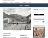
Eureka, CO Mining Town. Western Mining History presents a brief summary of …
Eureka, CO Mining Town. Western Mining History presents a brief summary of Colorado's Historical Mining Towns with links to additional Colorado resources for a mining town database and mines by county. Western Mining History is an historical site that provides information on mining, mining towns, the gold and silver rush, and Photos and maps of the western United States. This is a strong primary source resource that can be used for a variety of class research projects. Consider becoming a member or making a donation to help further the work of the site.
This activity leads to understanding common landslide hazards in the area and …
This activity leads to understanding common landslide hazards in the area and how they relate to weather patterns and/or local geology.
(Note: this resource was added to OER Commons as part of a batch upload of over 2,200 records. If you notice an issue with the quality of the metadata, please let us know by using the 'report' button and we will flag it for consideration.)
An in-class jigsaw activity, in which students play the role of investigators …
An in-class jigsaw activity, in which students play the role of investigators consulting on behalf of an industrial client seeking an appropriate location to site a new facility to handle environmentally-damaging materials, allows students to interactively tie together key aspects of decision-making (e.g. hazardous Earth processes, prevention/mitigation strategies, sustainability, and the incorporation of multiple types of data to solve complex problems). This activity was designed to be completed within one ~75 minute class meeting, although aspects of this activity can easily be modified to accommodate shorter class periods. In small groups, students examine one of five possible proposed sites for the facility, evaluating it based on its described geologic, economic, and/or social criteria. Students are then scrambled into new, larger groups, in which representatives of all five proposed sites report their findings, and then the sites are collectively ranked in order of preference. Rankings between the larger groups are compared and discussed as a class, including topics such as a comparison of criteria and overall rankings, descriptions of most beneficial and most needed data, and comparison of the activity to "real-life" scenarios.
Students use a series of maps and natural hazard data to evaluate …
Students use a series of maps and natural hazard data to evaluate the risk to a building structure of their choice in the state of California. For each hazard, students rate the potential risk in two dimensions: (1) Probability - probability that a hazardous event "may" occur, and (2) Severity of Impact - the size of the impact in terms of cost and impact on human health.
(Note: this resource was added to OER Commons as part of a batch upload of over 2,200 records. If you notice an issue with the quality of the metadata, please let us know by using the 'report' button and we will flag it for consideration.)
In this in-class exercise, students compare several lines of evidence that support …
In this in-class exercise, students compare several lines of evidence that support the ideas of continental drift and plate tectonics. Before the class meeting, each student is given a preparation assignment in which he/she studies one "continental drift" and one "ocean floor data" map. In class, students divide into teams of 3, with each team member having prepared different specialties. They discuss their respective maps and look for spatial patterns among the data.
(Note: this resource was added to OER Commons as part of a batch upload of over 2,200 records. If you notice an issue with the quality of the metadata, please let us know by using the 'report' button and we will flag it for consideration.)
This activity is designed for large freshman courses (>200 students) and is …
This activity is designed for large freshman courses (>200 students) and is used in-class. The activity requires a short (15 minute) overview of Earth history before students have the opportunity to work through various questions and problems. Tasks include simple math problems, critical thinking questions, and include place-based examples of geological situations for Arizona and California.
Students completing the activity will have knowledge of Earth history, knowledge of some geological disasters, and will have learned several different perspectives of timescales that affect various events on Earth.
(Note: this resource was added to OER Commons as part of a batch upload of over 2,200 records. If you notice an issue with the quality of the metadata, please let us know by using the 'report' button and we will flag it for consideration.)
In this inquiry based geologic field lab students will be estimating and …
In this inquiry based geologic field lab students will be estimating and measuring stream flow. Students will also map out a full scale live topography map of a dry streambed to help them estimate flow discharge. Students will use their journals to record their hypothesis, lab report questions, graphed data and evidence to backs up their observations.
The classic physical optics textbook approach to double-refraction starts from Huyghens constructions …
The classic physical optics textbook approach to double-refraction starts from Huyghens constructions of wave fronts and from the optical indicatrix. Optical indicatrices are useful for a systematic description of optical properties in crystals, but students do not usually consider them an easy subject, and, therefore, shy away from optical crystallography. This is unfortunate since a basic understanding of optical crystallography is prerequisite to a correct interpretation of phenomena observed with the polarizing microscope, the most commonly used tool for the detailed study of rocks. Generally, students are comfortable with simple optical terms like reflection and refraction, while it is uncommon that they actually have seen double-refraction and noticed that crystals polarize light. Many have an unnecessarily complicated idea about vibration directions, interference colors, and interference figures; they assume such phenomena always require a microscope to observe. This is not so. Students well trained in thin section microscopy are often surprised that interference figures can be made visible macroscopically. The purpose of the experiments below is to impart an intuitive understanding of the interaction between light and crystals and, thus, of optical crystallography. This will help to demystify what is seen in the polarizing microscope, and will better prepare the student for the introduction of optical indicatrices as 3-D models to describe the directional dependence of light velocities, and thus refractive indices in anisotropic crystals.
(Note: this resource was added to OER Commons as part of a batch upload of over 2,200 records. If you notice an issue with the quality of the metadata, please let us know by using the 'report' button and we will flag it for consideration.)
In this activity, students experiment with the effects of Reynolds numbers (viscosity), …
In this activity, students experiment with the effects of Reynolds numbers (viscosity), particle shape, and particle concentration (flocculation) on settling velocity.
Each student will load a database file into ArcGIS software during the …
Each student will load a database file into ArcGIS software during the class period. Following the written instructions, each student will work through various steps necessary to analyze the earthquake hazards. Uses online and/or real-time data Addresses student fear of quantitative aspect and/or inadequate quantitative skills
(Note: this resource was added to OER Commons as part of a batch upload of over 2,200 records. If you notice an issue with the quality of the metadata, please let us know by using the 'report' button and we will flag it for consideration.)
Average inquiry level: Structured This groundwater lab is designed for online, asynchronous …
Average inquiry level: Structured This groundwater lab is designed for online, asynchronous instruction and uses Google slides (or Powerpoint) so student can use the draw features. Within this lab, students will:
Evaluate and conclude the seasonal and annual trends of the water table from data monitored groundwater wells; Predict and assess the permeability and porosity of different substrates and rocks;�� Create a contour map and cross-section of the water table given data from multiple wells and draw the flow direction of water; Predict and communicate the changes of the water table that could occur in response to different water-related scenarios; Determine solutions for an area experiencing groundwater problems.
(Note: this resource was added to OER Commons as part of a batch upload of over 2,200 records. If you notice an issue with the quality of the metadata, please let us know by using the 'report' button and we will flag it for consideration.)
This exercise uses empirical data and Google Earth to explore the surficial …
This exercise uses empirical data and Google Earth to explore the surficial distribution of marine sediments in the modern ocean. Over 2500 sites are plotted with access to original data. We recommend first completing the Primer on Google Earth to become familiar with tools in Google Earth that are used in this exercise. The Exploring Marine Sediments in Google Earth exercise has four parts:
- Stories from the Sea Floor: A Lesson on How Science Works - A First Look at Marine Sediments - Exploring the Distribution of Marine Sediment Types on the Sea Floor - Refining Your Hypotheses on Biogenic Marine Sediment Distributions
Each page of this activity has a CODAP doc for recording data …
Each page of this activity has a CODAP doc for recording data from sensors. This can be used for ad hoc experimentation or just messing around with sensors to learn how to use them. If not using sensors, the sensor interactive can be minimized and moved out of the way.
An introduction to processes associated with continental rifting, and resulting fault geometries …
An introduction to processes associated with continental rifting, and resulting fault geometries and distributions, and lithospheric responses, using seismic data examples from the Gulf of California.
This activity is a field investigation where students make observations of the …
This activity is a field investigation where students make observations of the pebble beach, lava flows, and wetland restoration at Sugarloaf Cove to generate questions to be addressed throughout the earth science curriculum.
This laboratory exercise explores the topographic signature of fluvial and glacial landscapes …
This laboratory exercise explores the topographic signature of fluvial and glacial landscapes in different tectonic environments. Students develop a list of mountain ranges around the world to explore, then extract topographic data from 90-meter SRTM DEMs, and develop a series of hypsometric curves for each range. Each student works on a single range, but as a class we build up a database of 10-15 ranges around the world. The hypsometric curves are compared with each other and with published curves to look for signals of fluvial incision vs. glacial erosion in the landscapes.
No restrictions on your remixing, redistributing, or making derivative works. Give credit to the author, as required.
Your remixing, redistributing, or making derivatives works comes with some restrictions, including how it is shared.
Your redistributing comes with some restrictions. Do not remix or make derivative works.
Most restrictive license type. Prohibits most uses, sharing, and any changes.
Copyrighted materials, available under Fair Use and the TEACH Act for US-based educators, or other custom arrangements. Go to the resource provider to see their individual restrictions.