Updating search results...

Search Resources

999 Results

View
Selected filters:
  • Geology
Earthquakes Living Lab: Geology and the 1906 San Francisco Earthquake
Read the Fine Print
Educational Use
Rating
0.0 stars

Students examine the effects of geology on earthquake magnitudes and how engineers anticipate and prepare for these effects. Using information provided through the Earthquakes Living Lab interface, students investigate how geology, specifically soil type, can amplify the magnitude of earthquakes and their consequences. Students look in-depth at the historical 1906 San Francisco earthquake and its destruction thorough photographs and data. They compare the 1906 California earthquake to another historical earthquake in Kobe, Japan, looking at the geological differences and impacts in the two regions, and learning how engineers, geologists and seismologists work to predict earthquakes and minimize calamity. A worksheet serves as a student guide for the activity.

Subject:
Applied Science
Earth and Space Science
Engineering
Geology
Material Type:
Activity/Lab
Provider:
TeachEngineering
Provider Set:
TeachEngineering
Date Added:
09/18/2014
Earthquakes Living Lab: Locating Earthquakes
Read the Fine Print
Educational Use
Rating
0.0 stars

Students use U.S. Geological Survey (USGS) real-time, real-world seismic data from around the planet to identify where earthquakes occur and look for trends in earthquake activity. They explore where and why earthquakes occur, learning about faults and how they influence earthquakes. Looking at the interactive maps and the data, students use Microsoft® Excel® to conduct detailed analysis of the most-recent 25 earthquakes; they calculate mean, median, mode of the data set, as well as identify the minimum and maximum magnitudes. Students compare their predictions with the physical data, and look for trends to and patterns in the data. A worksheet serves as a student guide for the activity.

Subject:
Earth and Space Science
Geology
Material Type:
Activity/Lab
Provider:
TeachEngineering
Provider Set:
TeachEngineering
Date Added:
04/12/2023
Earthquakes Living Lab: The Theory of Plate Tectonics
Read the Fine Print
Educational Use
Rating
0.0 stars

Students gather evidence to explain the theory of plate tectonics. Using the online resources at the Earthquakes Living Lab, students examine information and gather evidence supporting the theory. They also look at how volcanoes and earthquakes are explained by tectonic plate movement, and how engineers use this information. Working in pairs, students think like engineers and connect what they understand about the theory of plate tectonics to the design of structures for earthquake-resistance. A worksheet serves as a student guide for the activity.

Subject:
Applied Science
Earth and Space Science
Engineering
Geology
Material Type:
Activity/Lab
Provider:
TeachEngineering
Provider Set:
TeachEngineering
Date Added:
09/18/2014
Earthquakes Rock!
Read the Fine Print
Educational Use
Rating
0.0 stars

Students learn the two main methods to measure earthquakes, the Richter Scale and the Mercalli Scale. They make a model of a seismograph a measuring device that records an earthquake on a seismogram. Students also investigate which structural designs are most likely to survive an earthquake. And, they illustrate an informational guide to the Mercalli Scale.

Subject:
Applied Science
Earth and Space Science
Engineering
Geology
Material Type:
Activity/Lab
Lesson Plan
Provider:
TeachEngineering
Provider Set:
TeachEngineering
Date Added:
09/18/2014
Earthquakes: San Francisco
Read the Fine Print
Educational Use
Rating
0.0 stars

The history of earthquakes in the San Francisco Bay area is plotted on a digital map and analyzed in this video segment adapted from NOVA.

Subject:
Astronomy
Chemistry
Earth and Space Science
Education
Geology
Physical Science
Physics
Material Type:
Activity/Lab
Diagram/Illustration
Provider:
PBS LearningMedia
Provider Set:
PBS Learning Media: Multimedia Resources for the Classroom and Professional Development
Date Added:
12/17/2005
Earth's Interior CogSketch geoscience worksheet
Conditional Remix & Share Permitted
CC BY-NC-SA
Rating
0.0 stars

The Earth's Interior worksheet involves the layers of the Earth and is meant to help students: 1) Draw the layers of the Earth true-to-scale (on an image with a scale bar), and 2) Grasp the size of the Earth by starting at a somewhat familiar scale (the upper 40km of the crust) and progressively adding layers and increasing the scale to the radius of the Earth (~6,400km). Moving from the familiar to the unfamiliar has been shown to be an effective strategy to understand large magnitudes (Resnick, Shipley, Newcombe, Massey, & Wills, 2012).

Starting at the surface, the student adds layers of the earth as the scale increases (40km, 400km, 700km, 3,000km, and 6,400km). The layers include the base of continental crust, upper mantle, transition zone, lower mantle, and the outer core, as well as drawing the height of a building at the surface to help gain perspective as the scale changes. Students also complete 3 multiple choice questions at the end of the worksheet to solidify and focus on goals and important concepts.

This worksheet uses the sketch-understanding program with built-in tutor: CogSketch. Therefore, students, instructors, and/or institution computer labs need to download the program from the CogSketch website: http://www.qrg.northwestern.edu/software/cogsketch/. At any point during the worksheet, students can click the FEEDBACK button and their sketch is compared to the solution sketch. The built-in tutor identifies any discrepancies and reports pre-written feedback to help the student correct their sketch until they are done with the activity. Once worksheets are emailed to the instructor, worksheets can be batch graded and easily evaluated. This program allows instructors to assign sketching activities that require very little time commitment. Instead, the built-in tutor provides feedback whenever the student requests, without the presence of the instructor. More information on using the program and the activity is in the Instructor's Notes.

We have developed approximately two dozen introductory geoscience worksheets using this program. Each worksheet has a background image and instructions for a sketching task. You can find additional worksheets by searching for "CogSketch" using the search box at the top of this page. We expect to have uploaded all of them by the end of the summer of 2016.

(Note: this resource was added to OER Commons as part of a batch upload of over 2,200 records. If you notice an issue with the quality of the metadata, please let us know by using the 'report' button and we will flag it for consideration.)

Subject:
Biology
Earth and Space Science
Geology
Life Science
Material Type:
Activity/Lab
Provider:
Science Education Resource Center (SERC) at Carleton College
Provider Set:
Teach the Earth
Date Added:
04/23/2020
The Earth's Layers Lesson #1
Unrestricted Use
Public Domain
Rating
0.0 stars

This lesson teaches the students about the different layers of the Earth and how they work together. Students will be able to: Name and label the four layers of the Earth; Identify the main minerals that make up each layer; Explain how scientists formulated the idea that the Earth is comprised of four layers.

Subject:
Earth and Space Science
Geology
Material Type:
Lesson Plan
Provider:
NASA
Date Added:
09/20/2000
El Paso County Mines
Read the Fine Print
Educational Use
Rating
0.0 stars

This Western Mining History database uses Mineral Resources Data System to list known Colorado historical mines by county. Each county site has links to the known mines within its borders. Some are known and named, others are unnamed. Mines should be assumed to be on private property unless other research is conducted. Data provided for each mine site include: Name, State, County, Elevation, Primary Mineral Mined, Latitude and Longitude and a link to Google Maps. Photos are provided where available. Additional information for some Mines are satellite photos, and ownership, business and historical records. Mining History is an historical site that provides information on mining, mining towns, the gold and silver rush, and Photos and maps of the western United States. This is a great database for student historical research or data and statistics classes. Consider becoming a member or making a donation to help further the work of the site.

Subject:
Anthropology
Applied Science
Chemistry
Cultural Geography
Earth and Space Science
Economics
English Language Arts
Environmental Science
Geology
Geoscience
History
Mathematics
Measurement and Data
Physical Geography
Physical Science
Reading Informational Text
Social Science
Sociology
U.S. History
Material Type:
Data Set
Primary Source
Reading
Provider:
Western Mining History
Provider Set:
Historical Colorado Mines
Date Added:
02/06/2023
Elbert County Mines
Read the Fine Print
Educational Use
Rating
0.0 stars

This Western Mining History database uses Mineral Resources Data System to list known Colorado historical mines by county. Each county site has links to the known mines within its borders. Some are known and named, others are unnamed. Mines should be assumed to be on private property unless other research is conducted. Data provided for each mine site include: Name, State, County, Elevation, Primary Mineral Mined, Latitude and Longitude and a link to Google Maps. Photos are provided where available. Additional information for some Mines are satellite photos, and ownership, business and historical records. Mining History is an historical site that provides information on mining, mining towns, the gold and silver rush, and Photos and maps of the western United States. This is a great database for student historical research or data and statistics classes. Consider becoming a member or making a donation to help further the work of the site.

Subject:
Anthropology
Applied Science
Chemistry
Cultural Geography
Earth and Space Science
Economics
English Language Arts
Environmental Science
Geology
Geoscience
History
Mathematics
Measurement and Data
Physical Geography
Physical Science
Reading Informational Text
Social Science
Sociology
U.S. History
Material Type:
Data Set
Primary Source
Reading
Provider:
Western Mining History
Provider Set:
Historical Colorado Mines
Date Added:
02/06/2023
Eldora, CO Mining Town
Read the Fine Print
Educational Use
Rating
0.0 stars

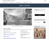
Eldora, CO Mining Town. Western Mining History presents a brief summary of Colorado's Historical Mining Towns with links to additional Colorado resources for a mining town database and mines by county. Western Mining History is an historical site that provides information on mining, mining towns, the gold and silver rush, and Photos and maps of the western United States. This is a strong primary source resource that can be used for a variety of class research projects. Consider becoming a member or making a donation to help further the work of the site.

Subject:
Anthropology
Applied Science
Chemistry
Cultural Geography
Earth and Space Science
Economics
English Language Arts
Environmental Science
Geology
Geoscience
History
Physical Geography
Physical Science
Reading Informational Text
Social Science
Sociology
U.S. History
Material Type:
Data Set
Primary Source
Reading
Provider:
Western Mining History
Provider Set:
Colorado Mining Towns
Date Added:
02/06/2023
The Electric and Magnetic Personalities of Mr. Maxwell
Read the Fine Print
Educational Use
Rating
0.0 stars

Students are briefly introduced to Maxwell's equations and their significance to phenomena associated with electricity and magnetism. Basic concepts such as current, electricity and field lines are covered and reinforced. Through multiple topics and activities, students see how electricity and magnetism are interrelated.

Subject:
Applied Science
Earth and Space Science
Engineering
Geology
Material Type:
Lesson Plan
Provider:
TeachEngineering
Provider Set:
TeachEngineering
Date Added:
09/18/2014
Elkton, CO Mining Town
Read the Fine Print
Educational Use
Rating
0.0 stars

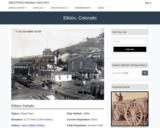
Elkton, CO Mining Town. Western Mining History presents a brief summary of Colorado's Historical Mining Towns with links to additional Colorado resources for a mining town database and mines by county. Western Mining History is an historical site that provides information on mining, mining towns, the gold and silver rush, and Photos and maps of the western United States. This is a strong primary source resource that can be used for a variety of class research projects. Consider becoming a member or making a donation to help further the work of the site.

Subject:
Anthropology
Applied Science
Chemistry
Cultural Geography
Earth and Space Science
Economics
English Language Arts
Environmental Science
Geology
Geoscience
History
Physical Geography
Physical Science
Reading Informational Text
Social Science
Sociology
U.S. History
Material Type:
Data Set
Primary Source
Reading
Provider:
Western Mining History
Provider Set:
Colorado Mining Towns
Date Added:
02/06/2023
Emergent Models in Google Earth
Conditional Remix & Share Permitted
CC BY-NC-SA
Rating
0.0 stars

Working in groups, students learn to navigate a virtual globe, read geophysical data, and assess plate tectonic models. They prepare by studying about plate tectonics from their notes or from the text, and then apply that knowledge to real tectonic settings on the virtual globe. Students drag 3D models out of the subsurface and compare real data to model interpretations. They can also substitute their own sketches for our images.

(Note: this resource was added to OER Commons as part of a batch upload of over 2,200 records. If you notice an issue with the quality of the metadata, please let us know by using the 'report' button and we will flag it for consideration.)
Subject:
Biology
Earth and Space Science
Geology
Life Science
Material Type:
Activity/Lab
Provider:
Science Education Resource Center (SERC) at Carleton College
Provider Set:
Teach the Earth
Date Added:
09/14/2020
Empire, CO Mining Town
Read the Fine Print
Educational Use
Rating
0.0 stars

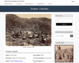
Empire, CO Mining Town. Western Mining History presents a brief summary of Colorado's Historical Mining Towns with links to additional Colorado resources for a mining town database and mines by county. Western Mining History is an historical site that provides information on mining, mining towns, the gold and silver rush, and Photos and maps of the western United States. This is a strong primary source resource that can be used for a variety of class research projects. Consider becoming a member or making a donation to help further the work of the site.

Subject:
Anthropology
Applied Science
Chemistry
Cultural Geography
Earth and Space Science
Economics
English Language Arts
Environmental Science
Geology
Geoscience
History
Physical Geography
Physical Science
Reading Informational Text
Social Science
Sociology
U.S. History
Material Type:
Data Set
Primary Source
Reading
Provider:
Western Mining History
Provider Set:
Colorado Mining Towns
Date Added:
02/06/2023
End of course critter exam
Conditional Remix & Share Permitted
CC BY-NC-SA
Rating
0.0 stars

In order to pass the paleobiology class, students must pass a critter test, which contains 25 different fossils. Students are asked to identify the fossils in as detailed a manner as possible.

Subject:
Earth and Space Science
Geology
Material Type:
Homework/Assignment
Provider:
Science Education Resource Center (SERC) at Carleton College
Provider Set:
Teach the Earth
Date Added:
04/12/2023
Engineering for the Three Little Pigs
Read the Fine Print
Educational Use
Rating
0.0 stars

The purpose of this activity is to demonstrate the importance of rocks, soils and minerals in engineering and how using the right material for the right job is important. The students build three different sand castles and test them for strength and resistance to weathering. Then, they discuss how the buildings are different and what engineers need to think about when using rocks, soils and minerals for construction.

Subject:
Applied Science
Earth and Space Science
Engineering
Geology
Material Type:
Activity/Lab
Lesson Plan
Provider:
TeachEngineering
Provider Set:
TeachEngineering
Date Added:
04/23/2009
The Environment of the Earth's Surface
Conditional Remix & Share Permitted
CC BY-NC-SA
Rating
0.0 stars

A great variety of processes affect the surface of the Earth. Topics to be covered are production and movement of surficial materials; soils and soil erosion; precipitation; streams and lakes; groundwater flow; glaciers and their deposits. The course combines aspects of geology, climatology, hydrology, and soil science to present a coherent introduction to the surface of the Earth, with emphasis on both fundamental concepts and practical applications, as a basis for understanding and intelligent management of the Earth's physical and chemical environment.

Subject:
Earth and Space Science
Geology
Hydrology
Material Type:
Full Course
Provider:
MIT
Provider Set:
MIT OpenCourseWare
Date Added:
01/02/2011
Erosion in Our World
Conditional Remix & Share Permitted
CC BY-NC-SA
Rating
0.0 stars

This activity is a field investigation where students find real-life examples of erosion in their school surroundings. Students will extend what they learned during stream table lessons about erosion, deposition, deltas, meandering streams, and dams.

Subject:
Earth and Space Science
Geology
Material Type:
Activity/Lab
Provider:
Science Education Resource Center (SERC) at Carleton College
Provider Set:
Pedagogy in Action
Date Added:
04/12/2023
Erosion in Our World
Conditional Remix & Share Permitted
CC BY-NC-SA
Rating
0.0 stars

This activity is a field investigation where students observe evidence of erosion and deposition in the schoolyard or designated area.

Subject:
Earth and Space Science
Geology
Material Type:
Activity/Lab
Provider:
Science Education Resource Center (SERC) at Carleton College
Provider Set:
Pedagogy in Action
Date Added:
04/12/2023