This NASA animation on land cover change zooms into Rondonia, Brazil. It …
This NASA animation on land cover change zooms into Rondonia, Brazil. It starts with a Landsat satellite image taken in 1975 and dissolves into a second image of the same region taken in 2009 that illustrates a significant amount of land use change.
This Western Mining History database uses Mineral Resources Data System to list …
This Western Mining History database uses Mineral Resources Data System to list known Colorado historical mines by county. Each county site has links to the known mines within its borders. Some are known and named, others are unnamed. Mines should be assumed to be on private property unless other research is conducted. Data provided for each mine site include: Name, State, County, Elevation, Primary Mineral Mined, Latitude and Longitude and a link to Google Maps. Photos are provided where available. Additional information for some Mines are satellite photos, and ownership, business and historical records. Mining History is an historical site that provides information on mining, mining towns, the gold and silver rush, and Photos and maps of the western United States. This is a great database for student historical research or data and statistics classes. Consider becoming a member or making a donation to help further the work of the site.
Describe different sociological models for understanding global stratificationUnderstand how studies of global …
Describe different sociological models for understanding global stratificationUnderstand how studies of global stratification identify worldwide inequalities
In this Physical Geography Lab, students are responsible for designing a simple …
In this Physical Geography Lab, students are responsible for designing a simple biological community.
(Note: this resource was added to OER Commons as part of a batch upload of over 2,200 records. If you notice an issue with the quality of the metadata, please let us know by using the 'report' button and we will flag it for consideration.)
The lesson content focuses on designing investigations concerning the notion of scale …
The lesson content focuses on designing investigations concerning the notion of scale through a series of investigations on their campus. The overarching goal is to foster a connection to the earth through an investigation of the local environment.
Some of the Viking images sent back from Mars in the 1970s …
Some of the Viking images sent back from Mars in the 1970s show tantalizing evidence of dendritic valley networks in some of the oldest terrains on the planet. One of the big questions ever since has been whether it might have rained early in Mars history.
One of the ways of deciding whether the Mars valley networks might have been produced by rainfall is to find out how similar they are to valley networks on Earth, which we know are produced by rainfall. The standard method for analyzing drainage basins is comparison of the number of drainage segments per square kilometer (drainage density) and how extensively branched the network is (stream order).
In this exercise, students calculate stream order for valley segments mapped by Hynek and Phillips (2003) using MOC/MOLA data. Students then use data on valley segment length and drainage basin area from Hynek and Phillips (2003) to calculate drainage density. They compare stream order and drainage density for the Mars site with similar calculations for areas on Earth and evaluate the question of whether valley networks on Mars might be consistent with rainfall on an early Mars, and what the uncertainties and limitations are in their conclusions.
(Note: this resource was added to OER Commons as part of a batch upload of over 2,200 records. If you notice an issue with the quality of the metadata, please let us know by using the 'report' button and we will flag it for consideration.)
Geographic information systems (GIS), once used predominantly by experts in cartography and …
Geographic information systems (GIS), once used predominantly by experts in cartography and computer programming, have become pervasive in everyday business and consumer use. This unit explores GIS in general as a technology about which much more can be learned, and it also explores applications of that technology. Students experience GIS technology through the use of Google Earth on the environmental topic of plastics in the ocean in an area known as the Great Pacific Garbage Patch. The use of this topic in GIS makes the unit multidisciplinary, incorporating the physics of ocean currents, the chemistry associated with pollutant degradation and chemical sorption to organic-rich plastics, and ecological impact to aquatic biota.
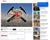
Brian Engh, paleoartist, explains the process of paleoart and does a demonstration …
Brian Engh, paleoartist, explains the process of paleoart and does a demonstration of creating a Stegosaurus. From skeleton to musculature to the possible colors of a Stegosaurus, follow along as Brian shows us what Sophie the Stegosaurus may have looked like. Warning Content Alert: This video contains brief discussion about dinosaur mating and may not be appropriate for all audiences.
General information on summer dinosaur dig opportunities through Dinosaur Journey, on of …
General information on summer dinosaur dig opportunities through Dinosaur Journey, on of the Museums of Western Colorado. Visit the Dinosaur Digs and Expeditions website to learn more: https://www.museumofwesternco.com/things-to-do/dino-digs/
Trail Guide for hiking trail near where important fossil finds occured in …
Trail Guide for hiking trail near where important fossil finds occured in Western Colorado. When visiting these trails it is important to visit with respect by staying on the trail and leaving fossils where you find them. These fossils and tracks are protected under the Paleontological Resources Preservation Act (PRPA) of 2009. The act prohibits an attempt to excavate, remove, damage, or otherwise alter or deface any paleontological resources located on Federal land. In order to collect any fossils (plants, invertebrates, vertebrates) at these sites, a proper permit must be obtained. If you are interested in excavating fossils with our scientists at Dinosaur Journey, check out our Dinosaur Digs and Expeditions! https://museumofwesternco.com/things-to-do/dino-digs/
Dinosaur Journey is part of the Mueums of Western Colorado. This short …
Dinosaur Journey is part of the Mueums of Western Colorado. This short documentary tells the story of dinosaurs in the Grand Valley, their history, discovery, excavation and research. Watch and find out what dinosaurs can be found on the Wester Slope of Colorado.
Clues from the Landscape Social Studies Lesson 2 Discovering Public Lands as …
Clues from the Landscape Social Studies Lesson 2 Discovering Public Lands as Living Museums is designed to be used with Clues from the Landscape Artifact Kit. Lessons 1, 2 and 4 can be completed without the artifacts from the kit. These kits are available through Musuems of Western Colorado to D51 Teachers. This lesson can be adapted to use without the kit. Students will be able to: • Conduct analysis of different types of maps • Discuss the difficulties faced by homesteaders moving across the state • Describe how homesteaders modified the land around them • Explain why it is important to preserve historic sites • Find information from primary sources including documents, and newspaper articles about life as a homesteader
Students pass around and distort messages written on index cards to learn …
Students pass around and distort messages written on index cards to learn how we use signals from GPS occultations to study the atmosphere. The cards represent information sent from GPS satellites being distorted as they pass through different locations in the Earth's atmosphere and reach other satellites. Analyzing GPS occultations enables better global weather forecasting, storm tracking and climate change monitoring.
No restrictions on your remixing, redistributing, or making derivative works. Give credit to the author, as required.
Your remixing, redistributing, or making derivatives works comes with some restrictions, including how it is shared.
Your redistributing comes with some restrictions. Do not remix or make derivative works.
Most restrictive license type. Prohibits most uses, sharing, and any changes.
Copyrighted materials, available under Fair Use and the TEACH Act for US-based educators, or other custom arrangements. Go to the resource provider to see their individual restrictions.