Updating search results...

Field Trips

222 affiliated resources

Search Resources

View
Selected filters:
LONGPRO Stream Modeling Exercise
Conditional Remix & Share Permitted
CC BY-NC-SA
Rating
0.0 stars

The purpose of this exercise is to integrate modeling with field data. The activity includes links to a "virtual field trip" of maps and photographs. Data from a creek is included in the field trip and students use an Excel spreadsheet model to analyze the data.

(Note: this resource was added to OER Commons as part of a batch upload of over 2,200 records. If you notice an issue with the quality of the metadata, please let us know by using the 'report' button and we will flag it for consideration.)


Subject:
Biology
Life Science
Mathematics
Measurement and Data
Statistics and Probability
Material Type:
Activity/Lab
Interactive
Simulation
Provider:
Science Education Resource Center (SERC) at Carleton College
Provider Set:
Teach the Earth
Date Added:
11/24/2020
Launch Your Class to the Moon and Back
Only Sharing Permitted
CC BY-NC-ND
Rating
0.0 stars

The Moon is a constant celestial companion in classrooms around the world. Lunar phenomena has much to offer teachers as both an engaging narrative and visible presence in the sky that students have personally experienced.

Subject:
Computer Science
Computer, Networking and Telecommunications Systems
Education
Physical Science
Material Type:
Activity/Lab
Lecture Notes
Reading
Simulation
Date Added:
04/11/2023
Loyd Files Research Library: Stop 14 Museum of the West Virtual Tour
Read the Fine Print
Educational Use
Rating
0.0 stars

Loyd Files Research Library: Stop 14 Museum of the West Virtual Tour. Watch this short video to learn about a Museum of the West exhibit or collection to preview your field trip or for a virtual field trip if you are unable to attend in person. The Museum of the West is part of the Museums of Westen Colorado. Museum of the West Registrar, Vida Jaber, describes what she does and how the Loyd Files Research Library is different from other libraries. She also explains primary and secondary sources. Access the online collections here: https://www.museumofwesternco.com/collections/

Subject:
Anthropology
Archaeology
Cultural Geography
Earth and Space Science
History
Physical Geography
Social Science
U.S. History
Material Type:
Lecture
Lesson
Primary Source
Student Guide
Provider:
Museums of Western Colorado
Provider Set:
Museum of the West
Date Added:
02/06/2023
Maritime Aquarium, Norwalk CT - Field Trip Assignment
Conditional Remix & Share Permitted
CC BY-NC-SA
Rating
0.0 stars

Self-guided field trip assignment to Maritime Aquarium in Norwalk CT. Students evaluate the main processes occurring in Long Island Sound estuary. Environmental issues are also examined. Students evaluate the displays for educational value and scientific content

(Note: this resource was added to OER Commons as part of a batch upload of over 2,200 records. If you notice an issue with the quality of the metadata, please let us know by using the 'report' button and we will flag it for consideration.)
Subject:
Biology
Earth and Space Science
Life Science
Oceanography
Material Type:
Activity/Lab
Provider:
Science Education Resource Center (SERC) at Carleton College
Provider Set:
Teach the Earth
Date Added:
08/09/2019
Metastability during metamorphism (reading a metamorphic petrology paper from the literature)
Conditional Remix & Share Permitted
CC BY-NC-SA
Rating
0.0 stars

I use this problem set as a way to introduce students (mostly sophomores) to reading a technical article from the literature. The paper is Austrheim, H, 1987, Eclogitization of lower crustal granulites by fluid migration through shear zones, Earth and Planetary Science Letters 81:221-232. The paper describes Grenville-age mafic and anorthositic granulites in Norway re-metamorphosed under eclogite facies conditions during the Caledonian. The granulite-facies assemblages persist metastabiliy, and only become eclogite assemblages in or near shear zones where fluids allow the granulite->eclogite reactions to occur.
I try to have this problem set serve a number of purposes. First, I ask the students to answer a number of guiding questions so that they work through the paper and look up terms as needed. Some of the questions are directly from the text, and others more are open-ended. I wrap-up the problem set with a 'virtual field trip' of the area discussed in the paper. This slide-show works out much better than similar ones I do in this class, because they have all read about the area and have tried to visualize the field relationships already. The virtual field trip typically leads into interesting discussions about tectonics and metamorphism, polymetamorphism, the meaning of facies, how petrology is done in the field, and how metastability is necessary in order to interpret metamorphic history. In an advanced class other papers by Austrheim and co-workers can be used to explore pseudotachylites and the interplay between metamorphism and seismicity.

(Note: this resource was added to OER Commons as part of a batch upload of over 2,200 records. If you notice an issue with the quality of the metadata, please let us know by using the 'report' button and we will flag it for consideration.)
Subject:
Biology
Life Science
Material Type:
Activity/Lab
Provider:
Science Education Resource Center (SERC) at Carleton College
Provider Set:
Teach the Earth
Date Added:
08/06/2019
Mid-Atlantic Appalachian Orogen Traverse �� Field Trip 1
Conditional Remix & Share Permitted
CC BY-NC-SA
Rating
0.0 stars

The Mid-Atlantic Appalachian Orogen Traverse is a series of 4 virtual field trips that cross the Blue Ridge and Valley and Ridge geologic provinces in northwestern Virginia and northeastern West Virginia. This field trip is a virtual version of the first field trip that is typically a component of a semester-long project for an upper-level undergraduate Stratigraphy, Structure, Tectonics (SST) class at James Madison University. The standard project includes a full-day, on-location field excursion, during which students visit sedimentary rocks and lithologies of the Valley and Ridge Geologic Province in central Virginia. Students primarily collect data on stratigraphic and sedimentological features, while also noting structural features. Students use the data they collect on the field trip to write a synthesis report that includes stratigraphic interpretations, basin analyses, and a tectonic summary of the region that encompasses events in the early to middle Paleozoic.
The objectives of this virtual field trip exercise are similar to the standard on-location trip: synthesize stratigraphic and structural field data to determine depositional environments, interpret flow regimes and possible depositional basins, and deduce tectonic settings. However, instead of personally collecting the data in the field, students are provided with a web-based Google Earth virtual field trip that covers the standard field locations. The web GE presentation allows students to virtually investigate the field data at each location via text descriptions, outcrop and sample images, and at some sites, 360�� Street View imagery. Field data includes lithologic, mineralogic, and textural data, orientation measurements, and annotated outcrop photos and interpretations.


Note that this is the first field trip in a series of 4 virtual field trip that encompass the Mid-Atlantic Appalachian Orogen Traverse project. The project components include:
Field Trip 1: This field trip
Field Trip 2: Virtual Field Trip to the Blue Ridge Province
Field Trip 3: Rt. 211/259 transect
Field Trip 4: Rt. 33 transect

(Note: this resource was added to OER Commons as part of a batch upload of over 2,200 records. If you notice an issue with the quality of the metadata, please let us know by using the 'report' button and we will flag it for consideration.)
Subject:
Biology
Life Science
Material Type:
Simulation
Provider:
Science Education Resource Center (SERC) at Carleton College
Provider Set:
Teach the Earth
Date Added:
09/29/2022
Mid-Atlantic Appalachian Orogen Traverse �� Field Trip 3
Conditional Remix & Share Permitted
CC BY-NC-SA
Rating
0.0 stars

The Mid-Atlantic Appalachian Orogen Traverse is a series of 4 virtual field trips that cross the Blue Ridge and Valley and Ridge geologic provinces in northwestern Virginia and northeastern West Virginia. This field trip is a virtual version of the third field trip that is typically a component of a semester-long project for an upper-level undergraduate Stratigraphy, Structure, Tectonics (SST) class at James Madison University. The standard project includes a full-day, on-location field excursion, during which students visit sedimentary rocks and lithologies of the Valley and Ridge Geologic Province along Rts. 211 and 259 in western Virginia. Students primarily collect data on stratigraphic and structural features, while also considering depositional and tectonic environments. Students use the data they collect on the field trip to draft cross-sections that transect the region and then write a synthesis report that includes stratigraphic and structural interpretations, and a tectonic summary of the region that encompasses events during the last ~1.2 billion years.
The objectives of this virtual field trip exercise are similar to the standard on-location trip: synthesize stratigraphic and structural field data to determine depositional environments, subsequent metamorphism and deformation, and deduce tectonic settings. However, instead of personally collecting the data in the field, students are provided with a web-based Google Earth (GE) virtual field trip that covers the standard field locations, plus a few additional sites. The web GE presentation allows students to virtually investigate the field data at each location via text descriptions, outcrop and sample images, and at some sites, 360�� Street View imagery. Field data includes lithologic, mineralogic, and textural data, orientation measurements, and annotated outcrop photos and interpretations.

Note that this is the third field trip in a series of 4 virtual field trip that encompass the Mid-Atlantic Appalachian Orogen Traverse project. The project components include:
Field Trip 1: Stratigraphic Sequences of the Valley and Ridge Province
Field Trip 2: Virtual Field Trip to the Blue Ridge Province
Field Trip 3: This Field Trip (the Rt. 211/259 transect)
Field Trip 4: Rt. 33 transect

(Note: this resource was added to OER Commons as part of a batch upload of over 2,200 records. If you notice an issue with the quality of the metadata, please let us know by using the 'report' button and we will flag it for consideration.)
Subject:
Biology
Life Science
Material Type:
Simulation
Provider:
Science Education Resource Center (SERC) at Carleton College
Provider Set:
Teach the Earth
Date Added:
08/04/2022
Mid-Atlantic Appalachian Orogen Traverse �� Field Trip 4
Conditional Remix & Share Permitted
CC BY-NC-SA
Rating
0.0 stars

The Mid-Atlantic Appalachian Orogen Traverse is a series of 4 virtual field trips that cross the Blue Ridge and Valley and Ridge geologic provinces in northwestern Virginia and northeastern West Virginia. This field trip is a virtual version of the fourth field trip that is typically a component of a semester-long project for an upper-level undergraduate Stratigraphy, Structure, Tectonics (SST) class at James Madison University. The standard project includes a two-day, on-location field excursion, during which students visit sedimentary rocks and lithologies of the Valley and Ridge Geologic Province along Rt. 33 in western Virginia and eastern West Virginia. Students primarily collect data on stratigraphic and structural features, while also considering depositional and tectonic environments. Students use the data they collect on the field trip to draft cross-sections that transect the region and then write a synthesis report that includes stratigraphic and structural interpretations, and a tectonic summary of the region that encompasses events during the last ~1.2 billion years.
The objectives of this virtual field trip exercise are similar to the standard on-location trip: synthesize stratigraphic and structural field data to determine depositional environments, subsequent metamorphism and deformation, and deduce tectonic settings. However, instead of personally collecting the data in the field, students are provided with a web-based Google Earth (GE) virtual field trip that covers the standard field locations, plus a few additional sites. The web GE presentation allows students to virtually investigate the field data at each location via text descriptions, outcrop and sample images, and at some sites, 360�� Street View imagery. Field data includes lithologic, mineralogic, and textural data, orientation measurements, and annotated outcrop photos and interpretations.

Note that this is the fourth and final field trip in a series of 4 virtual field trips that encompass the Mid-Atlantic Appalachian Orogen Traverse project. The project components include:
Field Trip 1: Stratigraphic Sequences of the Valley and Ridge Province
Field Trip 2: Virtual Field Trip to the Blue Ridge Province
Field Trip 3: Rt. 211/259 transect
Field Trip 4: This Field Trip (the Rt. 33 transect)

(Note: this resource was added to OER Commons as part of a batch upload of over 2,200 records. If you notice an issue with the quality of the metadata, please let us know by using the 'report' button and we will flag it for consideration.)

Subject:
Biology
Life Science
Material Type:
Simulation
Provider:
Science Education Resource Center (SERC) at Carleton College
Provider Set:
Teach the Earth
Date Added:
09/29/2022
Mindfulness, Read & Seed Activity, The Gardens on Spring Creek
Read the Fine Print
Educational Use
Rating
0.0 stars

This Read & Seed lesson will focus on practicing mindfulness in a fun and nature centered way. We will read A Quiet Place by Douglas Wood and Dan Andreasen, and create our own mindfulness wands. Participate in a Movement/Music/Finger Play activity by practicing some garden yoga. This lesson is aimed at connecting young learners to their natural world and promote school readiness skills. This Read & Seed activity is presented by The Gardens on Spring Creek by the City of Fort Collins. https://youtu.be/MTczG8WcGXg

Subject:
Agriculture and Natural Resources
Applied Science
Arts and Humanities
Early Childhood Development
Education
English Language Arts
Environmental Science
Environmental Studies
Language, Grammar and Vocabulary
Literature
Performing Arts
Psychology
Reading Foundation Skills
Reading Literature
Social Science
Speaking and Listening
Visual Arts
Visual Arts and Design
Material Type:
Activity/Lab
Lesson
Lesson Plan
Provider:
The City of Fort Collins
Provider Set:
The Gardens on Spring Creek: Read & Seed
Date Added:
02/06/2023
Mindfulness, Virtual Read & Seed Video, The Gardens on Spring Creek
Read the Fine Print
Educational Use
Rating
0.0 stars

This Read & Seed lesson will focus on practicing mindfulness in a fun and nature centered way. We will read A Quiet Place by Douglas Wood and Dan Andreasen, and create our own mindfulness wands. Participate in a Movement/Music/Finger Play activity by practicing some garden yoga. This lesson is aimed at connecting young learners to their natural world and promote school readiness skills. This Read & Seed activity is presented by The Gardens on Spring Creek by the City of Fort Collins. https://www.fcgov.com/gardens/files/read-seed-website-mindfulness-in-the-gardens.pdf?1589213978

Subject:
Agriculture and Natural Resources
Applied Science
Arts and Humanities
Early Childhood Development
Education
English Language Arts
Environmental Science
Environmental Studies
Language, Grammar and Vocabulary
Literature
Performing Arts
Psychology
Reading Foundation Skills
Reading Literature
Social Science
Speaking and Listening
Visual Arts
Visual Arts and Design
Material Type:
Reading
Provider:
The City of Fort Collins
Provider Set:
The Gardens on Spring Creek: Read & Seed
Date Added:
02/06/2023
Mining Towns in the Western United States
Read the Fine Print
Educational Use
Rating
0.0 stars

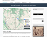
Western Mining History presents a brief summary of Historical Mining Towns in the Western United States with links to each states mining towns. The site includes an interative map and video. Western Mining History is an historical site that provides information on mining, mining towns, gold and Photos and maps of the western United States. Consider becoming a member or making a donation to help further the work of the site.

Subject:
Anthropology
Applied Science
Chemistry
Cultural Geography
Earth and Space Science
Economics
English Language Arts
Environmental Science
Geology
Geoscience
History
Physical Geography
Physical Science
Reading Informational Text
Social Science
Sociology
U.S. History
Material Type:
Primary Source
Reading
Provider:
Western Mining History
Provider Set:
Colorado Mining Towns
Date Added:
02/06/2023
Minnehaha Falls: Observing Changes in Nature through Drawing and Writing
Conditional Remix & Share Permitted
CC BY-NC-SA
Rating
0.0 stars

The activity is a field trip to Minnehaha Falls where students will observe and record their findings in a science notebook.

Subject:
Life Science
Material Type:
Activity/Lab
Lesson Plan
Provider:
Science Education Resource Center (SERC) at Carleton College
Provider Set:
Pedagogy in Action
Date Added:
04/12/2023
Mountain Man Map Analysis
Read the Fine Print
Educational Use
Rating
0.0 stars

Students analyze a mountain man's map to see how the political boundaries of the US have changed over time

Subject:
Ancient History
Anthropology
Archaeology
Art History
Cultural Geography
Earth and Space Science
Ethnic Studies
History
Physical Geography
Social Science
U.S. History
Visual Arts and Design
Material Type:
Activity/Lab
Primary Source
Student Guide
Provider:
Museums of Western Colorado
Provider Set:
Museum of the West
Date Added:
02/06/2023
The Mountain Men: Stop 5 Museum of the West Virtual Tour
Read the Fine Print
Educational Use
Rating
0.0 stars

The Mountain Men: Stop 5 Museum of the West Virtual Tour. Watch this short video to learn about a Museum of the West exhibit or collection to preview your field trip or for a virtual field trip if you are unable to attend in person. The Museum of the West is part of the Museums of Westen Colorado. Mountain Men not only worked in the fur trade, but they helped open the west to further expansion by the United States. David Bailey explains what life was like for mountain men and how territory in the west changed hands over time.

Subject:
Anthropology
Cultural Geography
Ethnic Studies
History
Social Science
U.S. History
Material Type:
Lecture
Lesson
Primary Source
Student Guide
Provider:
Museums of Western Colorado
Provider Set:
Museum of the West
Date Added:
02/06/2023
Museum of the West Virtual Tour
Read the Fine Print
Educational Use
Rating
0.0 stars

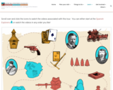
Museums of Western Colorado present an overview of 15 stops on the Museum of the West Virtual Tour. View short videos describing collections at the museum to preview your field trip or if you are unable to visit the museum in person for a virtual field trip.

Subject:
Ancient History
Anthropology
Archaeology
Cultural Geography
History
Paleontology
Physical Science
Social Science
U.S. History
Material Type:
Interactive
Provider:
Museums of Western Colorado
Provider Set:
Museum of the West
Date Added:
02/06/2023
Non-traditional and under-represented students in hydrogeology: Learning by discovery in an urban environment
Conditional Remix & Share Permitted
CC BY-NC-SA
Rating
0.0 stars

Background:
In my experience, I have discovered many common roadblocks to non-traditional and under-represented student participation in hydrogeology:
Time constraints -- many students have complicated schedules and demands on their time that a traditional undergraduate does not have. For example, many of these students are working full time, and required experiences outside of the classroom often pose scheduling conflicts for students.

Communication skills -- many under-represented students arrive in the classroom with communication skills that are not fully developed. Students are often learning English as they are learning the complex vocabulary of hydrogeology.

Math skills -- many students are under prepared in math and/or have math phobias

Funding -- many students are unable to pay laboratory and field trip fees.

I currently teach at minority serving institution. Here, I find that hands-on practice is the most successful learning experience for students. Students grasp concepts such as discharge, flux, and residence time more effectively when they are active participants in the learning process. The most effective method I have found for addressing these issues and encouraging under represented student participation in hydrogeology is to create student-designed group research projects. I used this strategy three quarters in a row, and the same students (as well as new students they recruit) continue to sign up for these courses. This trend, in addition to students' growing confidence in engaging in the scientific method, is my primary evidence for success.

Resources are very limited at my institution, so here are a couple of suggestions that work well.
Borrow equipment -- from other universities, from consulting companies, from colleagues.

Simplify analyses -- many interesting conclusions can be drawn from simply pH, conductivity, and temperature data. But, there are also relatively inexpensive test kits on the market that are sufficient for class purposes (ex. LaMotte urban water test kit ~$30).

Description
Everyone will have different class sizes, student preparation levels, and goals when attempting an exercise like this, so I will provide general information, which others can modify to meet their needs. Below I briefly outline the steps I take the students through during the project and highlight ideas for improving success for the targeted groups.

Form groups -- depending on class size, 2-4 students per group (I try to ensure the groups are balanced based on skills and student interests)
Choose topic -- I usually provide a list of possible topics and have students adapt a topic from the list that interests them. Students require a lot of guidance at this stage to assure selection of a manageable topic for a quarter-long project. This is the most important step - guiding students into a topic they are passionate about and where they can be successful is key. Students usually have no shortage of questions they want to answer about water in an urban environment! Since most of the students have spent their whole lives in an urban situation, they are deeply passionate about these issues.
Research literature -- students perform a background search for previous work on their topic to help guide them. I provide a laboratory session on how to search the library and databases for related information, as well as provide a list of recommended journals and websites. In addition, students locate supporting data (discharge, well levels, precipitation)
Plan study -- we discuss study design, sample types, sampling location, frequency. During this phase, students use maps, study weather patterns, and determine site accessibility.
Collect data -- we set aside lab periods for collecting data together. These are the sessions where you should be prepared to answer all sort of questions. Once the students begin implementing their study, many new questions come up.
Analyze and interpret results -- multiple lab periods are used to analyze data; student data are the basis of the remainder of labs. Techniques discussed are applied to their group projects.
Present findings -- students assemble posters and present results to their classmates.

Urban topics
Below is a short list of topics to stimulate ideas. Equipment required includes pH meter, conductivity meter, flow meter, Lamotte test kits.
Sources of N and P to the Los Angeles River
Contribution of golf courses to urban runoff
Extent of tidal influence on Ballona Creek
Metal fluxes from storm drains to the ocean
Relationship of land use to water quality
Relationship of population demographics to water quality

(Note: this resource was added to OER Commons as part of a batch upload of over 2,200 records. If you notice an issue with the quality of the metadata, please let us know by using the 'report' button and we will flag it for consideration.)

Subject:
Business and Communication
Chemistry
Earth and Space Science
Hydrology
Management
Physical Science
Political Science
Social Science
Material Type:
Activity/Lab
Provider:
Science Education Resource Center (SERC) at Carleton College
Provider Set:
Teach the Earth
Date Added:
11/28/2021
Nuclear Energy through a Virtual Field Trip
Read the Fine Print
Educational Use
Rating
0.0 stars

Students learn about nuclear energy generation through a nuclear power plant virtual field trip that includes visiting four websites and watching a short video taken inside a nuclear power plant. They are guided by a handout that provides the URLs and questions to answer from their readings. They conclude with a class discussion to share their findings and reflections. It is recommended that students complete the associated activity, Chernobyl Empathy, before conducting this lesson; doing this assists students in gaining an understanding of how devastating nuclear meltdowns can be, which underscores the importance of careful engineering.

Subject:
Applied Science
Engineering
Physical Science
Physics
Material Type:
Lesson
Provider:
TeachEngineering
Provider Set:
Lessons
Date Added:
04/26/2017
Oceanography Virtual Field Trips
Conditional Remix & Share Permitted
CC BY-NC-SA
Rating
0.0 stars

Students explore online data, maps, webcams, and articles from specific US locations to understand and visualize the oceanographic phenomena of that location. Through the worksheet, students will learn to explore online resources to gather data on a particular topic, and practice making observations of scientific phenomena. Through the writing assignment, students learn to synthesize observations into scientific explorations, draw together ideas and relate to course concepts, and reflect on their learning process.

Subject:
Earth and Space Science
Oceanography
Material Type:
Activity/Lab
Homework/Assignment
Provider:
Science Education Resource Center (SERC) at Carleton College
Provider Set:
Teach the Earth
Date Added:
04/12/2023
The Once and Future City
Conditional Remix & Share Permitted
CC BY-NC-SA
Rating
0.0 stars

What is a city? What shapes it? How does its history influence future development? How do physical form and institutions vary from city to city and how are these differences significant? How are cities changing and what is their future? This course will explore these and other questions, with emphasis upon twentieth-century American cities. A major focus will be on the physical form of cities—from downtown and inner-city to suburb and edge city—and the processes that shape them.

These questions and more are explored through lectures, readings, workshops, field trips, and analysis of particular places, with the city itself as a primary text. In light of the 2016 centennial of MIT’s move from Boston to Cambridge, the 2015 iteration of the course focused on MIT’s original campus in Boston’s Back Bay, and the university’s current neighborhood in Cambridge. Short field assignments, culminating in a final project, will provide students opportunities to use, develop, and refine new skills in “reading” the city.

Subject:
Applied Science
Architecture and Design
Material Type:
Full Course
Textbook
Provider:
MIT
Provider Set:
MIT OpenCourseWare
Author:
Anne Whiston Spirn
Date Added:
03/30/2023